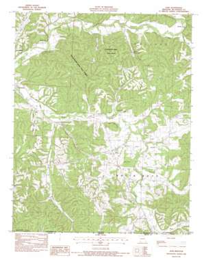
Jane Topo Map Missouri
To zoom in, hover over the map of Jane
USGS Topo Quad 36094e3 - 1:24,000 scale
| Topo Map Name: | Jane |
| USGS Topo Quad ID: | 36094e3 |
| Print Size: | ca. 21 1/4" wide x 27" high |
| Southeast Coordinates: | 36.5° N latitude / 94.25° W longitude |
| Map Center Coordinates: | 36.5625° N latitude / 94.3125° W longitude |
| U.S. State: | MO |
| Filename: | o36094e3.jpg |
| Download Map JPG Image: | Jane topo map 1:24,000 scale |
| Map Type: | Topographic |
| Topo Series: | 7.5´ |
| Map Scale: | 1:24,000 |
| Source of Map Images: | United States Geological Survey (USGS) |
| Alternate Map Versions: |
Jane MO 1982, updated 1982 Download PDF Buy paper map Jane MO 2012 Download PDF Buy paper map Jane MO 2015 Download PDF Buy paper map |
1:24,000 Topo Quads surrounding Jane
> Back to 36094e1 at 1:100,000 scale
> Back to 36094a1 at 1:250,000 scale
> Back to U.S. Topo Maps home
Jane topo map: Gazetteer
Jane: Airports
B S Ranch Airport elevation 311m 1020′Jane: Areas
White Oak Prairie elevation 285m 935′Jane: Cliffs
Clemens Bluff elevation 268m 879′White Rock Bluff elevation 337m 1105′
Jane: Dams
Keaton Lake Dam elevation 319m 1046′Jane: Forests
Huckleberry Ridge State Forest elevation 367m 1204′Jane: Gaps
Slate Gap elevation 340m 1115′Jane: Populated Places
Crag O Lea elevation 277m 908′Cyclone elevation 281m 921′
Deep Ford elevation 268m 879′
Griffin Ford elevation 274m 898′
Havenhurst elevation 268m 879′
Jane elevation 300m 984′
Meadors Ford elevation 275m 902′
Sugar Beach elevation 278m 912′
Jane: Reservoirs
Jackman Lake elevation 319m 1046′Jane: Springs
Whittaker Spring elevation 301m 987′Jane: Streams
Bear Creek elevation 291m 954′Brush Creek elevation 269m 882′
East Fork Brush Creek elevation 282m 925′
Grannys Branch elevation 289m 948′
Missouri Creek elevation 280m 918′
Tanner Branch elevation 274m 898′
Jane: Summits
Bobs Knob elevation 337m 1105′Pine Hill elevation 373m 1223′
Polk Mountain elevation 351m 1151′
Tatter Knob elevation 316m 1036′
Jane: Valleys
Gordon Hollow elevation 287m 941′Green Hollow elevation 278m 912′
Hambrich Hollow elevation 270m 885′
Hickory Hollow elevation 289m 948′
Miser Hollow elevation 286m 938′
Packett Hollow elevation 279m 915′
Polly Hollow elevation 269m 882′
Skaggs Hollow elevation 277m 908′
Wolf Pen Hollow elevation 274m 898′
Jane digital topo map on disk
Buy this Jane topo map showing relief, roads, GPS coordinates and other geographical features, as a high-resolution digital map file on DVD:


