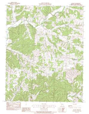
Mcnatt Topo Map Missouri
To zoom in, hover over the map of Mcnatt
USGS Topo Quad 36094f3 - 1:24,000 scale
| Topo Map Name: | Mcnatt |
| USGS Topo Quad ID: | 36094f3 |
| Print Size: | ca. 21 1/4" wide x 27" high |
| Southeast Coordinates: | 36.625° N latitude / 94.25° W longitude |
| Map Center Coordinates: | 36.6875° N latitude / 94.3125° W longitude |
| U.S. State: | MO |
| Filename: | o36094f3.jpg |
| Download Map JPG Image: | Mcnatt topo map 1:24,000 scale |
| Map Type: | Topographic |
| Topo Series: | 7.5´ |
| Map Scale: | 1:24,000 |
| Source of Map Images: | United States Geological Survey (USGS) |
| Alternate Map Versions: |
McNatt MO 1982, updated 1982 Download PDF Buy paper map McNatt MO 2012 Download PDF Buy paper map McNatt MO 2015 Download PDF Buy paper map |
1:24,000 Topo Quads surrounding Mcnatt
> Back to 36094e1 at 1:100,000 scale
> Back to 36094a1 at 1:250,000 scale
> Back to U.S. Topo Maps home
Mcnatt topo map: Gazetteer
Mcnatt: Gaps
Salt Lick Gap elevation 375m 1230′Mcnatt: Parks
Elkhorn Tower State Public Hunting Grounds elevation 385m 1263′Mcnatt: Populated Places
Erie elevation 307m 1007′McCullough Ford elevation 286m 938′
McNatt elevation 314m 1030′
Plainview elevation 393m 1289′
Wylie elevation 373m 1223′
Mcnatt: Streams
Bullskin Creek elevation 293m 961′Elkhorn Creek elevation 302m 990′
North Elkhorn Creek elevation 307m 1007′
Mcnatt: Summits
Coal Mine Hill elevation 367m 1204′Mcnatt: Valleys
Big Cedar Hollow elevation 287m 941′Dry Hollow elevation 311m 1020′
Happy Hollow elevation 305m 1000′
Hungry Hollow elevation 301m 987′
Little Cedar Hollow elevation 287m 941′
Peach Orchard Hollow elevation 297m 974′
Steep Hollow elevation 299m 980′
Mcnatt digital topo map on disk
Buy this Mcnatt topo map showing relief, roads, GPS coordinates and other geographical features, as a high-resolution digital map file on DVD:


