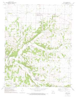
Stella Topo Map Missouri
To zoom in, hover over the map of Stella
USGS Topo Quad 36094g2 - 1:24,000 scale
| Topo Map Name: | Stella |
| USGS Topo Quad ID: | 36094g2 |
| Print Size: | ca. 21 1/4" wide x 27" high |
| Southeast Coordinates: | 36.75° N latitude / 94.125° W longitude |
| Map Center Coordinates: | 36.8125° N latitude / 94.1875° W longitude |
| U.S. State: | MO |
| Filename: | o36094g2.jpg |
| Download Map JPG Image: | Stella topo map 1:24,000 scale |
| Map Type: | Topographic |
| Topo Series: | 7.5´ |
| Map Scale: | 1:24,000 |
| Source of Map Images: | United States Geological Survey (USGS) |
| Alternate Map Versions: |
Stella MO 1972, updated 1974 Download PDF Buy paper map Stella MO 2012 Download PDF Buy paper map Stella MO 2015 Download PDF Buy paper map |
1:24,000 Topo Quads surrounding Stella
> Back to 36094e1 at 1:100,000 scale
> Back to 36094a1 at 1:250,000 scale
> Back to U.S. Topo Maps home
Stella topo map: Gazetteer
Stella: Airports
Dalbom Airport elevation 342m 1122′Stella: Areas
Olivers Prairie elevation 388m 1272′Stella: Populated Places
Boulder City elevation 329m 1079′Cartmell (historical) elevation 362m 1187′
Chester (historical) elevation 375m 1230′
Stark City elevation 372m 1220′
Stella elevation 349m 1145′
Wadell elevation 389m 1276′
Wanda elevation 359m 1177′
Stella: Springs
Lentz Spring elevation 344m 1128′Macedonia Spring elevation 337m 1105′
Shannon Spring elevation 346m 1135′
Weatherspoon Spring elevation 359m 1177′
Stella: Streams
Huffman Branch elevation 344m 1128′Kenny Branch elevation 345m 1131′
Middle Indian Creek elevation 335m 1099′
North Indian Creek elevation 323m 1059′
South Indian Creek elevation 326m 1069′
Stedman Branch elevation 351m 1151′
Weatherspoon Branch elevation 344m 1128′
Stella: Valleys
Edmondson Hollow elevation 338m 1108′Shannon Hollow elevation 345m 1131′
Stella digital topo map on disk
Buy this Stella topo map showing relief, roads, GPS coordinates and other geographical features, as a high-resolution digital map file on DVD:


