Neosho East Topo Map Missouri
To zoom in, hover over the map of Neosho East
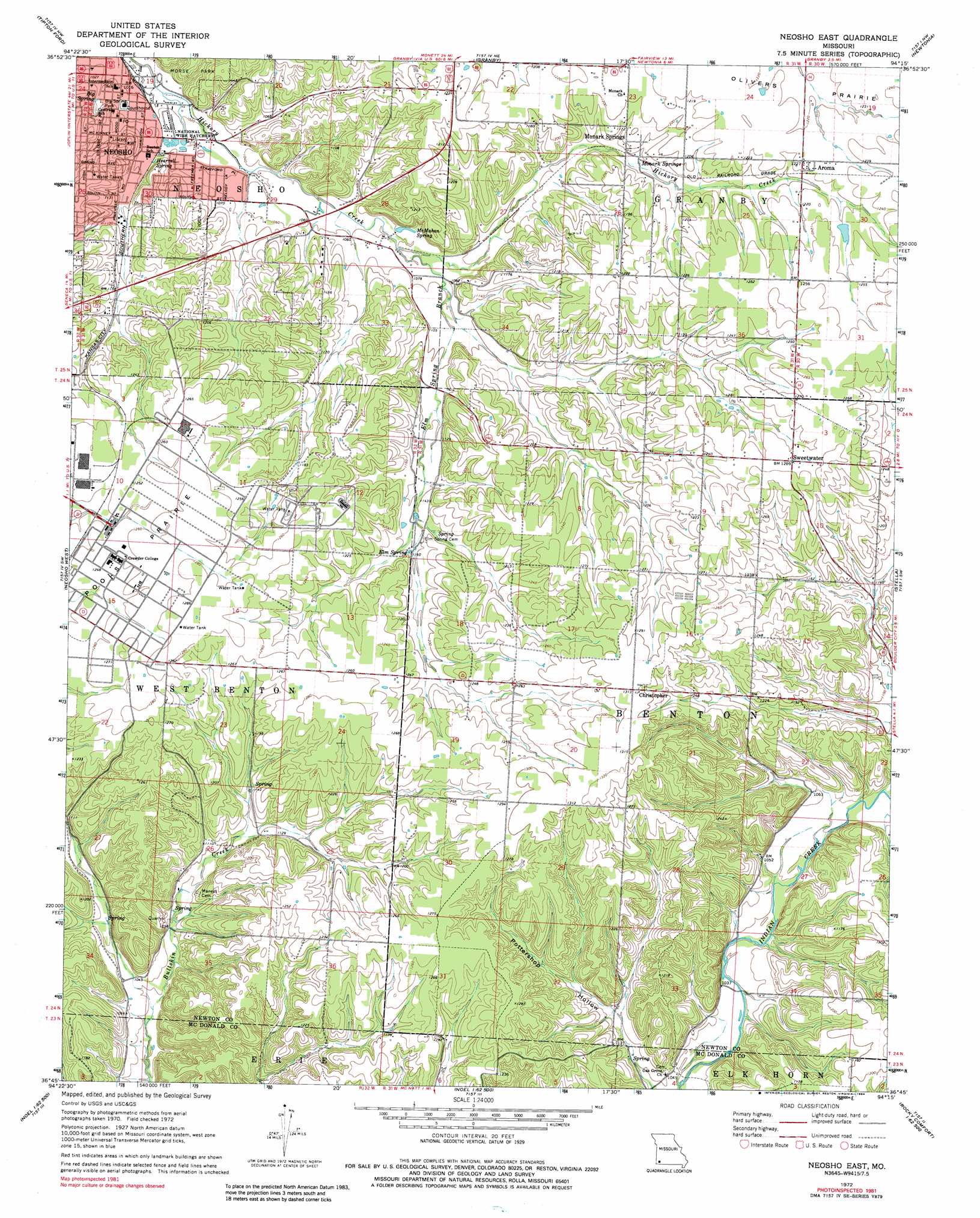
USGS Topo Quad 36094g3 - 1:24,000 scale
| Topo Map Name: | Neosho East |
| USGS Topo Quad ID: | 36094g3 |
| Print Size: | ca. 21 1/4" wide x 27" high |
| Southeast Coordinates: | 36.75° N latitude / 94.25° W longitude |
| Map Center Coordinates: | 36.8125° N latitude / 94.3125° W longitude |
| U.S. State: | MO |
| Filename: | o36094g3.jpg |
| Download Map JPG Image: | Neosho East topo map 1:24,000 scale |
| Map Type: | Topographic |
| Topo Series: | 7.5´ |
| Map Scale: | 1:24,000 |
| Source of Map Images: | United States Geological Survey (USGS) |
| Alternate Map Versions: |
Neosho East MO 1972, updated 1973 Download PDF Buy paper map Neosho East MO 1972, updated 1984 Download PDF Buy paper map Neosho East MO 1972, updated 1984 Download PDF Buy paper map Neosho East MO 2012 Download PDF Buy paper map Neosho East MO 2015 Download PDF Buy paper map |
1:24,000 Topo Quads surrounding Neosho East
Joplin West |
Joplin East |
Fidelity |
Reeds |
Sarcoxie |
Racine |
Tipton Ford |
Granby |
Newtonia |
Pierce City |
Seneca |
Neosho West |
Neosho East |
Stella |
Wheaton |
Tiff City |
Anderson |
Mcnatt |
Bethpage |
Rocky Comfort |
South West City |
Noel |
Jane |
Powell |
Jacket |
> Back to 36094e1 at 1:100,000 scale
> Back to 36094a1 at 1:250,000 scale
> Back to U.S. Topo Maps home
Neosho East topo map: Gazetteer
Neosho East: Dams
Stuffle Dam elevation 373m 1223′Neosho East: Parks
Big Spring Park elevation 317m 1040′Morse Park elevation 342m 1122′
Neosho East: Populated Places
Aroma elevation 373m 1223′Christopher elevation 399m 1309′
June elevation 391m 1282′
Monark Springs elevation 353m 1158′
Neosho elevation 316m 1036′
Sweetwater elevation 388m 1272′
Neosho East: Springs
Big Spring elevation 317m 1040′Elm Spring elevation 353m 1158′
Hearrell Spring elevation 320m 1049′
McMahan Spring elevation 328m 1076′
Monark Springs elevation 353m 1158′
Neosho East: Streams
Elm Spring Branch elevation 323m 1059′Neosho East: Valleys
Pottershop Hollow elevation 314m 1030′Neosho East digital topo map on disk
Buy this Neosho East topo map showing relief, roads, GPS coordinates and other geographical features, as a high-resolution digital map file on DVD: