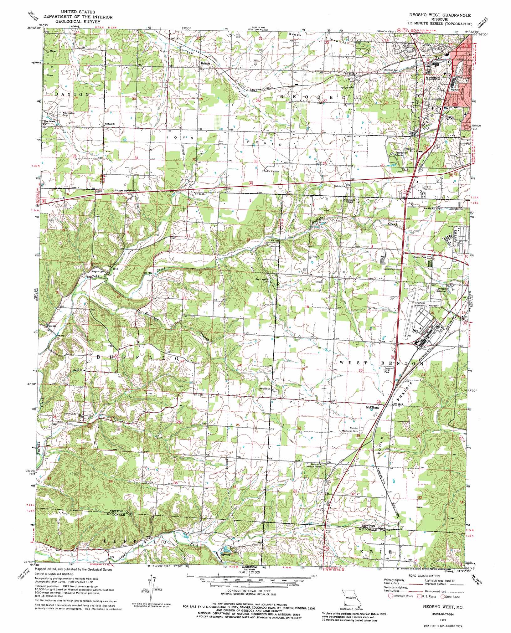
Neosho West Topo Map Missouri
To zoom in, hover over the map of Neosho West
USGS Topo Quad 36094g4 - 1:24,000 scale
| Topo Map Name: | Neosho West |
| USGS Topo Quad ID: | 36094g4 |
| Print Size: | ca. 21 1/4" wide x 27" high |
| Southeast Coordinates: | 36.75° N latitude / 94.375° W longitude |
| Map Center Coordinates: | 36.8125° N latitude / 94.4375° W longitude |
| U.S. State: | MO |
| Filename: | o36094g4.jpg |
| Download Map JPG Image: | Neosho West topo map 1:24,000 scale |
| Map Type: | Topographic |
| Topo Series: | 7.5´ |
| Map Scale: | 1:24,000 |
| Source of Map Images: | United States Geological Survey (USGS) |
| Alternate Map Versions: |
Neosho West MO 1972, updated 1973 Download PDF Buy paper map Neosho West MO 1972, updated 1986 Download PDF Buy paper map Neosho West MO 2012 Download PDF Buy paper map Neosho West MO 2015 Download PDF Buy paper map |
1:24,000 Topo Quads surrounding Neosho West
Baxter Springs |
Joplin West |
Joplin East |
Fidelity |
Reeds |
Peoria |
Racine |
Tipton Ford |
Granby |
Newtonia |
Wyandotte |
Seneca |
Neosho West |
Neosho East |
Stella |
Cayuga |
Tiff City |
Anderson |
Mcnatt |
Bethpage |
Dodge |
South West City |
Noel |
Jane |
Powell |
> Back to 36094e1 at 1:100,000 scale
> Back to 36094a1 at 1:250,000 scale
> Back to U.S. Topo Maps home
Neosho West topo map: Gazetteer
Neosho West: Airports
Neosho Memorial Airport elevation 378m 1240′Neosho West: Areas
Pools Prairie elevation 373m 1223′Neosho West: Parks
Neosho Memorial Park elevation 384m 1259′Neosho West: Populated Places
Belfast elevation 346m 1135′McElhany elevation 381m 1250′
Neosho West: Streams
Harrison Branch elevation 301m 987′Neosho West: Valleys
Slover Hollow elevation 315m 1033′Neosho West digital topo map on disk
Buy this Neosho West topo map showing relief, roads, GPS coordinates and other geographical features, as a high-resolution digital map file on DVD: