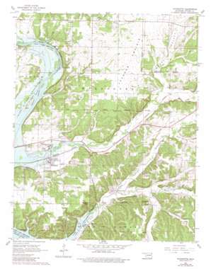
Wyandotte Topo Map Oklahoma
To zoom in, hover over the map of Wyandotte
USGS Topo Quad 36094g6 - 1:24,000 scale
| Topo Map Name: | Wyandotte |
| USGS Topo Quad ID: | 36094g6 |
| Print Size: | ca. 21 1/4" wide x 27" high |
| Southeast Coordinates: | 36.75° N latitude / 94.625° W longitude |
| Map Center Coordinates: | 36.8125° N latitude / 94.6875° W longitude |
| U.S. State: | OK |
| Filename: | o36094g6.jpg |
| Download Map JPG Image: | Wyandotte topo map 1:24,000 scale |
| Map Type: | Topographic |
| Topo Series: | 7.5´ |
| Map Scale: | 1:24,000 |
| Source of Map Images: | United States Geological Survey (USGS) |
| Alternate Map Versions: |
Wyandotte OK 1961, updated 1963 Download PDF Buy paper map Wyandotte OK 1961, updated 1982 Download PDF Buy paper map Wyandotte OK 2010 Download PDF Buy paper map Wyandotte OK 2012 Download PDF Buy paper map Wyandotte OK 2016 Download PDF Buy paper map |
1:24,000 Topo Quads surrounding Wyandotte
> Back to 36094e1 at 1:100,000 scale
> Back to 36094a1 at 1:250,000 scale
> Back to U.S. Topo Maps home
Wyandotte topo map: Gazetteer
Wyandotte: Flats
Jackson Prairie elevation 275m 902′Yankee Bill Prairie elevation 271m 889′
Wyandotte: Populated Places
Eastside elevation 272m 892′Kellyville elevation 235m 770′
Wyandotte elevation 232m 761′
Wyandotte: Streams
Brush Creek elevation 234m 767′Cedar Creek elevation 284m 931′
Lost Creek elevation 225m 738′
Roark Creek elevation 247m 810′
Shawnee Branch elevation 225m 738′
Sycamore Creek elevation 225m 738′
Wyandotte: Valleys
Mason Springs Valley elevation 260m 853′Modoc Valley elevation 251m 823′
Sycamore Cove elevation 225m 738′
Wyandotte digital topo map on disk
Buy this Wyandotte topo map showing relief, roads, GPS coordinates and other geographical features, as a high-resolution digital map file on DVD:


