Miami Sw Topo Map Oklahoma
To zoom in, hover over the map of Miami Sw
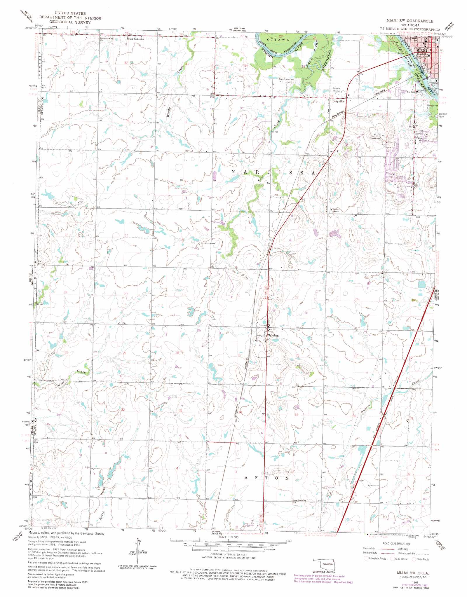
USGS Topo Quad 36094g8 - 1:24,000 scale
| Topo Map Name: | Miami Sw |
| USGS Topo Quad ID: | 36094g8 |
| Print Size: | ca. 21 1/4" wide x 27" high |
| Southeast Coordinates: | 36.75° N latitude / 94.875° W longitude |
| Map Center Coordinates: | 36.8125° N latitude / 94.9375° W longitude |
| U.S. State: | OK |
| Filename: | o36094g8.jpg |
| Download Map JPG Image: | Miami Sw topo map 1:24,000 scale |
| Map Type: | Topographic |
| Topo Series: | 7.5´ |
| Map Scale: | 1:24,000 |
| Source of Map Images: | United States Geological Survey (USGS) |
| Alternate Map Versions: |
Miami SW OK 1961, updated 1963 Download PDF Buy paper map Miami SW OK 1961, updated 1982 Download PDF Buy paper map Miami SW OK 2010 Download PDF Buy paper map Miami SW OK 2012 Download PDF Buy paper map Miami SW OK 2016 Download PDF Buy paper map |
1:24,000 Topo Quads surrounding Miami Sw
Bartlett |
Chetopa |
Melrose |
Neutral |
Baxter Springs |
Welch Nw |
Welch North |
Miami Nw |
Picher |
Peoria |
Pyramid Corners |
Welch South |
Miami Sw |
Miami Se |
Wyandotte |
Vinita |
Vinita Ne |
Afton |
Afton Ne |
Cayuga |
Big Cabin |
Ketchum |
Bernice |
Grove |
Dodge |
> Back to 36094e1 at 1:100,000 scale
> Back to 36094a1 at 1:250,000 scale
> Back to U.S. Topo Maps home
Miami Sw digital topo map on disk
Buy this Miami Sw topo map showing relief, roads, GPS coordinates and other geographical features, as a high-resolution digital map file on DVD: