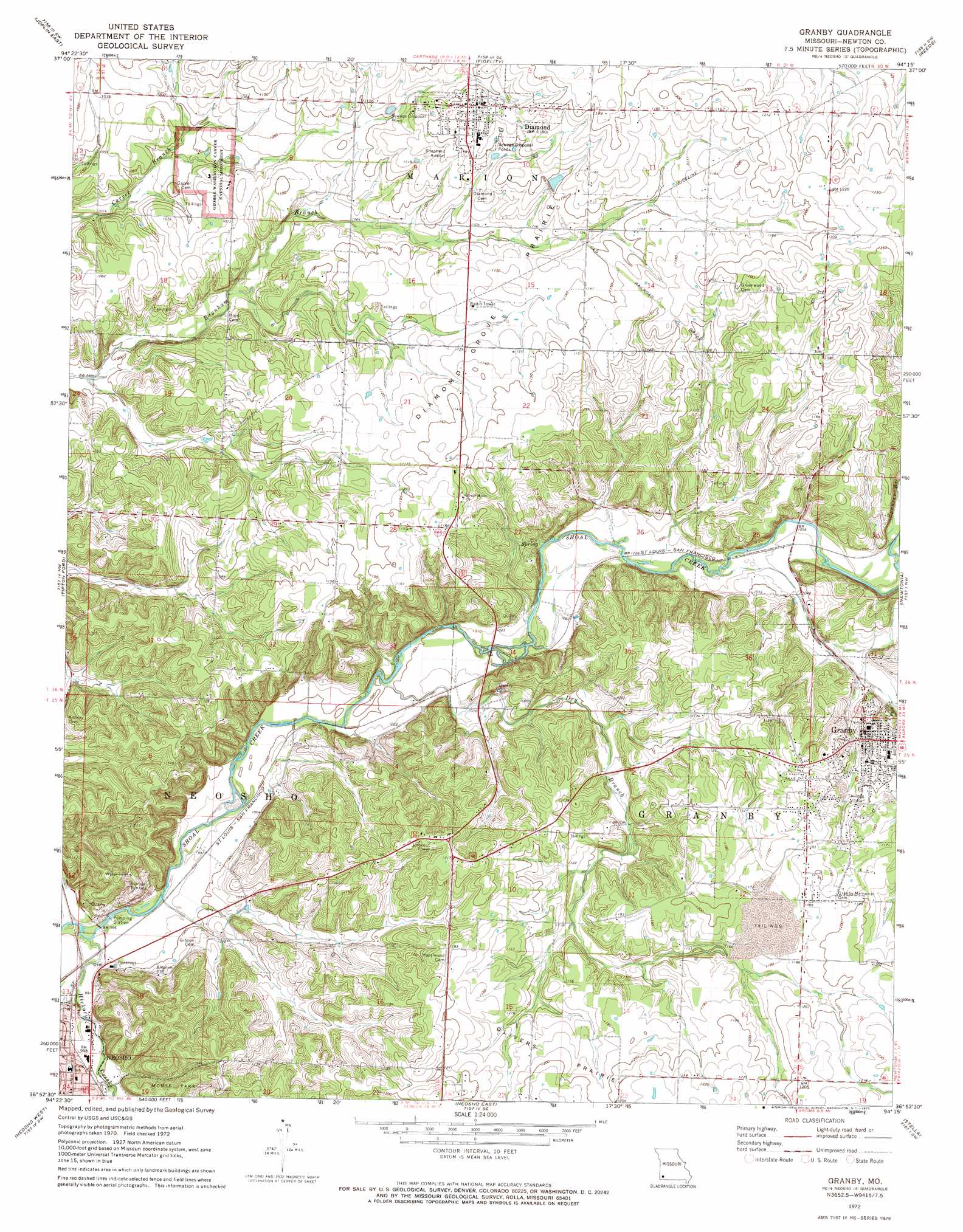
Granby Topo Map Missouri
To zoom in, hover over the map of Granby
USGS Topo Quad 36094h3 - 1:24,000 scale
| Topo Map Name: | Granby |
| USGS Topo Quad ID: | 36094h3 |
| Print Size: | ca. 21 1/4" wide x 27" high |
| Southeast Coordinates: | 36.875° N latitude / 94.25° W longitude |
| Map Center Coordinates: | 36.9375° N latitude / 94.3125° W longitude |
| U.S. State: | MO |
| Filename: | o36094h3.jpg |
| Download Map JPG Image: | Granby topo map 1:24,000 scale |
| Map Type: | Topographic |
| Topo Series: | 7.5´ |
| Map Scale: | 1:24,000 |
| Source of Map Images: | United States Geological Survey (USGS) |
| Alternate Map Versions: |
Granby MO 1972, updated 1973 Download PDF Buy paper map Granby MO 2012 Download PDF Buy paper map Granby MO 2015 Download PDF Buy paper map |
1:24,000 Topo Quads surrounding Granby
Carl Junction |
Webb City |
Carthage |
Avilla |
La Russell |
Joplin West |
Joplin East |
Fidelity |
Reeds |
Sarcoxie |
Racine |
Tipton Ford |
Granby |
Newtonia |
Pierce City |
Seneca |
Neosho West |
Neosho East |
Stella |
Wheaton |
Tiff City |
Anderson |
Mcnatt |
Bethpage |
Rocky Comfort |
> Back to 36094e1 at 1:100,000 scale
> Back to 36094a1 at 1:250,000 scale
> Back to U.S. Topo Maps home
Granby topo map: Gazetteer
Granby: Airports
Shepherd Airport elevation 348m 1141′Granby: Areas
Diamond Grove Prairie elevation 348m 1141′Granby: Lakes
Williams Pond elevation 320m 1049′Granby: Parks
Carver Bust elevation 325m 1066′George Washington Carver National Monument elevation 327m 1072′
Granby: Populated Places
Diamond elevation 353m 1158′Granby elevation 343m 1125′
Granby City elevation 314m 1030′
Granby: Springs
Williams Spring elevation 320m 1049′Granby: Streams
Dry Branch elevation 302m 990′Hickory Creek elevation 299m 980′
Spencer Branch elevation 315m 1033′
Williams Branch elevation 317m 1040′
Granby digital topo map on disk
Buy this Granby topo map showing relief, roads, GPS coordinates and other geographical features, as a high-resolution digital map file on DVD: