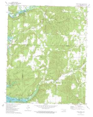
Cedar Crest Topo Map Oklahoma
To zoom in, hover over the map of Cedar Crest
USGS Topo Quad 36095a2 - 1:24,000 scale
| Topo Map Name: | Cedar Crest |
| USGS Topo Quad ID: | 36095a2 |
| Print Size: | ca. 21 1/4" wide x 27" high |
| Southeast Coordinates: | 36° N latitude / 95.125° W longitude |
| Map Center Coordinates: | 36.0625° N latitude / 95.1875° W longitude |
| U.S. State: | OK |
| Filename: | o36095a2.jpg |
| Download Map JPG Image: | Cedar Crest topo map 1:24,000 scale |
| Map Type: | Topographic |
| Topo Series: | 7.5´ |
| Map Scale: | 1:24,000 |
| Source of Map Images: | United States Geological Survey (USGS) |
| Alternate Map Versions: |
Cedar Crest OK 1972, updated 1974 Download PDF Buy paper map Cedar Crest OK 2010 Download PDF Buy paper map Cedar Crest OK 2013 Download PDF Buy paper map Cedar Crest OK 2016 Download PDF Buy paper map |
1:24,000 Topo Quads surrounding Cedar Crest
> Back to 36095a1 at 1:100,000 scale
> Back to 36094a1 at 1:250,000 scale
> Back to U.S. Topo Maps home
Cedar Crest topo map: Gazetteer
Cedar Crest: Airports
Cedar Crest Heliport elevation 252m 826′Vo-Tech Heliport elevation 208m 682′
Cedar Crest: Parks
Big Hollow Public Use Area elevation 178m 583′Earbob Ferry Recreation Area elevation 173m 567′
Spring Creek Recreation Area elevation 173m 567′
Cedar Crest: Populated Places
Cedar Crest elevation 201m 659′Cedar Crest: Reservoirs
Cedar Crest Lake elevation 176m 577′Cedar Crest: Streams
Clear Creek elevation 169m 554′Hare Branch elevation 169m 554′
Little Clear Creek elevation 183m 600′
Pipe Spring Branch elevation 177m 580′
Cedar Crest: Summits
Hadley Mountain elevation 276m 905′Neely Mountain elevation 215m 705′
Cedar Crest: Valleys
Calven Hollow elevation 193m 633′Coleman Hollow elevation 181m 593′
Davis Hollow elevation 197m 646′
Hogskin Hollow elevation 205m 672′
Wooded Hollow elevation 169m 554′
Cedar Crest digital topo map on disk
Buy this Cedar Crest topo map showing relief, roads, GPS coordinates and other geographical features, as a high-resolution digital map file on DVD:


