Pryor Topo Map Oklahoma
To zoom in, hover over the map of Pryor
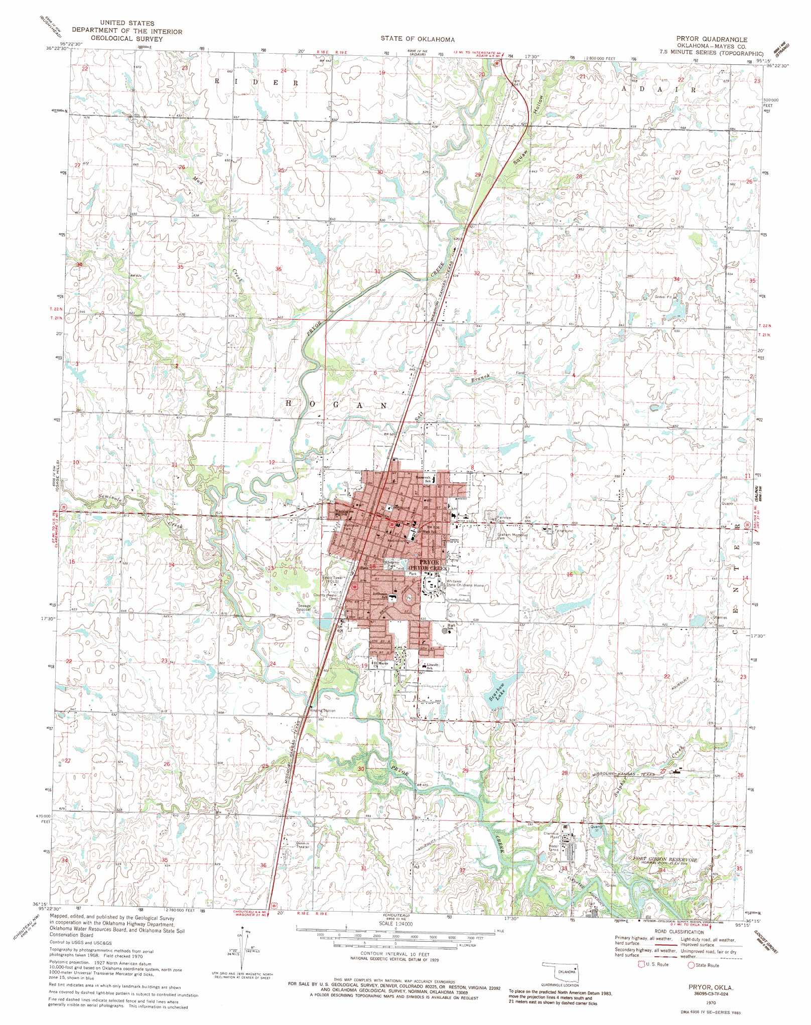
USGS Topo Quad 36095c3 - 1:24,000 scale
| Topo Map Name: | Pryor |
| USGS Topo Quad ID: | 36095c3 |
| Print Size: | ca. 21 1/4" wide x 27" high |
| Southeast Coordinates: | 36.25° N latitude / 95.25° W longitude |
| Map Center Coordinates: | 36.3125° N latitude / 95.3125° W longitude |
| U.S. State: | OK |
| Filename: | o36095c3.jpg |
| Download Map JPG Image: | Pryor topo map 1:24,000 scale |
| Map Type: | Topographic |
| Topo Series: | 7.5´ |
| Map Scale: | 1:24,000 |
| Source of Map Images: | United States Geological Survey (USGS) |
| Alternate Map Versions: |
Pryor OK 1970, updated 1972 Download PDF Buy paper map Pryor OK 1970, updated 1986 Download PDF Buy paper map Pryor OK 2010 Download PDF Buy paper map Pryor OK 2012 Download PDF Buy paper map Pryor OK 2016 Download PDF Buy paper map |
1:24,000 Topo Quads surrounding Pryor
Winganon |
Chelsea |
White Oak |
Big Cabin |
Ketchum |
Foyil |
Bushyhead |
Adair |
Strang |
Spavinaw |
Claremore |
Osage Hills |
Pryor |
Salina |
Salina Se |
Inola |
Choteau Nw |
Chouteau |
Locust Grove |
Rose |
Catoosa Se |
Neodesha |
Rocky Point |
Cedar Crest |
Peggs |
> Back to 36095a1 at 1:100,000 scale
> Back to 36094a1 at 1:250,000 scale
> Back to U.S. Topo Maps home
Pryor topo map: Gazetteer
Pryor: Airports
Longs Airport North Airport elevation 195m 639′Whittaker Army Heliport elevation 196m 643′
Pryor: Dams
Dr Williams Pond Number 5 Dam elevation 189m 620′Scarbow Lake Dam elevation 185m 606′
Whitaker Home Pond Dam elevation 198m 649′
Pryor: Parks
Westside Park elevation 188m 616′Whitaker Park elevation 189m 620′
Pryor: Populated Places
Pryor elevation 192m 629′Pryor: Reservoirs
Dr Williams Pond Number 5 elevation 189m 620′Scarbow Lake elevation 185m 606′
Whitaker Home Pond elevation 198m 649′
Pryor: Streams
Mud Creek elevation 180m 590′Salt Branch elevation 183m 600′
Seminole Creek elevation 180m 590′
Squaw Creek elevation 186m 610′
Sulphur Creek elevation 173m 567′
Pryor: Valleys
Squaw Hollow elevation 186m 610′Pryor digital topo map on disk
Buy this Pryor topo map showing relief, roads, GPS coordinates and other geographical features, as a high-resolution digital map file on DVD: