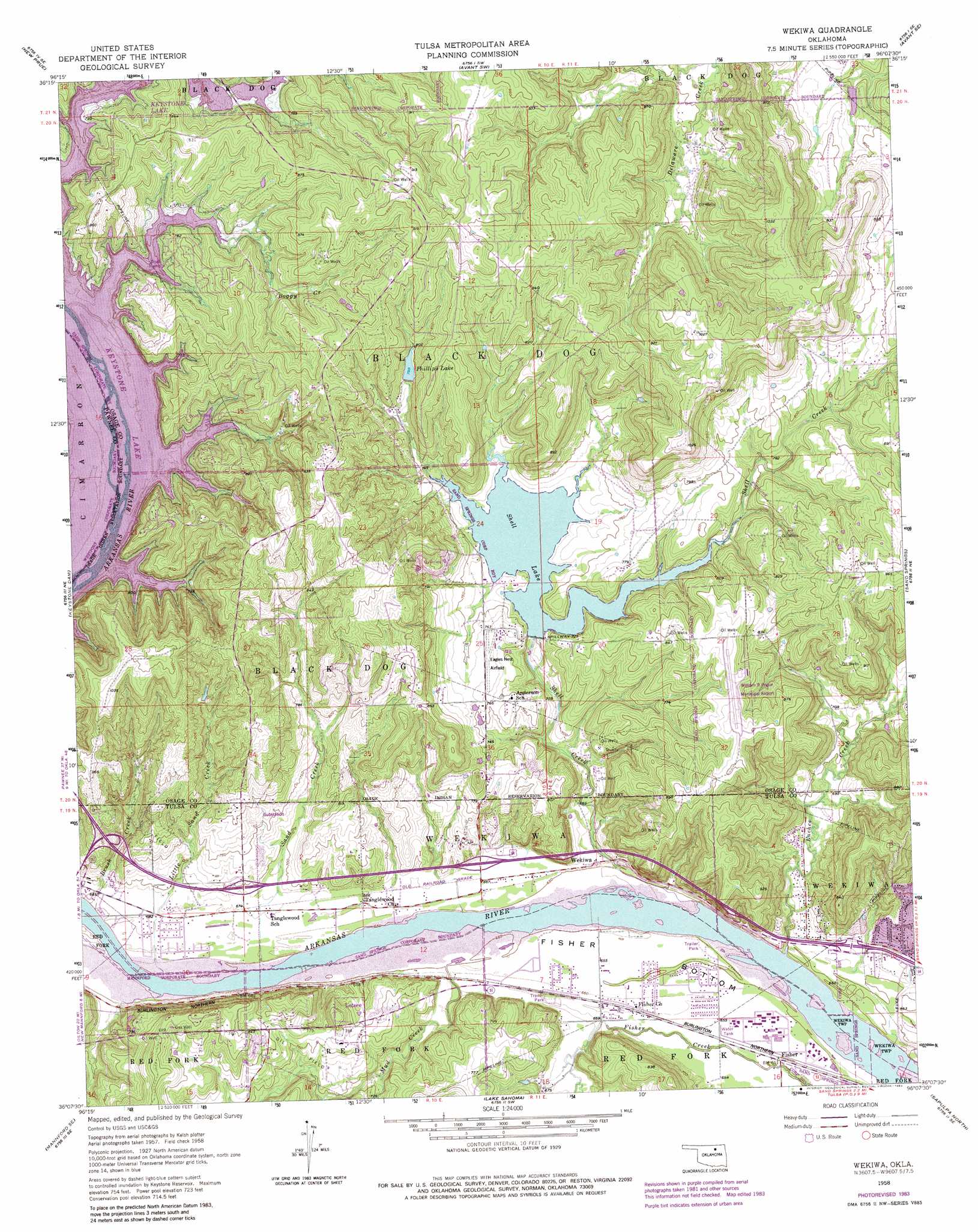
Wekiwa Topo Map Oklahoma
To zoom in, hover over the map of Wekiwa
USGS Topo Quad 36096b2 - 1:24,000 scale
| Topo Map Name: | Wekiwa |
| USGS Topo Quad ID: | 36096b2 |
| Print Size: | ca. 21 1/4" wide x 27" high |
| Southeast Coordinates: | 36.125° N latitude / 96.125° W longitude |
| Map Center Coordinates: | 36.1875° N latitude / 96.1875° W longitude |
| U.S. State: | OK |
| Filename: | o36096b2.jpg |
| Download Map JPG Image: | Wekiwa topo map 1:24,000 scale |
| Map Type: | Topographic |
| Topo Series: | 7.5´ |
| Map Scale: | 1:24,000 |
| Source of Map Images: | United States Geological Survey (USGS) |
| Alternate Map Versions: |
Wekiwa OK 1958, updated 1959 Download PDF Buy paper map Wekiwa OK 1958, updated 1964 Download PDF Buy paper map Wekiwa OK 1958, updated 1969 Download PDF Buy paper map Wekiwa OK 1958, updated 1976 Download PDF Buy paper map Wekiwa OK 1958, updated 1983 Download PDF Buy paper map Wekiwa OK 2010 Download PDF Buy paper map Wekiwa OK 2012 Download PDF Buy paper map Wekiwa OK 2016 Download PDF Buy paper map |
1:24,000 Topo Quads surrounding Wekiwa
Hominy |
Hominy Ne |
Avant Nw |
Avant |
Vera |
Cleveland |
New Prue |
Avant Sw |
Avant Se |
Sperry |
Terlton |
Keystone Dam |
Wekiwa |
Sand Springs |
Tulsa |
Olive |
Mannford Se |
Lake Sahoma |
Sapulpa North |
Jenks |
Bellvue |
Heyburn Reservoir |
Kellyville |
Sapulpa South |
Bixby |
> Back to 36096a1 at 1:100,000 scale
> Back to 36096a1 at 1:250,000 scale
> Back to U.S. Topo Maps home
Wekiwa topo map: Gazetteer
Wekiwa: Airports
Double W Airport elevation 241m 790′Hissom Memorial Center Heliport elevation 198m 649′
William R Pogue Municipal Airport elevation 269m 882′
Wekiwa: Bends
Fisher Bottom elevation 200m 656′Wekiwa: Dams
Shell Dam elevation 221m 725′Wekiwa: Populated Places
Fisher elevation 199m 652′Lotsee elevation 231m 757′
Wekiwa elevation 202m 662′
Wekiwa: Reservoirs
Phillips Lake elevation 243m 797′Shell Lake elevation 207m 679′
Wekiwa: Streams
Boggy Creek elevation 221m 725′Brush Creek elevation 200m 656′
Euchee Creek elevation 194m 636′
Little Sand Creek elevation 198m 649′
Mud Creek elevation 198m 649′
Sand Creek elevation 197m 646′
Shell Creek elevation 195m 639′
Wekiwa digital topo map on disk
Buy this Wekiwa topo map showing relief, roads, GPS coordinates and other geographical features, as a high-resolution digital map file on DVD: