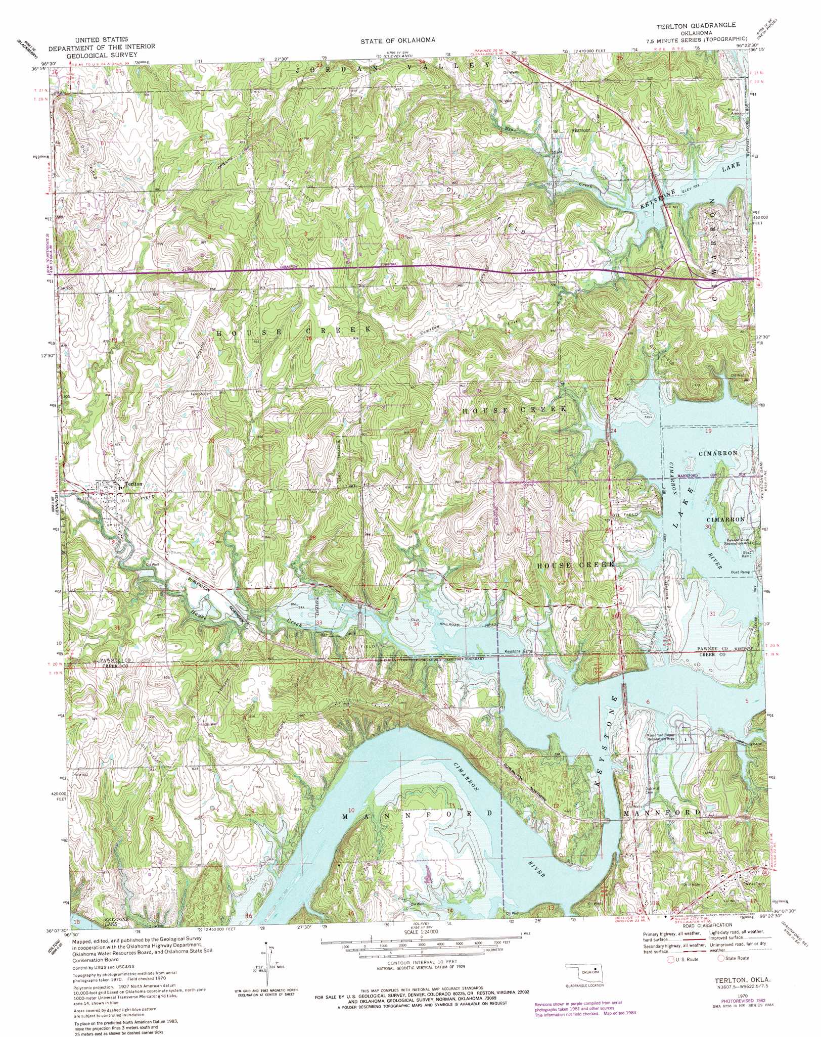
Terlton Topo Map Oklahoma
To zoom in, hover over the map of Terlton
USGS Topo Quad 36096b4 - 1:24,000 scale
| Topo Map Name: | Terlton |
| USGS Topo Quad ID: | 36096b4 |
| Print Size: | ca. 21 1/4" wide x 27" high |
| Southeast Coordinates: | 36.125° N latitude / 96.375° W longitude |
| Map Center Coordinates: | 36.1875° N latitude / 96.4375° W longitude |
| U.S. State: | OK |
| Filename: | o36096b4.jpg |
| Download Map JPG Image: | Terlton topo map 1:24,000 scale |
| Map Type: | Topographic |
| Topo Series: | 7.5´ |
| Map Scale: | 1:24,000 |
| Source of Map Images: | United States Geological Survey (USGS) |
| Alternate Map Versions: |
Terlton OK 1970, updated 1972 Download PDF Buy paper map Terlton OK 1970, updated 1983 Download PDF Buy paper map Terlton OK 2009 Download PDF Buy paper map Terlton OK 2012 Download PDF Buy paper map Terlton OK 2016 Download PDF Buy paper map |
1:24,000 Topo Quads surrounding Terlton
Skedee |
Bug Creek |
Hominy |
Hominy Ne |
Avant Nw |
Casey |
Blackburn |
Cleveland |
New Prue |
Avant Sw |
Maramec |
Jennings |
Terlton |
Keystone Dam |
Wekiwa |
Yale |
Oilton |
Olive |
Mannford Se |
Lake Sahoma |
North Village |
Drumright |
Bellvue |
Heyburn Reservoir |
Kellyville |
> Back to 36096a1 at 1:100,000 scale
> Back to 36096a1 at 1:250,000 scale
> Back to U.S. Topo Maps home
Terlton topo map: Gazetteer
Terlton: Dams
Oknoname 037005 Dam elevation 236m 774′Oknoname 037006 Dam elevation 243m 797′
Terlton: Parks
Mannford Ramp Recreation Area elevation 223m 731′Rawnee Cove Recreation Area elevation 222m 728′
Terlton: Populated Places
Terlton elevation 240m 787′Terlton: Reservoirs
Oknoname 037005 Reservoir elevation 236m 774′Oknoname 037006 Reservoir elevation 243m 797′
Terlton: Streams
Cowskin Creek elevation 220m 721′House Creek elevation 220m 721′
Terlton digital topo map on disk
Buy this Terlton topo map showing relief, roads, GPS coordinates and other geographical features, as a high-resolution digital map file on DVD: