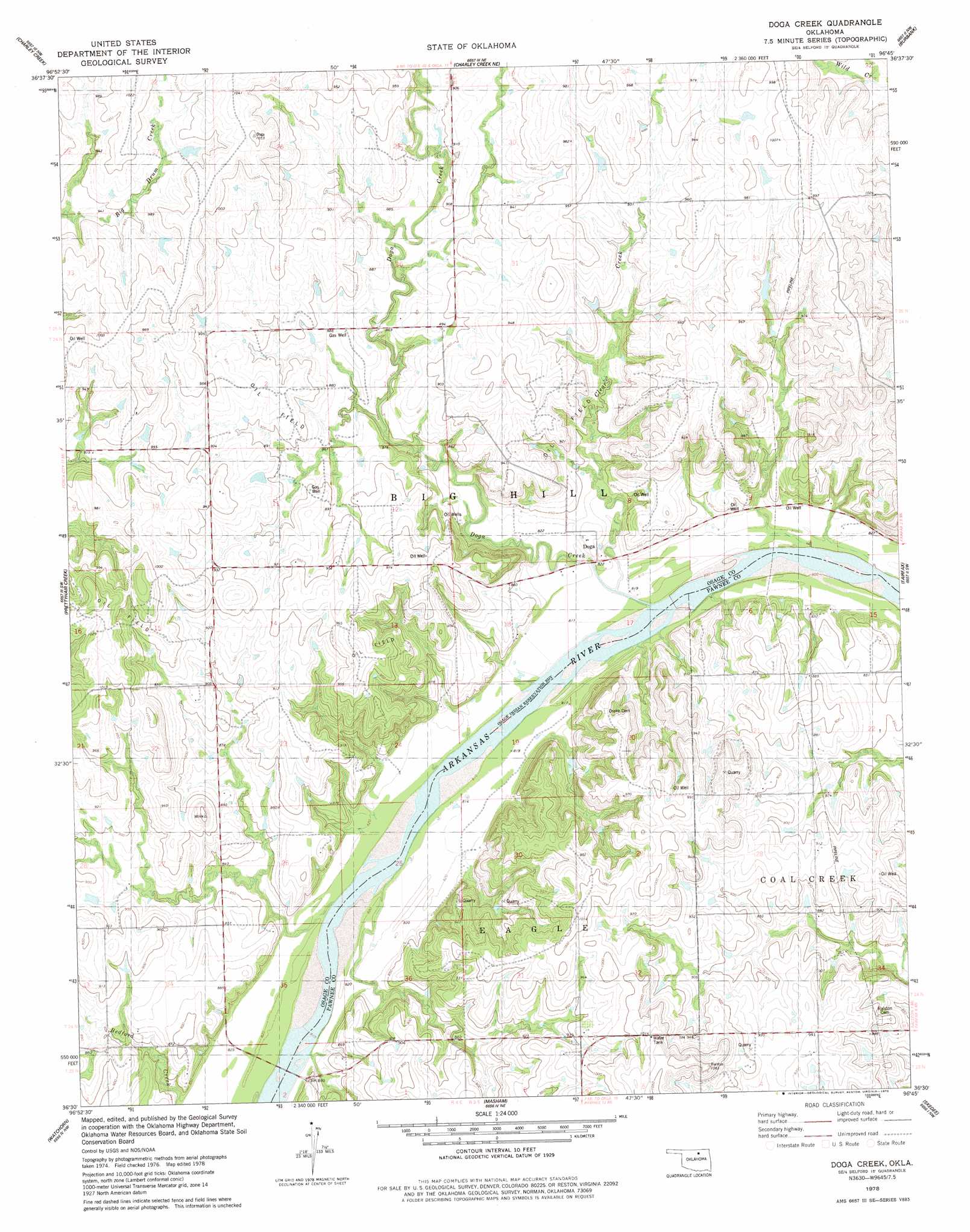
Doga Creek Topo Map Oklahoma
To zoom in, hover over the map of Doga Creek
USGS Topo Quad 36096e7 - 1:24,000 scale
| Topo Map Name: | Doga Creek |
| USGS Topo Quad ID: | 36096e7 |
| Print Size: | ca. 21 1/4" wide x 27" high |
| Southeast Coordinates: | 36.5° N latitude / 96.75° W longitude |
| Map Center Coordinates: | 36.5625° N latitude / 96.8125° W longitude |
| U.S. State: | OK |
| Filename: | o36096e7.jpg |
| Download Map JPG Image: | Doga Creek topo map 1:24,000 scale |
| Map Type: | Topographic |
| Topo Series: | 7.5´ |
| Map Scale: | 1:24,000 |
| Source of Map Images: | United States Geological Survey (USGS) |
| Alternate Map Versions: |
Doga Creek OK 1978, updated 1978 Download PDF Buy paper map Doga Creek OK 2009 Download PDF Buy paper map Doga Creek OK 2012 Download PDF Buy paper map Doga Creek OK 2016 Download PDF Buy paper map |
1:24,000 Topo Quads surrounding Doga Creek
Kildare |
Uncas |
Kaw City |
Shidler |
Foraker South |
Ponca City |
Charley Creek East |
Charley Creek West |
Burbank |
Baconrind Creek |
Ponca City Se |
Prettyhair Creek |
Doga Creek |
Fairfax |
Lucy Creek |
Morrison Ne |
Watchorn |
Masham |
Skedee |
Bug Creek |
Morrison |
Lela |
Pawnee |
Casey |
Blackburn |
> Back to 36096e1 at 1:100,000 scale
> Back to 36096a1 at 1:250,000 scale
> Back to U.S. Topo Maps home
Doga Creek topo map: Gazetteer
Doga Creek: Dams
Oknoname 13901 Dam elevation 290m 951′Doga Creek: Populated Places
Doga elevation 254m 833′Doga Creek: Reservoirs
Oknoname 13901 Reservoir elevation 290m 951′Doga Creek: Streams
Bedford Creek elevation 248m 813′Clear Creek elevation 245m 803′
Doga Creek elevation 244m 800′
Doga Creek digital topo map on disk
Buy this Doga Creek topo map showing relief, roads, GPS coordinates and other geographical features, as a high-resolution digital map file on DVD: