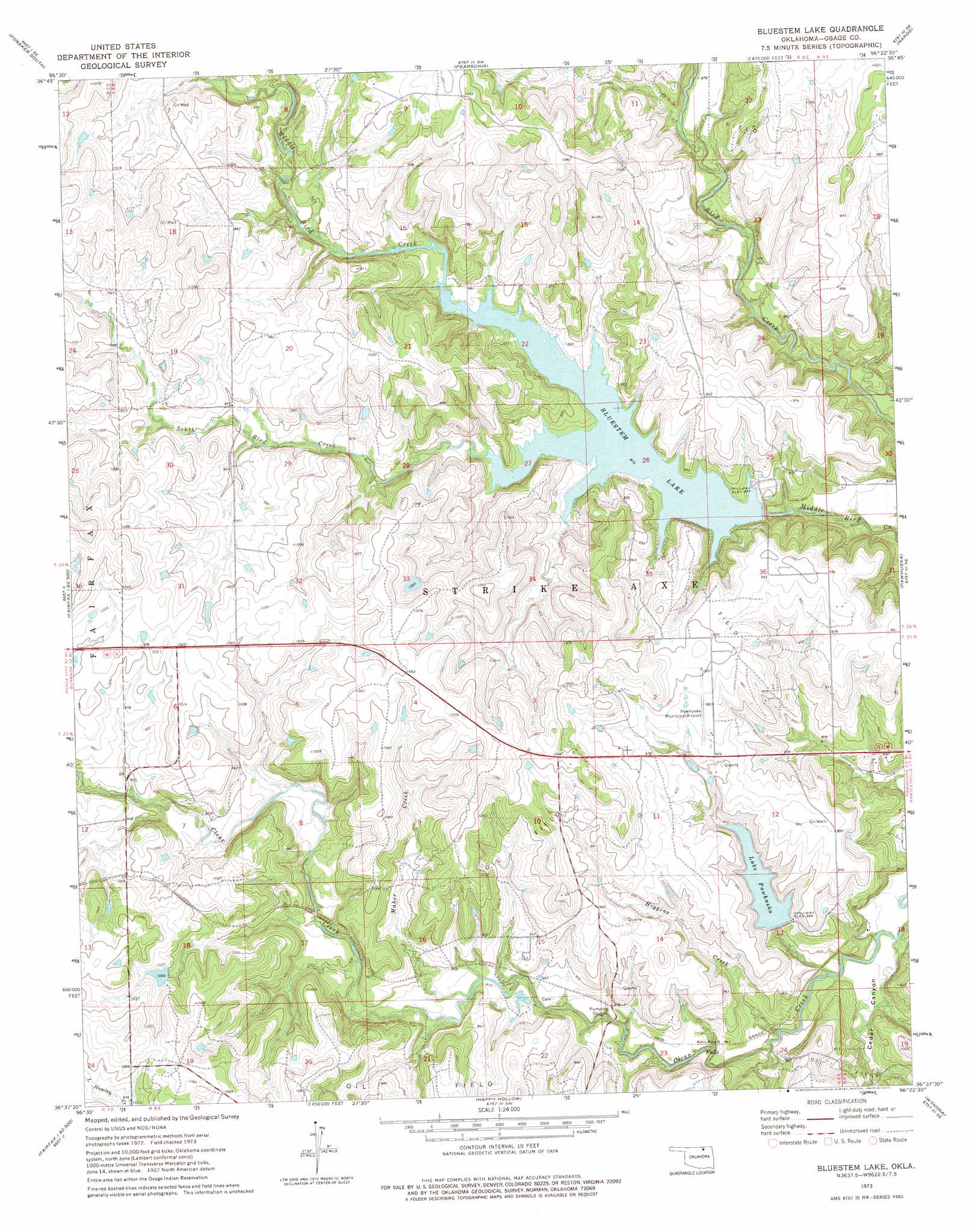
Bluestem Lake Topo Map Oklahoma
To zoom in, hover over the map of Bluestem Lake
USGS Topo Quad 36096f4 - 1:24,000 scale
| Topo Map Name: | Bluestem Lake |
| USGS Topo Quad ID: | 36096f4 |
| Print Size: | ca. 21 1/4" wide x 27" high |
| Southeast Coordinates: | 36.625° N latitude / 96.375° W longitude |
| Map Center Coordinates: | 36.6875° N latitude / 96.4375° W longitude |
| U.S. State: | OK |
| Filename: | o36096f4.jpg |
| Download Map JPG Image: | Bluestem Lake topo map 1:24,000 scale |
| Map Type: | Topographic |
| Topo Series: | 7.5´ |
| Map Scale: | 1:24,000 |
| Source of Map Images: | United States Geological Survey (USGS) |
| Alternate Map Versions: |
Bluestem Lake OK 1973, updated 1975 Download PDF Buy paper map Bluestem Lake OK 2010 Download PDF Buy paper map Bluestem Lake OK 2013 Download PDF Buy paper map Bluestem Lake OK 2016 Download PDF Buy paper map |
1:24,000 Topo Quads surrounding Bluestem Lake
Grainola |
Foraker North |
Pearsonia Nw |
Pearsonia Ne |
Whippoorwill |
Shidler |
Foraker South |
Pearsonia |
Nanos |
Herd |
Burbank |
Baconrind Creek |
Bluestem Lake |
Pawhuska |
Nelagoney |
Fairfax |
Lucy Creek |
Happy Hollow |
Wynona |
Barnsdall |
Skedee |
Bug Creek |
Hominy |
Hominy Ne |
Avant Nw |
> Back to 36096e1 at 1:100,000 scale
> Back to 36096a1 at 1:250,000 scale
> Back to U.S. Topo Maps home
Bluestem Lake topo map: Gazetteer
Bluestem Lake: Airports
Pawhuska Municipal Airport elevation 301m 987′Bluestem Lake: Dams
Bluestem Dam elevation 283m 928′Oknoname 113034 Dam elevation 309m 1013′
Oknoname 113112 Dam elevation 290m 951′
Oknoname 113113 Dam elevation 305m 1000′
Oknoname 113114 Dam elevation 307m 1007′
Pawhuska Dam elevation 270m 885′
Bluestem Lake: Reservoirs
Bluestem Lake elevation 267m 875′Lake Pawhuska elevation 271m 889′
Oknoname 113034 Reservoir elevation 309m 1013′
Oknoname 113112 Reservoir elevation 290m 951′
Oknoname 113113 Reservoir elevation 305m 1000′
Oknoname 113114 Reservoir elevation 307m 1007′
Pawhuska Lake elevation 270m 885′
Bluestem Lake: Streams
Baconrind Creek elevation 287m 941′Higgins Creek elevation 253m 830′
Maher Creek elevation 263m 862′
South Bird Creek elevation 267m 875′
Bluestem Lake: Valleys
Cedar Canyon elevation 256m 839′Bluestem Lake digital topo map on disk
Buy this Bluestem Lake topo map showing relief, roads, GPS coordinates and other geographical features, as a high-resolution digital map file on DVD: