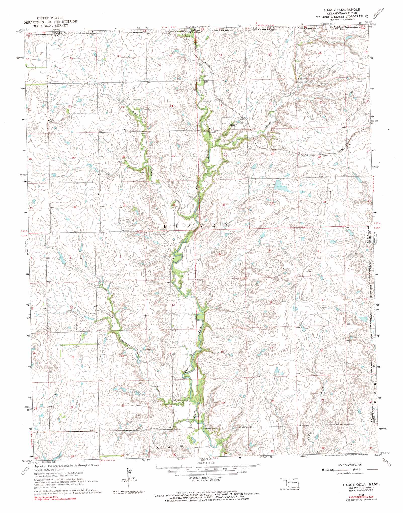
Hardy Topo Map Oklahoma
To zoom in, hover over the map of Hardy
USGS Topo Quad 36096h7 - 1:24,000 scale
| Topo Map Name: | Hardy |
| USGS Topo Quad ID: | 36096h7 |
| Print Size: | ca. 21 1/4" wide x 27" high |
| Southeast Coordinates: | 36.875° N latitude / 96.75° W longitude |
| Map Center Coordinates: | 36.9375° N latitude / 96.8125° W longitude |
| U.S. States: | OK, KS |
| Filename: | o36096h7.jpg |
| Download Map JPG Image: | Hardy topo map 1:24,000 scale |
| Map Type: | Topographic |
| Topo Series: | 7.5´ |
| Map Scale: | 1:24,000 |
| Source of Map Images: | United States Geological Survey (USGS) |
| Alternate Map Versions: |
Hardy OK 1964, updated 1965 Download PDF Buy paper map Hardy OK 1964, updated 1990 Download PDF Buy paper map Hardy OK 2010 Download PDF Buy paper map Hardy OK 2012 Download PDF Buy paper map Hardy OK 2016 Download PDF Buy paper map |
1:24,000 Topo Quads surrounding Hardy
Hackney |
Winfield |
Eaton |
Dexter |
Dexter Ne |
Arkansas City |
Silverdale |
Maple City |
Dexter Sw |
Cedar Vale West |
Newkirk |
Kaw City Nw |
Hardy |
Grainola |
Foraker North |
Kildare |
Uncas |
Kaw City |
Shidler |
Foraker South |
Ponca City |
Charley Creek East |
Charley Creek West |
Burbank |
Baconrind Creek |
> Back to 36096e1 at 1:100,000 scale
> Back to 36096a1 at 1:250,000 scale
> Back to U.S. Topo Maps home
Hardy topo map: Gazetteer
Hardy: Dams
Oknoname 071036 Dam elevation 367m 1204′Oknoname 071037 Dam elevation 384m 1259′
Oknoname 071038 Dam elevation 368m 1207′
Oknoname 071039 Dam elevation 365m 1197′
Oknoname 071040 Dam elevation 365m 1197′
Hardy: Populated Places
Hardy elevation 361m 1184′Hardy: Reservoirs
Oknoname 071036 Reservoir elevation 367m 1204′Oknoname 071037 Reservoir elevation 384m 1259′
Oknoname 071038 Reservoir elevation 368m 1207′
Oknoname 071039 Reservoir elevation 365m 1197′
Oknoname 071040 Reservoir elevation 365m 1197′
Hardy: Streams
Canadian Creek elevation 317m 1040′Mud Creek elevation 329m 1079′
Mud Creek elevation 333m 1092′
Myers Creek elevation 335m 1099′
Myers Creek elevation 335m 1099′
Hardy digital topo map on disk
Buy this Hardy topo map showing relief, roads, GPS coordinates and other geographical features, as a high-resolution digital map file on DVD: