Kaw City Nw Topo Map Oklahoma
To zoom in, hover over the map of Kaw City Nw
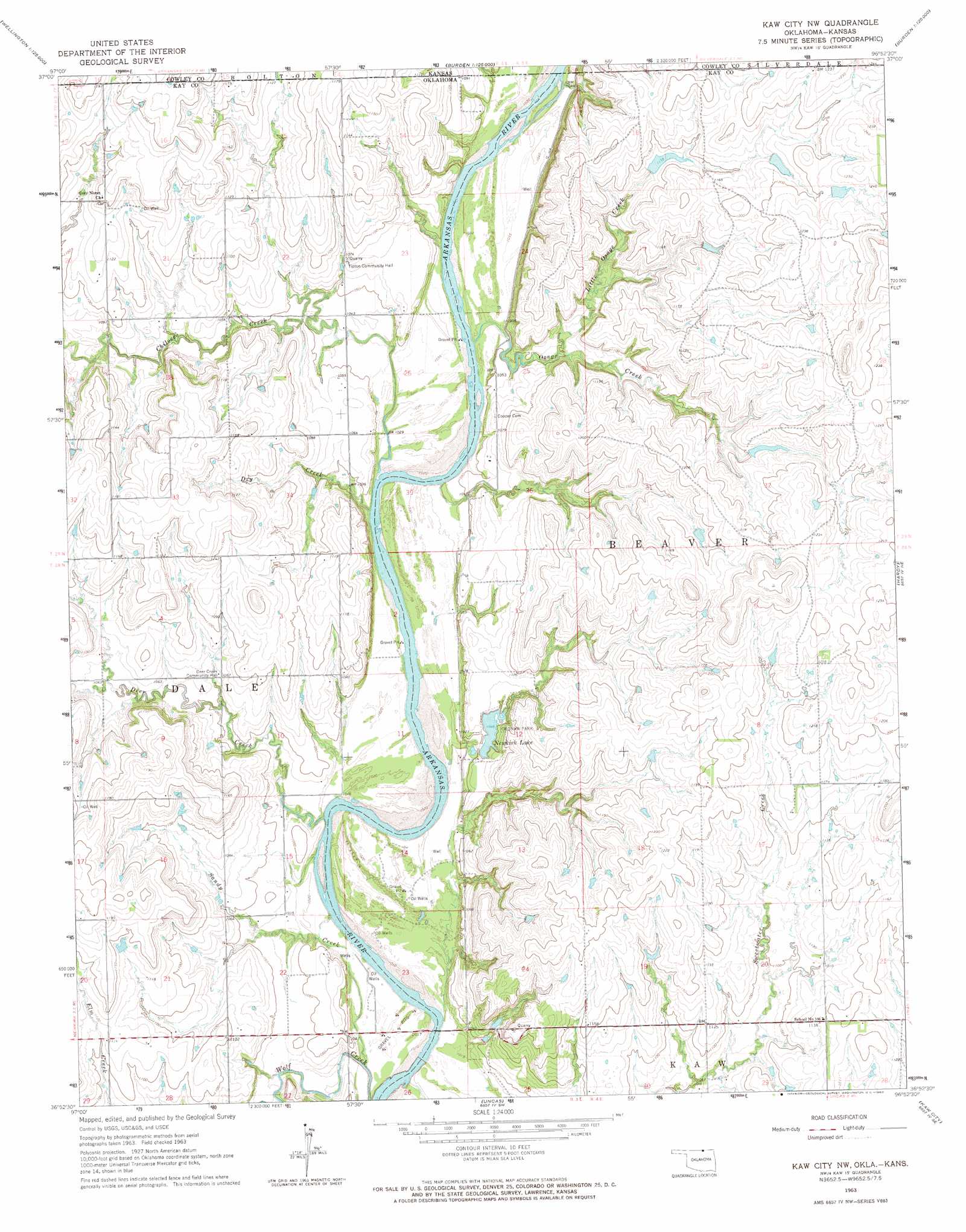
USGS Topo Quad 36096h8 - 1:24,000 scale
| Topo Map Name: | Kaw City Nw |
| USGS Topo Quad ID: | 36096h8 |
| Print Size: | ca. 21 1/4" wide x 27" high |
| Southeast Coordinates: | 36.875° N latitude / 96.875° W longitude |
| Map Center Coordinates: | 36.9375° N latitude / 96.9375° W longitude |
| U.S. States: | OK, KS |
| Filename: | o36096h8.jpg |
| Download Map JPG Image: | Kaw City Nw topo map 1:24,000 scale |
| Map Type: | Topographic |
| Topo Series: | 7.5´ |
| Map Scale: | 1:24,000 |
| Source of Map Images: | United States Geological Survey (USGS) |
| Alternate Map Versions: |
Kaw City NW OK 1963, updated 1965 Download PDF Buy paper map Kaw City NW OK 2010 Download PDF Buy paper map Kaw City NW OK 2012 Download PDF Buy paper map Kaw City NW OK 2016 Download PDF Buy paper map |
1:24,000 Topo Quads surrounding Kaw City Nw
Adamsville |
Hackney |
Winfield |
Eaton |
Dexter |
Geuda Springs |
Arkansas City |
Silverdale |
Maple City |
Dexter Sw |
Peckham |
Newkirk |
Kaw City Nw |
Hardy |
Grainola |
Newkirk Sw |
Kildare |
Uncas |
Kaw City |
Shidler |
Ponca City Nw |
Ponca City |
Charley Creek East |
Charley Creek West |
Burbank |
> Back to 36096e1 at 1:100,000 scale
> Back to 36096a1 at 1:250,000 scale
> Back to U.S. Topo Maps home
Kaw City Nw topo map: Gazetteer
Kaw City Nw: Dams
Newkirk Lake Dam elevation 326m 1069′Oknoname 071033 Dam elevation 346m 1135′
Oknoname 071034 Dam elevation 358m 1174′
Oknoname 071035 Dam elevation 354m 1161′
Kaw City Nw: Parks
Cronan Park elevation 319m 1046′Kaw City Nw: Reservoirs
Newkirk Lake elevation 319m 1046′Oknoname 071033 Reservoir elevation 346m 1135′
Oknoname 071034 Reservoir elevation 358m 1174′
Oknoname 071035 Reservoir elevation 354m 1161′
Kaw City Nw: Streams
Chilocco Creek elevation 310m 1017′Chilocco Creek elevation 310m 1017′
Deer Creek elevation 308m 1010′
Dry Creek elevation 310m 1017′
Little Osage Creek elevation 321m 1053′
Osage Creek elevation 315m 1033′
Sandy Creek elevation 308m 1010′
Kaw City Nw digital topo map on disk
Buy this Kaw City Nw topo map showing relief, roads, GPS coordinates and other geographical features, as a high-resolution digital map file on DVD: