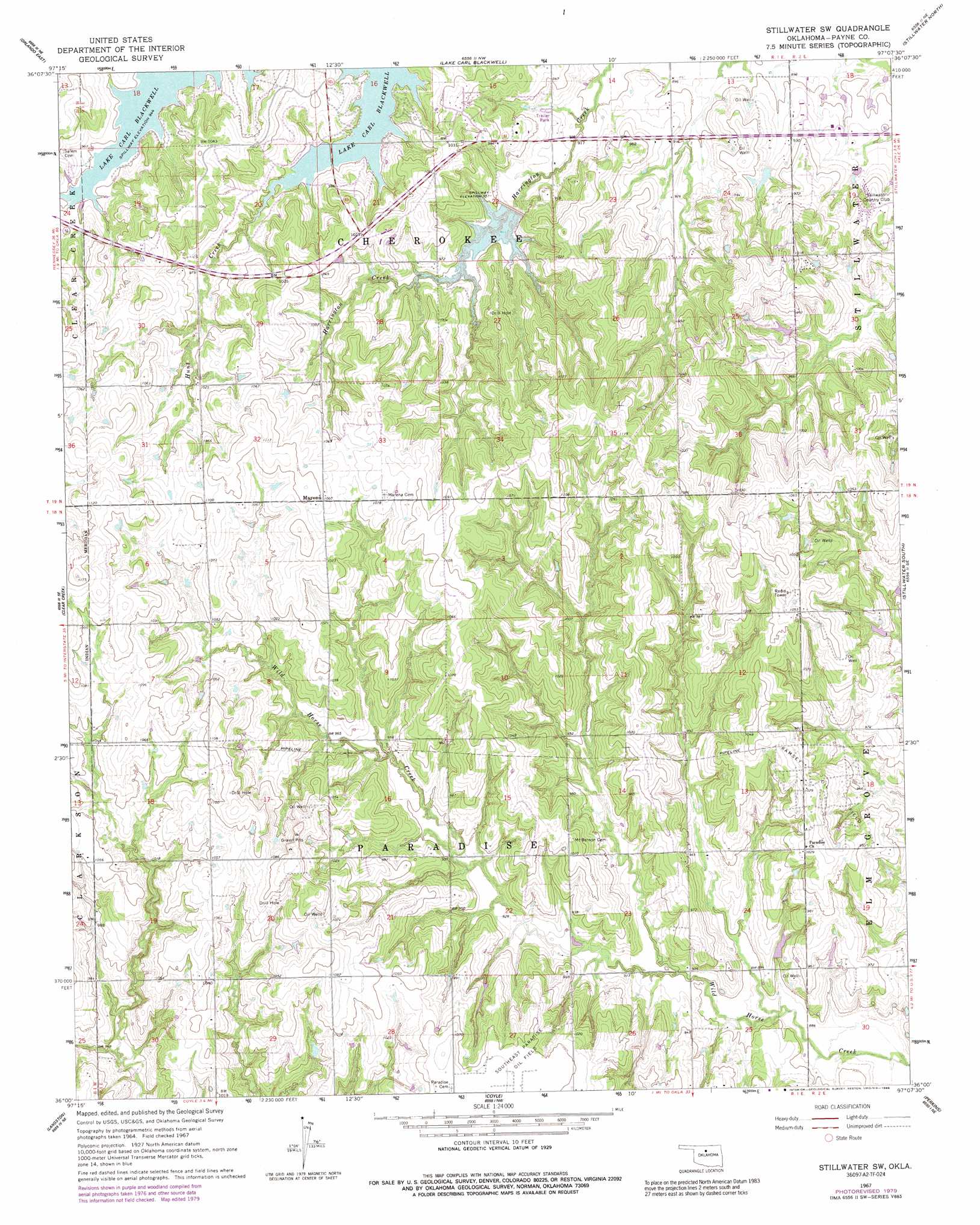
Stillwater Sw Topo Map Oklahoma
To zoom in, hover over the map of Stillwater Sw
USGS Topo Quad 36097a2 - 1:24,000 scale
| Topo Map Name: | Stillwater Sw |
| USGS Topo Quad ID: | 36097a2 |
| Print Size: | ca. 21 1/4" wide x 27" high |
| Southeast Coordinates: | 36° N latitude / 97.125° W longitude |
| Map Center Coordinates: | 36.0625° N latitude / 97.1875° W longitude |
| U.S. State: | OK |
| Filename: | o36097a2.jpg |
| Download Map JPG Image: | Stillwater Sw topo map 1:24,000 scale |
| Map Type: | Topographic |
| Topo Series: | 7.5´ |
| Map Scale: | 1:24,000 |
| Source of Map Images: | United States Geological Survey (USGS) |
| Alternate Map Versions: |
Stillwater SW OK 1967, updated 1968 Download PDF Buy paper map Stillwater SW OK 1967, updated 1979 Download PDF Buy paper map Stillwater SW OK 1967, updated 1989 Download PDF Buy paper map Stillwater SW OK 2010 Download PDF Buy paper map Stillwater SW OK 2013 Download PDF Buy paper map Stillwater SW OK 2016 Download PDF Buy paper map |
1:24,000 Topo Quads surrounding Stillwater Sw
Lucien |
Perry |
Black Bear |
Morrison |
Lela |
Orlando West |
Orlando East |
Lake Carl Blackwell |
Stillwater North |
Glencoe |
Mulhall |
Clear Creek |
Stillwater Sw |
Stillwater South |
Ripley |
Guthrie North |
Langston |
Coyle |
Perkins |
Tryon North |
Guthrie South |
Guthrie Se |
Meridian |
Carney |
Tryon South |
> Back to 36097a1 at 1:100,000 scale
> Back to 36096a1 at 1:250,000 scale
> Back to U.S. Topo Maps home
Stillwater Sw topo map: Gazetteer
Stillwater Sw: Dams
Oknoname 11907 Dam elevation 306m 1003′Stillwater Creek Site 46 Dam elevation 279m 915′
Stillwater Creek Site 48 Dam elevation 283m 928′
Stillwater Sw: Oilfields
Ramsey Oil Field elevation 313m 1026′Southeast Paradise Oil Field elevation 321m 1053′
Stillwater Sw: Populated Places
Marena elevation 334m 1095′Stillwater Sw: Reservoirs
Oknoname 11907 Reservoir elevation 306m 1003′Stillwater Creek Site 46 Reservoir elevation 279m 915′
Stillwater Creek Site 48 Reservoir elevation 283m 928′
Stillwater Sw: Streams
Hunt Creek elevation 289m 948′Stillwater Sw digital topo map on disk
Buy this Stillwater Sw topo map showing relief, roads, GPS coordinates and other geographical features, as a high-resolution digital map file on DVD: