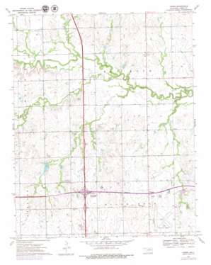
Ceres Topo Map Oklahoma
To zoom in, hover over the map of Ceres
USGS Topo Quad 36097d3 - 1:24,000 scale
| Topo Map Name: | Ceres |
| USGS Topo Quad ID: | 36097d3 |
| Print Size: | ca. 21 1/4" wide x 27" high |
| Southeast Coordinates: | 36.375° N latitude / 97.25° W longitude |
| Map Center Coordinates: | 36.4375° N latitude / 97.3125° W longitude |
| U.S. State: | OK |
| Filename: | o36097d3.jpg |
| Download Map JPG Image: | Ceres topo map 1:24,000 scale |
| Map Type: | Topographic |
| Topo Series: | 7.5´ |
| Map Scale: | 1:24,000 |
| Source of Map Images: | United States Geological Survey (USGS) |
| Alternate Map Versions: |
Ceres OK 1972, updated 1974 Download PDF Buy paper map Ceres OK 1972, updated 1979 Download PDF Buy paper map Ceres OK 2009 Download PDF Buy paper map Ceres OK 2012 Download PDF Buy paper map Ceres OK 2016 Download PDF Buy paper map |
1:24,000 Topo Quads surrounding Ceres
> Back to 36097a1 at 1:100,000 scale
> Back to 36096a1 at 1:250,000 scale
> Back to U.S. Topo Maps home
Ceres topo map: Gazetteer
Ceres: Airports
Perry Municipal Airport elevation 302m 990′Ceres: Crossings
Enid Interchange elevation 323m 1059′Ceres: Dams
Lower Red Rock Creek Site 13 Dam elevation 284m 931′Lower Red Rock Creek Site 16 Dam elevation 287m 941′
Lower Red Rock Creek Site 17 Dam elevation 285m 935′
Upper Red Rock Creek Site 1 Dam elevation 280m 918′
Upper Red Rock Creek Site 2 Dam elevation 284m 931′
Upper Red Rock Creek Site 54 Dam elevation 301m 987′
Upper Red Rock Creek Site 55 Dam elevation 300m 984′
Upper Red Rock Creek Site 56 Dam elevation 296m 971′
Upper Red Rock Creek Site 8 Dam elevation 285m 935′
Ceres: Populated Places
Ceres elevation 296m 971′Ceres: Reservoirs
Lower Red Rock Creek Site 13 Reservoir elevation 284m 931′Lower Red Rock Creek Site 16 Reservoir elevation 287m 941′
Lower Red Rock Creek Site 17 Reservoir elevation 285m 935′
Upper Red Rock Creek Site 1 Reservoir elevation 280m 918′
Upper Red Rock Creek Site 2 Reservoir elevation 284m 931′
Upper Red Rock Creek Site 54 Reservoir elevation 301m 987′
Upper Red Rock Creek Site 55 Reservoir elevation 300m 984′
Upper Red Rock Creek Site 56 Reservoir elevation 296m 971′
Upper Red Rock Creek Site 8 Reservoir elevation 285m 935′
Ceres: Streams
Dean Creek elevation 287m 941′Doe Creek elevation 280m 918′
Grassy Creek elevation 277m 908′
Hackberry Creek elevation 274m 898′
Ceres digital topo map on disk
Buy this Ceres topo map showing relief, roads, GPS coordinates and other geographical features, as a high-resolution digital map file on DVD:


