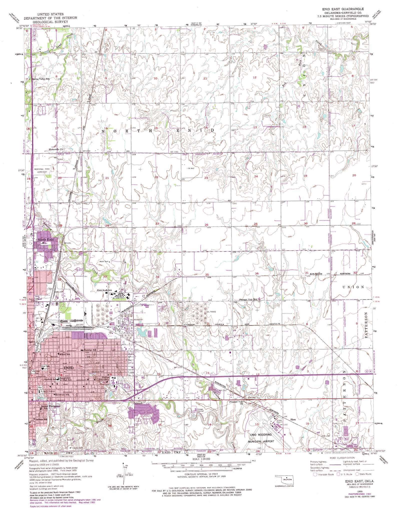
Enid East Topo Map Oklahoma
To zoom in, hover over the map of Enid East
USGS Topo Quad 36097d7 - 1:24,000 scale
| Topo Map Name: | Enid East |
| USGS Topo Quad ID: | 36097d7 |
| Print Size: | ca. 21 1/4" wide x 27" high |
| Southeast Coordinates: | 36.375° N latitude / 97.75° W longitude |
| Map Center Coordinates: | 36.4375° N latitude / 97.8125° W longitude |
| U.S. State: | OK |
| Filename: | o36097d7.jpg |
| Download Map JPG Image: | Enid East topo map 1:24,000 scale |
| Map Type: | Topographic |
| Topo Series: | 7.5´ |
| Map Scale: | 1:24,000 |
| Source of Map Images: | United States Geological Survey (USGS) |
| Alternate Map Versions: |
Enid East OK 1955, updated 1957 Download PDF Buy paper map Enid East OK 1955, updated 1976 Download PDF Buy paper map Enid East OK 1955, updated 1983 Download PDF Buy paper map Enid East OK 2010 Download PDF Buy paper map Enid East OK 2012 Download PDF Buy paper map Enid East OK 2016 Download PDF Buy paper map |
1:24,000 Topo Quads surrounding Enid East
Nash |
Pond Creek Nw |
Pond Creek |
Lamont Nw |
Lamont |
Jet Se |
Hillsdale |
Kremlin |
Hunter |
Lamont Se |
Lahoma |
Enid West |
Enid East |
Breckinridge |
Garber |
Drummond |
Waukomis |
Enid Se |
Fairmont |
Covington |
Barr |
Bison |
Steinerts Lake |
Marshall West |
Marshall East |
> Back to 36097a1 at 1:100,000 scale
> Back to 36096a1 at 1:250,000 scale
> Back to U.S. Topo Maps home
Enid East topo map: Gazetteer
Enid East: Airports
Enid State School Heliport elevation 377m 1236′Enid Woodring Municipal Airport elevation 351m 1151′
North/Hirst Aero Spray Airport elevation 385m 1263′
Woodring Airport elevation 352m 1154′
Enid East: Parks
Glenwood Park elevation 372m 1220′Gore Park elevation 379m 1243′
Springs Park elevation 369m 1210′
Enid East: Populated Places
North Enid elevation 383m 1256′Shea elevation 355m 1164′
Enid East: Streams
Boggy Creek elevation 342m 1122′Enid East digital topo map on disk
Buy this Enid East topo map showing relief, roads, GPS coordinates and other geographical features, as a high-resolution digital map file on DVD: