Lamont Se Topo Map Oklahoma
To zoom in, hover over the map of Lamont Se
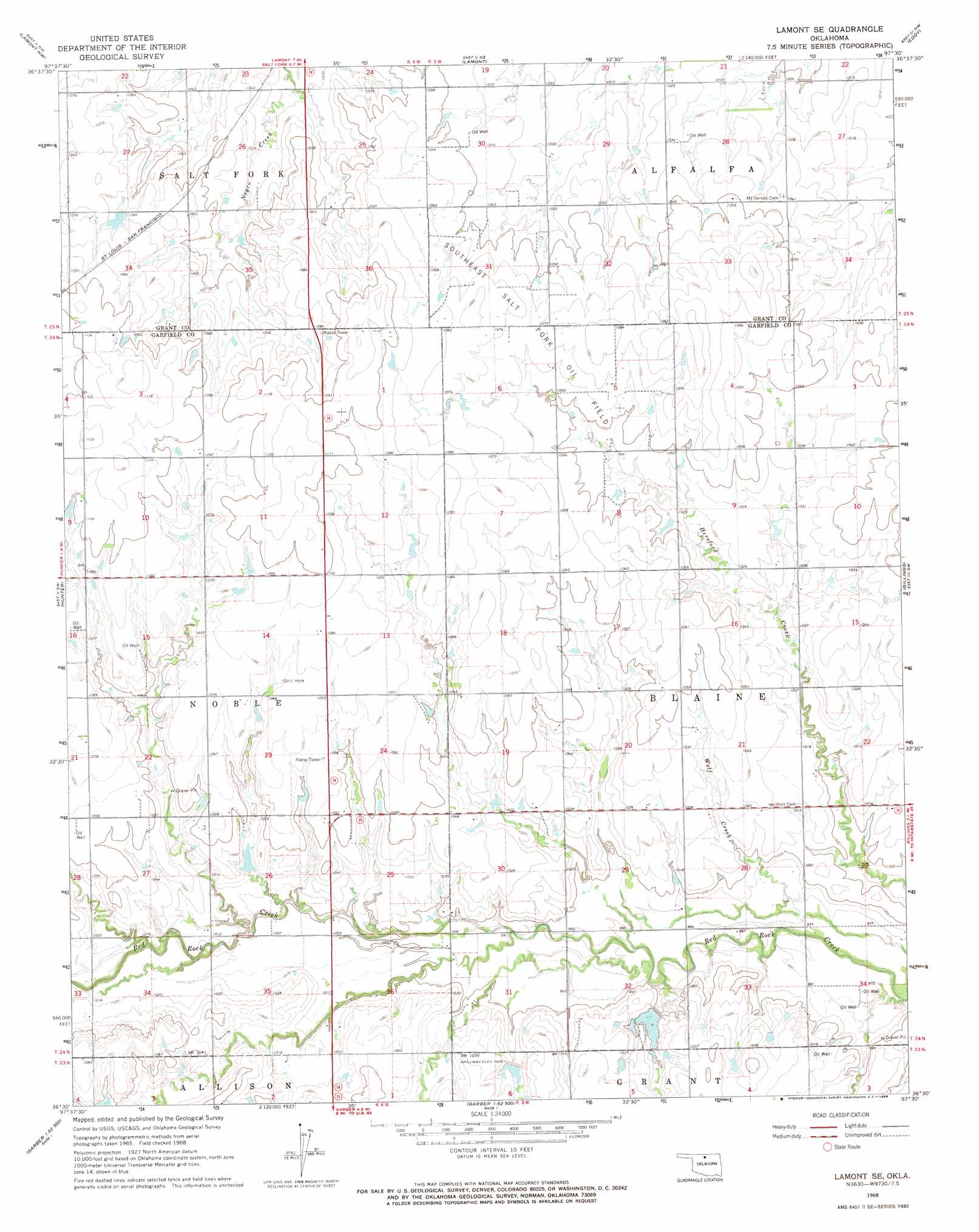
USGS Topo Quad 36097e5 - 1:24,000 scale
| Topo Map Name: | Lamont Se |
| USGS Topo Quad ID: | 36097e5 |
| Print Size: | ca. 21 1/4" wide x 27" high |
| Southeast Coordinates: | 36.5° N latitude / 97.5° W longitude |
| Map Center Coordinates: | 36.5625° N latitude / 97.5625° W longitude |
| U.S. State: | OK |
| Filename: | o36097e5.jpg |
| Download Map JPG Image: | Lamont Se topo map 1:24,000 scale |
| Map Type: | Topographic |
| Topo Series: | 7.5´ |
| Map Scale: | 1:24,000 |
| Source of Map Images: | United States Geological Survey (USGS) |
| Alternate Map Versions: |
Lamont SE OK 1968, updated 1969 Download PDF Buy paper map Lamont SE OK 2010 Download PDF Buy paper map Lamont SE OK 2012 Download PDF Buy paper map Lamont SE OK 2016 Download PDF Buy paper map |
1:24,000 Topo Quads surrounding Lamont Se
Wakita Se |
Medford |
Deer Creek |
Nardin |
Blackwell |
Pond Creek |
Lamont Nw |
Lamont |
Eddy |
Tonkawa |
Kremlin |
Hunter |
Lamont Se |
Billings |
Tonkawa Se |
Enid East |
Breckinridge |
Garber |
Perry Nw |
Ceres |
Enid Se |
Fairmont |
Covington |
Lucien |
Perry |
> Back to 36097e1 at 1:100,000 scale
> Back to 36096a1 at 1:250,000 scale
> Back to U.S. Topo Maps home
Lamont Se topo map: Gazetteer
Lamont Se: Dams
Upper Red Rock Creek Site 18 Dam elevation 308m 1010′Upper Red Rock Creek Site 20 Dam elevation 305m 1000′
Upper Red Rock Creek Site 21 Dam elevation 313m 1026′
Upper Red Rock Creek Site 22 Dam elevation 315m 1033′
Upper Red Rock Creek Site 40 Dam elevation 309m 1013′
Upper Red Rock Creek Site 42 Dam elevation 308m 1010′
Upper Red Rock Creek Site 43 Dam elevation 306m 1003′
Lamont Se: Oilfields
Southeast Salt Fork Oil Field elevation 325m 1066′Lamont Se: Reservoirs
Upper Rec Rock Creek Site 21 Reservoir elevation 313m 1026′Upper Red Rock Creek Site 18 Reservoir elevation 308m 1010′
Upper Red Rock Creek Site 20 Reservoir elevation 305m 1000′
Upper Red Rock Creek Site 22 Reservoir elevation 315m 1033′
Upper Red Rock Creek Site 40 Reservoir elevation 309m 1013′
Upper Red Rock Creek Site 42 Reservoir elevation 308m 1010′
Upper Red Rock Creek Site 43 Reservoir elevation 306m 1003′
Lamont Se digital topo map on disk
Buy this Lamont Se topo map showing relief, roads, GPS coordinates and other geographical features, as a high-resolution digital map file on DVD: