Canton Nw Topo Map Oklahoma
To zoom in, hover over the map of Canton Nw
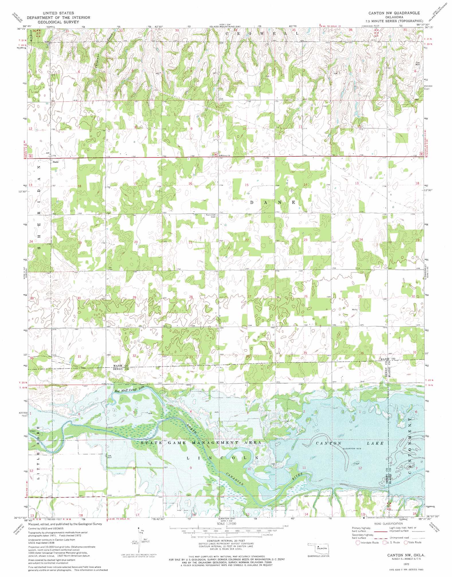
USGS Topo Quad 36098b6 - 1:24,000 scale
| Topo Map Name: | Canton Nw |
| USGS Topo Quad ID: | 36098b6 |
| Print Size: | ca. 21 1/4" wide x 27" high |
| Southeast Coordinates: | 36.125° N latitude / 98.625° W longitude |
| Map Center Coordinates: | 36.1875° N latitude / 98.6875° W longitude |
| U.S. State: | OK |
| Filename: | o36098b6.jpg |
| Download Map JPG Image: | Canton Nw topo map 1:24,000 scale |
| Map Type: | Topographic |
| Topo Series: | 7.5´ |
| Map Scale: | 1:24,000 |
| Source of Map Images: | United States Geological Survey (USGS) |
| Alternate Map Versions: |
Canton NW OK 1972, updated 1974 Download PDF Buy paper map Canton NW OK 2009 Download PDF Buy paper map Canton NW OK 2012 Download PDF Buy paper map Canton NW OK 2016 Download PDF Buy paper map |
1:24,000 Topo Quads surrounding Canton Nw
Belva |
Togo |
Glass Mountains Nw |
Glass Mountains Ne |
Cleo Springs |
Cedardale |
Phroso |
Glass Mountains Sw |
Glass Mountains |
Fairview |
Seiling |
Orion |
Canton Nw |
Longdale |
Homestead |
Taloga |
Hucmac |
Canton Sw |
Canton |
Southard |
Putnam Nw |
Parallel |
Oakwood |
Eagle City |
Watonga Lake |
> Back to 36098a1 at 1:100,000 scale
> Back to 36098a1 at 1:250,000 scale
> Back to U.S. Topo Maps home
Canton Nw topo map: Gazetteer
Canton Nw: Dams
Oknoname 093006 Dam elevation 499m 1637′Oknoname 093007 Dam elevation 522m 1712′
Canton Nw: Lakes
Red Bluff Cutoff Lake elevation 496m 1627′Canton Nw: Parks
Canton Wildlife Management Area elevation 494m 1620′Canton Nw: Populated Places
Bado elevation 542m 1778′Canton Nw: Reservoirs
Oknoname 093006 Reservoir elevation 499m 1637′Oknoname 093007 Reservoir elevation 522m 1712′
Canton Nw digital topo map on disk
Buy this Canton Nw topo map showing relief, roads, GPS coordinates and other geographical features, as a high-resolution digital map file on DVD: