Lahoma Topo Map Oklahoma
To zoom in, hover over the map of Lahoma
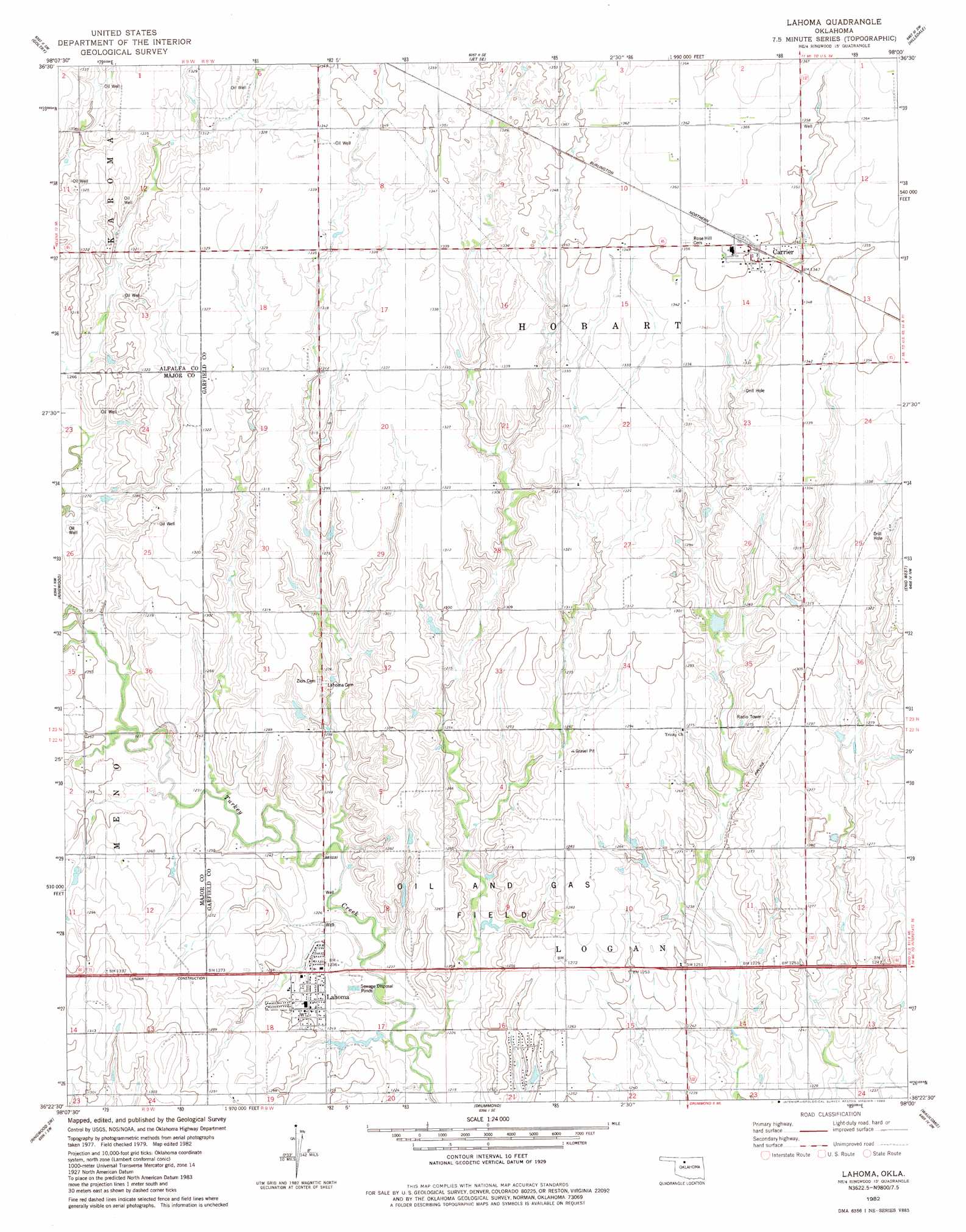
USGS Topo Quad 36098d1 - 1:24,000 scale
| Topo Map Name: | Lahoma |
| USGS Topo Quad ID: | 36098d1 |
| Print Size: | ca. 21 1/4" wide x 27" high |
| Southeast Coordinates: | 36.375° N latitude / 98° W longitude |
| Map Center Coordinates: | 36.4375° N latitude / 98.0625° W longitude |
| U.S. State: | OK |
| Filename: | o36098d1.jpg |
| Download Map JPG Image: | Lahoma topo map 1:24,000 scale |
| Map Type: | Topographic |
| Topo Series: | 7.5´ |
| Map Scale: | 1:24,000 |
| Source of Map Images: | United States Geological Survey (USGS) |
| Alternate Map Versions: |
Lahoma OK 1982, updated 1983 Download PDF Buy paper map Lahoma OK 2009 Download PDF Buy paper map Lahoma OK 2012 Download PDF Buy paper map Lahoma OK 2016 Download PDF Buy paper map |
1:24,000 Topo Quads surrounding Lahoma
Cherokee South |
Jet |
Nash |
Pond Creek Nw |
Pond Creek |
Helena |
Goltry |
Jet Se |
Hillsdale |
Kremlin |
Fairview Ne |
Ringwood |
Lahoma |
Enid West |
Enid East |
Fairview Se |
Ringwood Sw |
Drummond |
Waukomis |
Enid Se |
Isabella |
Ames |
Barr |
Bison |
Steinerts Lake |
> Back to 36098a1 at 1:100,000 scale
> Back to 36098a1 at 1:250,000 scale
> Back to U.S. Topo Maps home
Lahoma topo map: Gazetteer
Lahoma: Dams
Oknoname 04702 Dam elevation 387m 1269′Lahoma: Populated Places
Carrier elevation 411m 1348′Lahoma elevation 379m 1243′
Lahoma: Reservoirs
Oknoname 04702 Reservoir elevation 387m 1269′Lahoma digital topo map on disk
Buy this Lahoma topo map showing relief, roads, GPS coordinates and other geographical features, as a high-resolution digital map file on DVD: