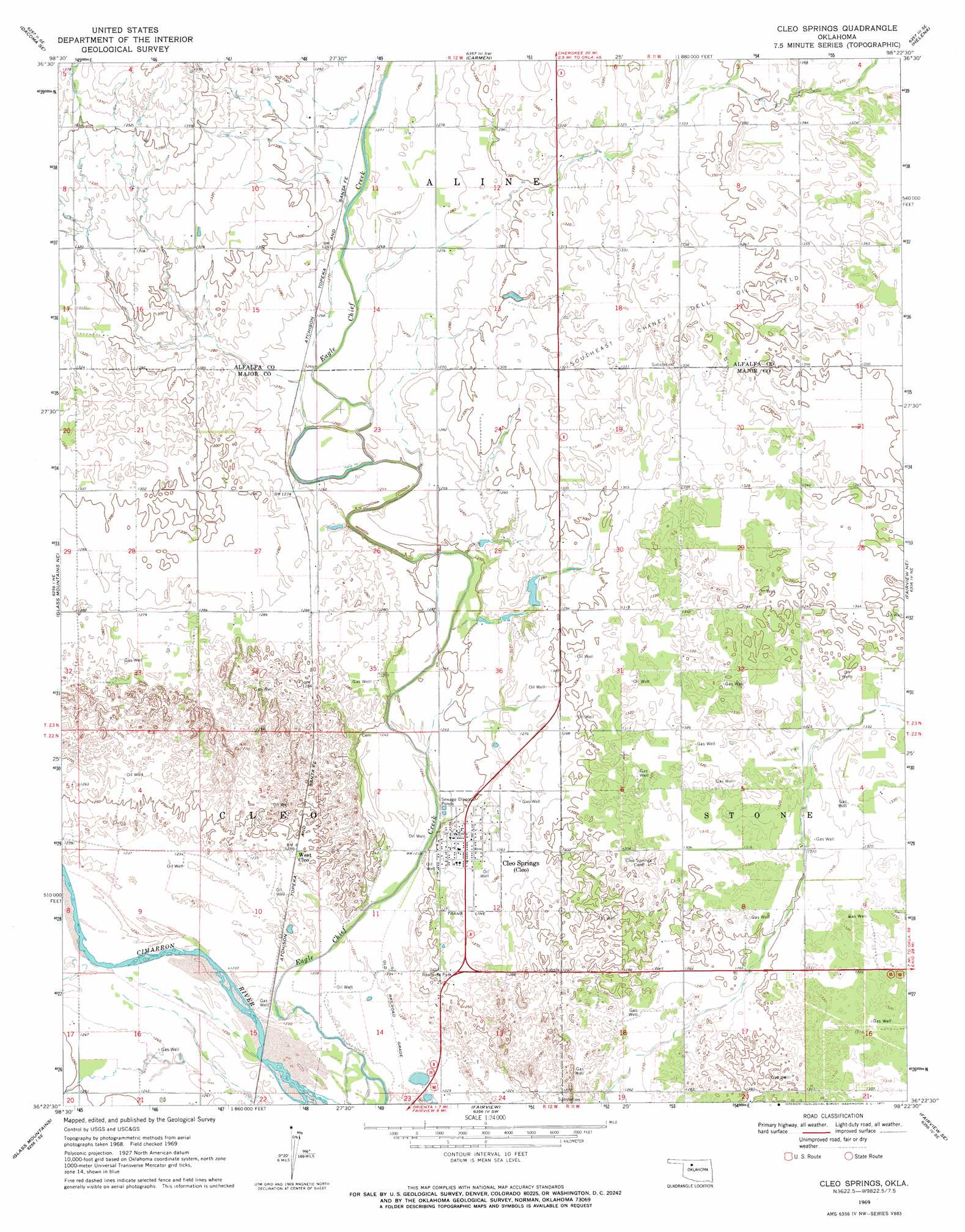
Cleo Springs Topo Map Oklahoma
To zoom in, hover over the map of Cleo Springs
USGS Topo Quad 36098d4 - 1:24,000 scale
| Topo Map Name: | Cleo Springs |
| USGS Topo Quad ID: | 36098d4 |
| Print Size: | ca. 21 1/4" wide x 27" high |
| Southeast Coordinates: | 36.375° N latitude / 98.375° W longitude |
| Map Center Coordinates: | 36.4375° N latitude / 98.4375° W longitude |
| U.S. State: | OK |
| Filename: | o36098d4.jpg |
| Download Map JPG Image: | Cleo Springs topo map 1:24,000 scale |
| Map Type: | Topographic |
| Topo Series: | 7.5´ |
| Map Scale: | 1:24,000 |
| Source of Map Images: | United States Geological Survey (USGS) |
| Alternate Map Versions: |
Cleo Springs OK 1969, updated 1971 Download PDF Buy paper map Cleo Springs OK 2009 Download PDF Buy paper map Cleo Springs OK 2012 Download PDF Buy paper map Cleo Springs OK 2016 Download PDF Buy paper map |
1:24,000 Topo Quads surrounding Cleo Springs
Hopeton |
Dacoma |
Lambert |
Cherokee South |
Jet |
Dacoma Sw |
Dacoma Se |
Carmen |
Helena |
Goltry |
Glass Mountains Nw |
Glass Mountains Ne |
Cleo Springs |
Fairview Ne |
Ringwood |
Glass Mountains Sw |
Glass Mountains |
Fairview |
Fairview Se |
Ringwood Sw |
Canton Nw |
Longdale |
Homestead |
Isabella |
Ames |
> Back to 36098a1 at 1:100,000 scale
> Back to 36098a1 at 1:250,000 scale
> Back to U.S. Topo Maps home
Cleo Springs topo map: Gazetteer
Cleo Springs: Dams
Oknoname 093002 Dam elevation 393m 1289′Cleo Springs: Populated Places
Cleo Springs elevation 389m 1276′West Cleo elevation 379m 1243′
Cleo Springs: Reservoirs
Oknoname 093002 Reservoir elevation 393m 1289′Cleo Springs digital topo map on disk
Buy this Cleo Springs topo map showing relief, roads, GPS coordinates and other geographical features, as a high-resolution digital map file on DVD: