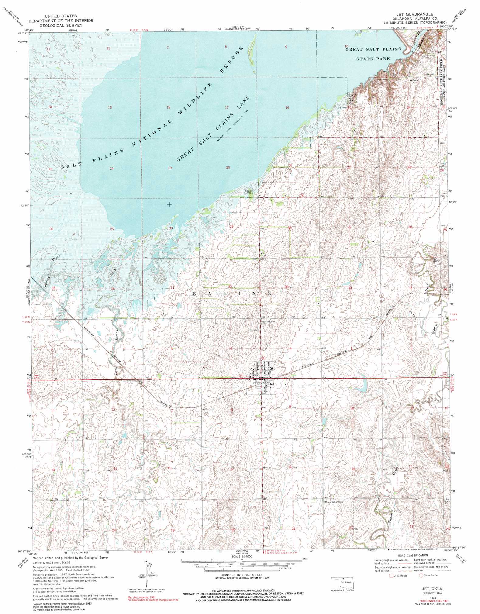
Jet Topo Map Oklahoma
To zoom in, hover over the map of Jet
USGS Topo Quad 36098f2 - 1:24,000 scale
| Topo Map Name: | Jet |
| USGS Topo Quad ID: | 36098f2 |
| Print Size: | ca. 21 1/4" wide x 27" high |
| Southeast Coordinates: | 36.625° N latitude / 98.125° W longitude |
| Map Center Coordinates: | 36.6875° N latitude / 98.1875° W longitude |
| U.S. State: | OK |
| Filename: | o36098f2.jpg |
| Download Map JPG Image: | Jet topo map 1:24,000 scale |
| Map Type: | Topographic |
| Topo Series: | 7.5´ |
| Map Scale: | 1:24,000 |
| Source of Map Images: | United States Geological Survey (USGS) |
| Alternate Map Versions: |
Jet OK 1969, updated 1969 Download PDF Buy paper map Jet OK 1969, updated 1971 Download PDF Buy paper map Jet OK 1969, updated 1991 Download PDF Buy paper map Jet OK 2009 Download PDF Buy paper map Jet OK 2012 Download PDF Buy paper map Jet OK 2016 Download PDF Buy paper map |
1:24,000 Topo Quads surrounding Jet
Burlington |
Amorita |
Manchester Nw |
Manchester |
Wakita |
Ingersoll |
Cherokee North |
Manchester Sw |
Sand Creek |
Wakita Sw |
Lambert |
Cherokee South |
Jet |
Nash |
Pond Creek Nw |
Carmen |
Helena |
Goltry |
Jet Se |
Hillsdale |
Cleo Springs |
Fairview Ne |
Ringwood |
Lahoma |
Enid West |
> Back to 36098e1 at 1:100,000 scale
> Back to 36098a1 at 1:250,000 scale
> Back to U.S. Topo Maps home
Jet topo map: Gazetteer
Jet: Dams
Great Salt Plains Dam elevation 339m 1112′Jet: Parks
Great Salt Plains State Park elevation 353m 1158′Jet: Populated Places
Jet elevation 379m 1243′Jet: Reservoirs
Great Salt Plains Lake elevation 348m 1141′Great Salt Plains Reservoir elevation 339m 1112′
Jet: Streams
Clay Creek elevation 343m 1125′Cottonwood Creek elevation 343m 1125′
Spring Creek elevation 344m 1128′
Twin Spring Creek elevation 344m 1128′
Jet digital topo map on disk
Buy this Jet topo map showing relief, roads, GPS coordinates and other geographical features, as a high-resolution digital map file on DVD: