Fairvalley Se Topo Map Oklahoma
To zoom in, hover over the map of Fairvalley Se
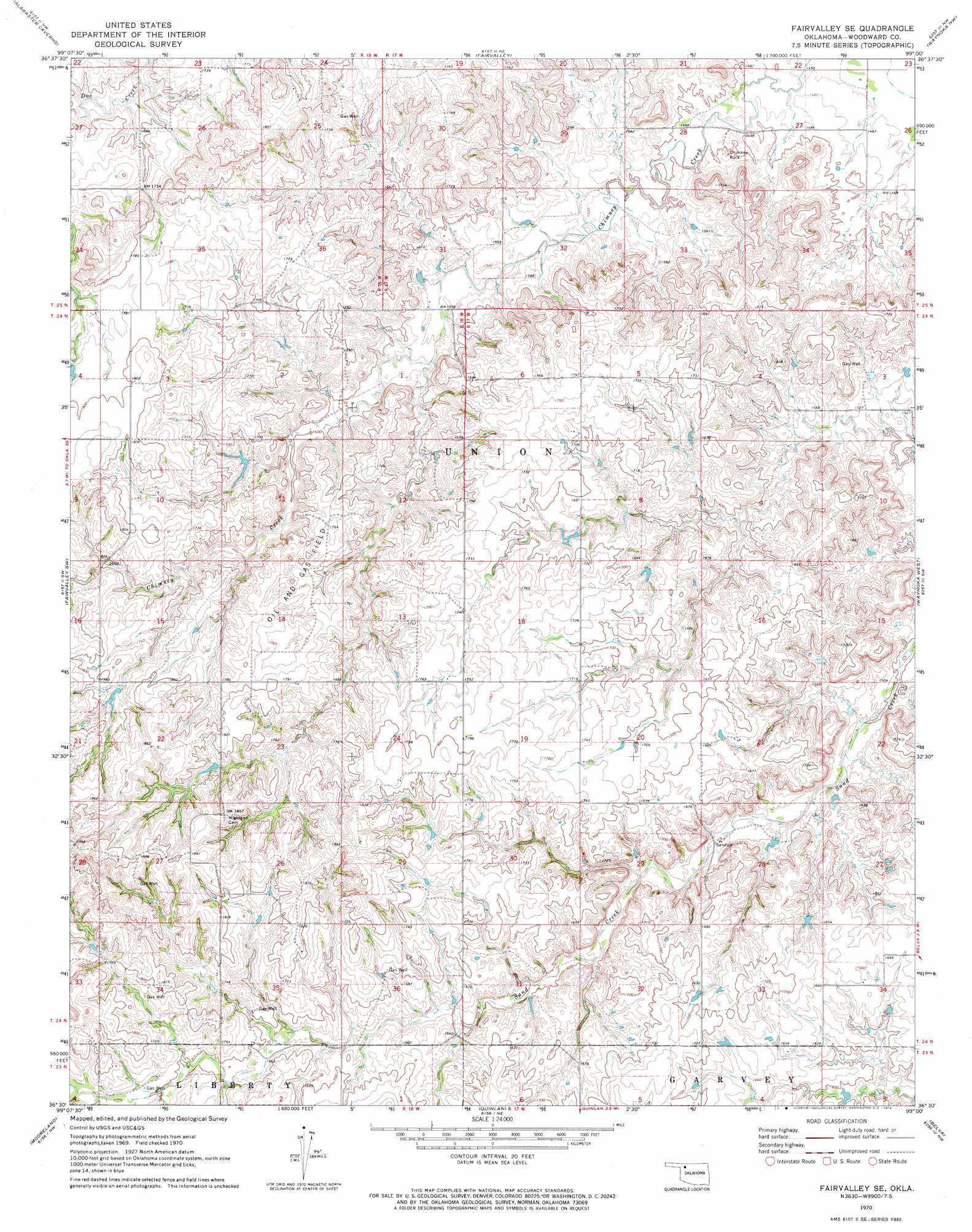
USGS Topo Quad 36099e1 - 1:24,000 scale
| Topo Map Name: | Fairvalley Se |
| USGS Topo Quad ID: | 36099e1 |
| Print Size: | ca. 21 1/4" wide x 27" high |
| Southeast Coordinates: | 36.5° N latitude / 99° W longitude |
| Map Center Coordinates: | 36.5625° N latitude / 99.0625° W longitude |
| U.S. State: | OK |
| Filename: | o36099e1.jpg |
| Download Map JPG Image: | Fairvalley Se topo map 1:24,000 scale |
| Map Type: | Topographic |
| Topo Series: | 7.5´ |
| Map Scale: | 1:24,000 |
| Source of Map Images: | United States Geological Survey (USGS) |
| Alternate Map Versions: |
Fairvalley SE OK 1970, updated 1972 Download PDF Buy paper map Fairvalley SE OK 2010 Download PDF Buy paper map Fairvalley SE OK 2012 Download PDF Buy paper map Fairvalley SE OK 2016 Download PDF Buy paper map |
1:24,000 Topo Quads surrounding Fairvalley Se
Selman Se |
Edith |
Freedom |
Tegarden |
Tegarden Se |
Sleeping Bear Creek |
Alabaster Caverns |
Fairvalley |
Waynoka Nw |
Avard |
Sleeping Bear Creek Se |
Fairvalley Sw |
Fairvalley Se |
Waynoka West |
Waynoka East |
Woodward Ne |
Mooreland |
Quinlan |
Belva |
Togo |
Sharon |
Mooreland Sw |
Mooreland Se |
Cedardale |
Phroso |
> Back to 36099e1 at 1:100,000 scale
> Back to 36098a1 at 1:250,000 scale
> Back to U.S. Topo Maps home
Fairvalley Se topo map: Gazetteer
Fairvalley Se: Dams
Bingham Dam elevation 488m 1601′Gardner Number 1 Dam elevation 515m 1689′
Lockhart Dam elevation 507m 1663′
Matteson Number 2 Dam elevation 492m 1614′
Matteson Number 2b Dam elevation 476m 1561′
Oknoname 153001 Dam elevation 505m 1656′
Fairvalley Se: Pillars
Chimney Rock elevation 459m 1505′Fairvalley Se: Reservoirs
Bingham Reservoir elevation 488m 1601′Gardner Number 1 Reservoir elevation 515m 1689′
Lockhart Reservoir elevation 507m 1663′
Matteson Number 2 Reservoir elevation 492m 1614′
Matteson Number 2b Reservoir elevation 476m 1561′
Oknoname 153001 Reservoir elevation 505m 1656′
Fairvalley Se digital topo map on disk
Buy this Fairvalley Se topo map showing relief, roads, GPS coordinates and other geographical features, as a high-resolution digital map file on DVD: