Freedom Nw Topo Map Oklahoma
To zoom in, hover over the map of Freedom Nw
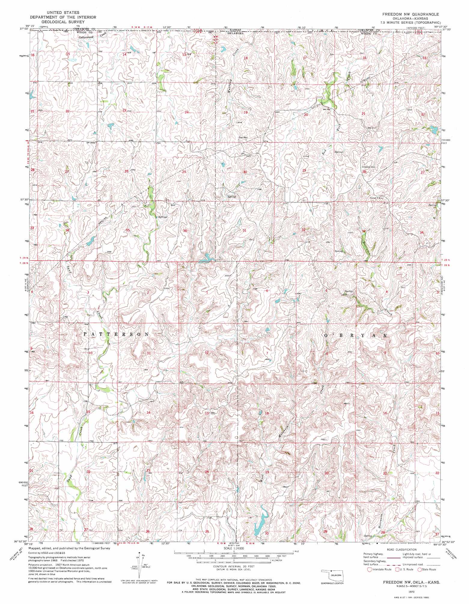
USGS Topo Quad 36099h2 - 1:24,000 scale
| Topo Map Name: | Freedom Nw |
| USGS Topo Quad ID: | 36099h2 |
| Print Size: | ca. 21 1/4" wide x 27" high |
| Southeast Coordinates: | 36.875° N latitude / 99.125° W longitude |
| Map Center Coordinates: | 36.9375° N latitude / 99.1875° W longitude |
| U.S. States: | OK, KS |
| Filename: | o36099h2.jpg |
| Download Map JPG Image: | Freedom Nw topo map 1:24,000 scale |
| Map Type: | Topographic |
| Topo Series: | 7.5´ |
| Map Scale: | 1:24,000 |
| Source of Map Images: | United States Geological Survey (USGS) |
| Alternate Map Versions: |
Freedom NW OK 1970, updated 1972 Download PDF Buy paper map Freedom NW OK 2010 Download PDF Buy paper map Freedom NW OK 2012 Download PDF Buy paper map Freedom NW OK 2016 Download PDF Buy paper map |
1:24,000 Topo Quads surrounding Freedom Nw
Protection |
Protection Ne |
Nescatunga Creek North |
Indian Creek |
Deerhead |
Protection Sw |
Buttermilk |
Nescatunga Creek South |
Fancy Canyon |
Aetna |
Selman Nw |
Lookout |
Freedom Nw |
Freedom Ne |
Tegarden Nw |
Selman |
Selman Se |
Edith |
Freedom |
Tegarden |
Sleeping Bear Creek Nw |
Sleeping Bear Creek |
Alabaster Caverns |
Fairvalley |
Waynoka Nw |
> Back to 36099e1 at 1:100,000 scale
> Back to 36098a1 at 1:250,000 scale
> Back to U.S. Topo Maps home
Freedom Nw topo map: Gazetteer
Freedom Nw: Dams
Burbnham Number 4 Dam elevation 532m 1745′Burnham Number 9 Dam elevation 531m 1742′
Freedom Nw: Reservoirs
Burnham Number 4 Reservoir elevation 532m 1745′Burnham Number 9 Reservoir elevation 531m 1742′
Freedom Nw digital topo map on disk
Buy this Freedom Nw topo map showing relief, roads, GPS coordinates and other geographical features, as a high-resolution digital map file on DVD: