Selman Nw Topo Map Oklahoma
To zoom in, hover over the map of Selman Nw
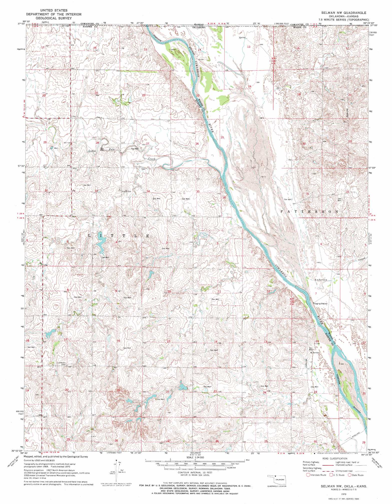
USGS Topo Quad 36099h4 - 1:24,000 scale
| Topo Map Name: | Selman Nw |
| USGS Topo Quad ID: | 36099h4 |
| Print Size: | ca. 21 1/4" wide x 27" high |
| Southeast Coordinates: | 36.875° N latitude / 99.375° W longitude |
| Map Center Coordinates: | 36.9375° N latitude / 99.4375° W longitude |
| U.S. States: | OK, KS |
| Filename: | o36099h4.jpg |
| Download Map JPG Image: | Selman Nw topo map 1:24,000 scale |
| Map Type: | Topographic |
| Topo Series: | 7.5´ |
| Map Scale: | 1:24,000 |
| Source of Map Images: | United States Geological Survey (USGS) |
| Alternate Map Versions: |
Selman NW OK 1970, updated 1973 Download PDF Buy paper map Selman NW OK 2010 Download PDF Buy paper map Selman NW OK 2012 Download PDF Buy paper map Selman NW OK 2016 Download PDF Buy paper map |
1:24,000 Topo Quads surrounding Selman Nw
Sitka |
Sugarloaf |
Protection |
Protection Ne |
Nescatunga Creek North |
Sitka Sw |
Trout Creek |
Protection Sw |
Buttermilk |
Nescatunga Creek South |
Buffalo Nw |
Buffalo Ne |
Selman Nw |
Lookout |
Freedom Nw |
Buffalo |
Buffalo Se |
Selman |
Selman Se |
Edith |
Fort Supply Nw |
Fort Supply Ne |
Sleeping Bear Creek Nw |
Sleeping Bear Creek |
Alabaster Caverns |
> Back to 36099e1 at 1:100,000 scale
> Back to 36098a1 at 1:250,000 scale
> Back to U.S. Topo Maps home
Selman Nw topo map: Gazetteer
Selman Nw: Dams
Miller Lake Dam elevation 556m 1824′Oknoname 059046 Dam elevation 539m 1768′
Oknoname 059047 Dam elevation 568m 1863′
Oknoname 05906 Dam elevation 530m 1738′
Oknoname 05908 Dam elevation 552m 1811′
Selman Nw: Reservoirs
Miller Lake elevation 556m 1824′Oknoname 059046 Reservoir elevation 539m 1768′
Oknoname 059047 Reservoir elevation 568m 1863′
Oknoname 05906 Reservoir elevation 530m 1738′
Oknoname 05908 Reservoir elevation 552m 1811′
Selman Nw: Streams
Anderson Creek elevation 506m 1660′Anderson Creek elevation 506m 1660′
Lodge Pole Creek elevation 508m 1666′
West Creek elevation 513m 1683′
Selman Nw digital topo map on disk
Buy this Selman Nw topo map showing relief, roads, GPS coordinates and other geographical features, as a high-resolution digital map file on DVD: