Lipscomb Topo Map Texas
To zoom in, hover over the map of Lipscomb
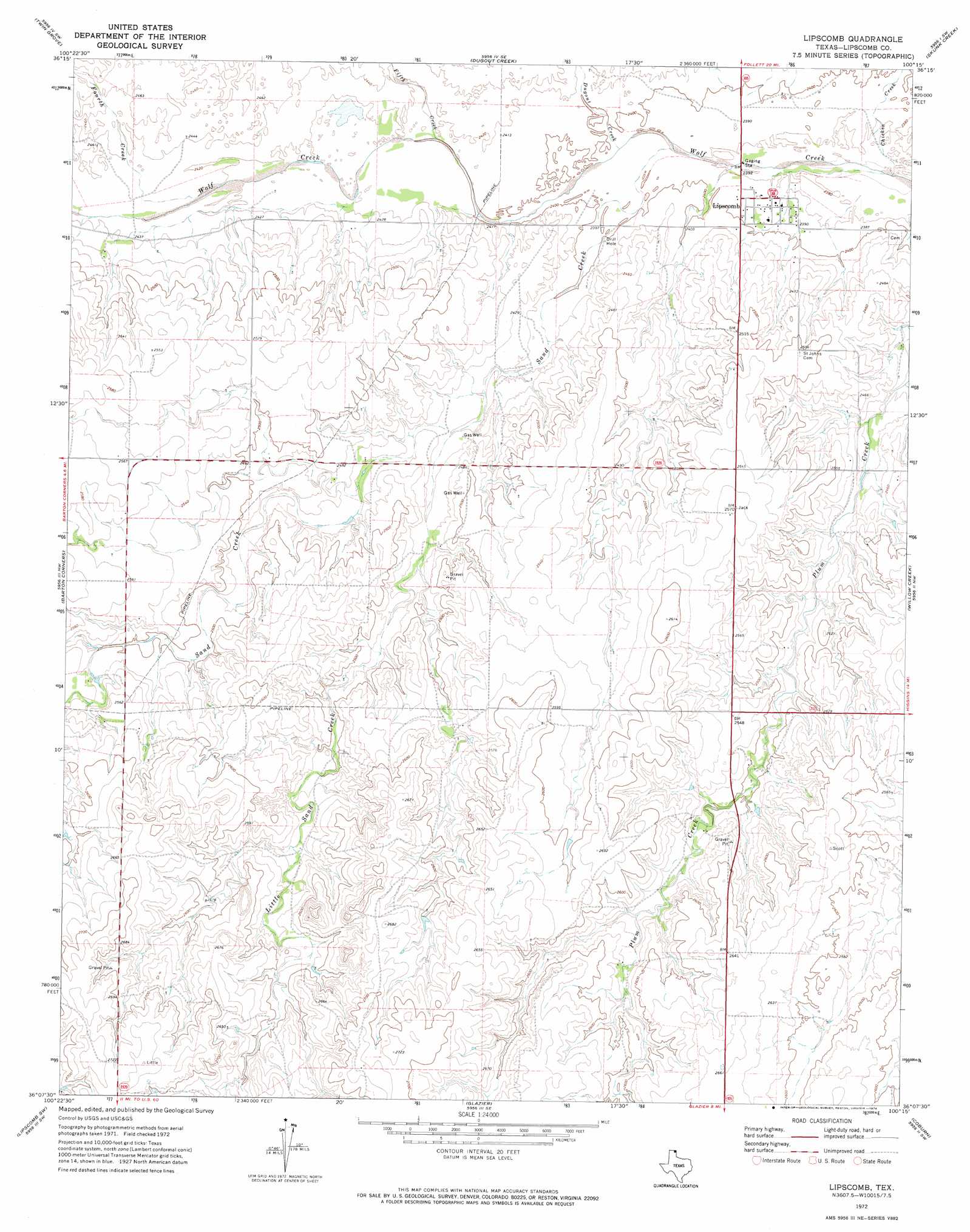
USGS Topo Quad 36100b3 - 1:24,000 scale
| Topo Map Name: | Lipscomb |
| USGS Topo Quad ID: | 36100b3 |
| Print Size: | ca. 21 1/4" wide x 27" high |
| Southeast Coordinates: | 36.125° N latitude / 100.25° W longitude |
| Map Center Coordinates: | 36.1875° N latitude / 100.3125° W longitude |
| U.S. State: | TX |
| Filename: | o36100b3.jpg |
| Download Map JPG Image: | Lipscomb topo map 1:24,000 scale |
| Map Type: | Topographic |
| Topo Series: | 7.5´ |
| Map Scale: | 1:24,000 |
| Source of Map Images: | United States Geological Survey (USGS) |
| Alternate Map Versions: |
Lipscomb TX 1972, updated 1974 Download PDF Buy paper map Lipscomb TX 2010 Download PDF Buy paper map Lipscomb TX 2012 Download PDF Buy paper map Lipscomb TX 2016 Download PDF Buy paper map |
1:24,000 Topo Quads surrounding Lipscomb
Booker |
Gaylord |
Darrouzett |
Follett |
Magoun |
Booker Se |
Twin Grove |
Dugout Creek |
Skunk Creek |
Follett Se |
Lake Fryer Ne |
Barton Corners |
Lipscomb |
Willow Creek |
Higgins North |
Barton Creek |
Lipscomb Sw |
Glazier |
Coburn |
Higgins South |
East Dry Creek |
Canadian West |
Canadian East |
Lake Marvin |
Dreyfoos |
> Back to 36100a1 at 1:100,000 scale
> Back to 36100a1 at 1:250,000 scale
> Back to U.S. Topo Maps home
Lipscomb topo map: Gazetteer
Lipscomb: Parks
Gene Howe Wildlife Management Area - Murphy Unit elevation 769m 2522′Lipscomb: Populated Places
Lipscomb elevation 729m 2391′Lipscomb: Streams
Chicken Creek elevation 723m 2372′Dugout Creek elevation 726m 2381′
Fifth Creek elevation 731m 2398′
Fourth Creek elevation 737m 2417′
Little Sand Creek elevation 738m 2421′
Sand Creek elevation 725m 2378′
Lipscomb digital topo map on disk
Buy this Lipscomb topo map showing relief, roads, GPS coordinates and other geographical features, as a high-resolution digital map file on DVD: