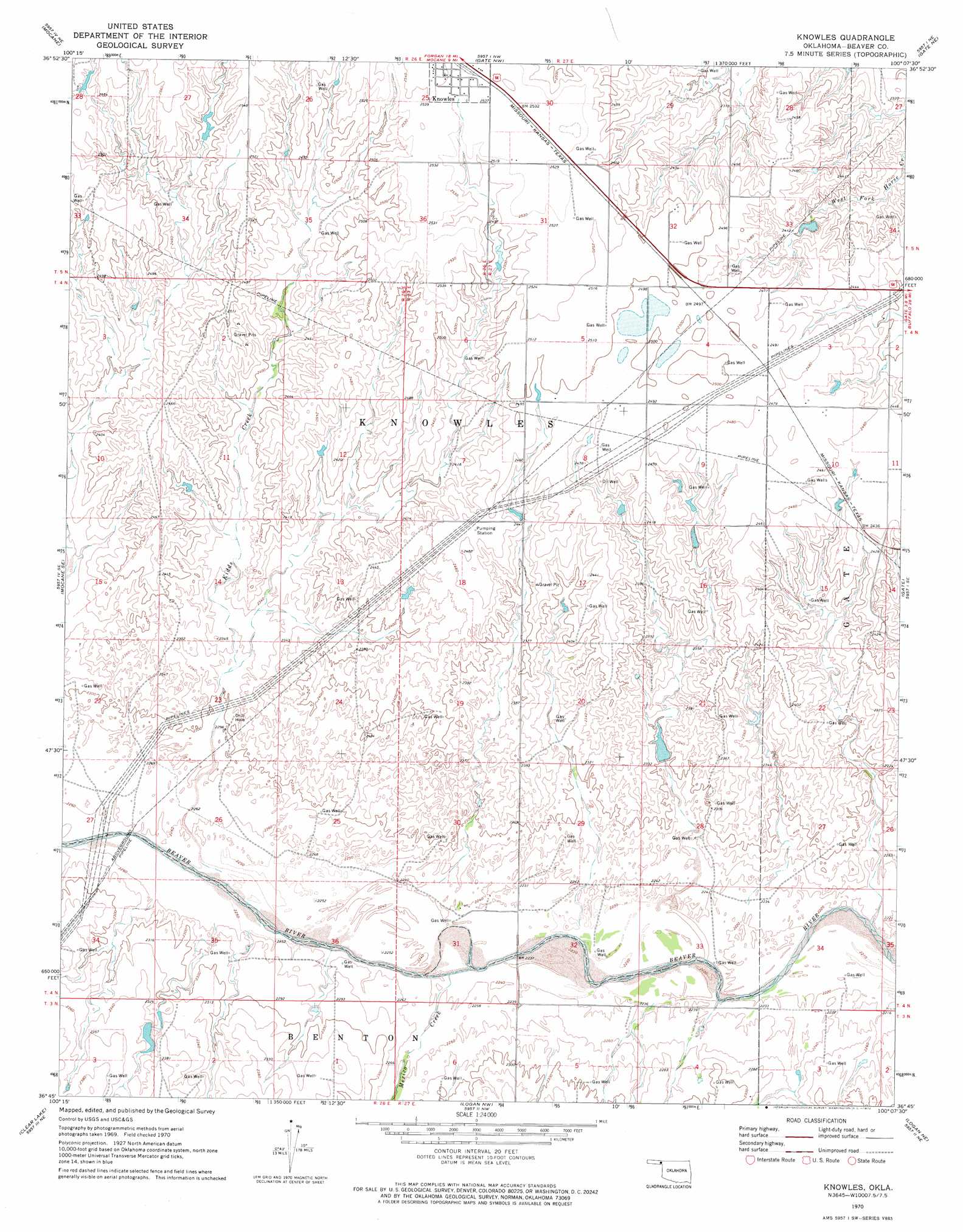
Knowles Topo Map Oklahoma
To zoom in, hover over the map of Knowles
USGS Topo Quad 36100g2 - 1:24,000 scale
| Topo Map Name: | Knowles |
| USGS Topo Quad ID: | 36100g2 |
| Print Size: | ca. 21 1/4" wide x 27" high |
| Southeast Coordinates: | 36.75° N latitude / 100.125° W longitude |
| Map Center Coordinates: | 36.8125° N latitude / 100.1875° W longitude |
| U.S. State: | OK |
| Filename: | o36100g2.jpg |
| Download Map JPG Image: | Knowles topo map 1:24,000 scale |
| Map Type: | Topographic |
| Topo Series: | 7.5´ |
| Map Scale: | 1:24,000 |
| Source of Map Images: | United States Geological Survey (USGS) |
| Alternate Map Versions: |
Knowles OK 1970, updated 1972 Download PDF Buy paper map Knowles OK 2010 Download PDF Buy paper map Knowles OK 2012 Download PDF Buy paper map Knowles OK 2016 Download PDF Buy paper map |
1:24,000 Topo Quads surrounding Knowles
Irish Flats |
Irish Flats Se |
Proffitt Lake Sw |
Mount Helen |
Englewood |
Mocane Nw |
Mocane |
Gate Nw |
Gate Ne |
Rosston Nw |
Mocane Sw |
Mocane Se |
Knowles |
Gate |
Rosston |
Clear Lake Nw |
Clear Lake |
Logan Nw |
Logan Ne |
Laverne |
Clear Lake Sw |
Clear Lake Se |
Logan |
Slapout |
Laverne Sw |
> Back to 36100e1 at 1:100,000 scale
> Back to 36100a1 at 1:250,000 scale
> Back to U.S. Topo Maps home
Knowles topo map: Gazetteer
Knowles: Dams
Barby Number 18 Dam elevation 701m 2299′Barby Number 3 Dam elevation 705m 2312′
Barby Number 5 Dam elevation 708m 2322′
Knowles: Populated Places
Knowles elevation 774m 2539′Knowles: Reservoirs
Barby Number 18 Reservoir elevation 701m 2299′Barby Number 3 Reservoir elevation 705m 2312′
Barby Number 5 Reservoir elevation 708m 2322′
Knowles: Streams
Kidds Creek elevation 687m 2253′Mexico Creek elevation 681m 2234′
Knowles digital topo map on disk
Buy this Knowles topo map showing relief, roads, GPS coordinates and other geographical features, as a high-resolution digital map file on DVD: