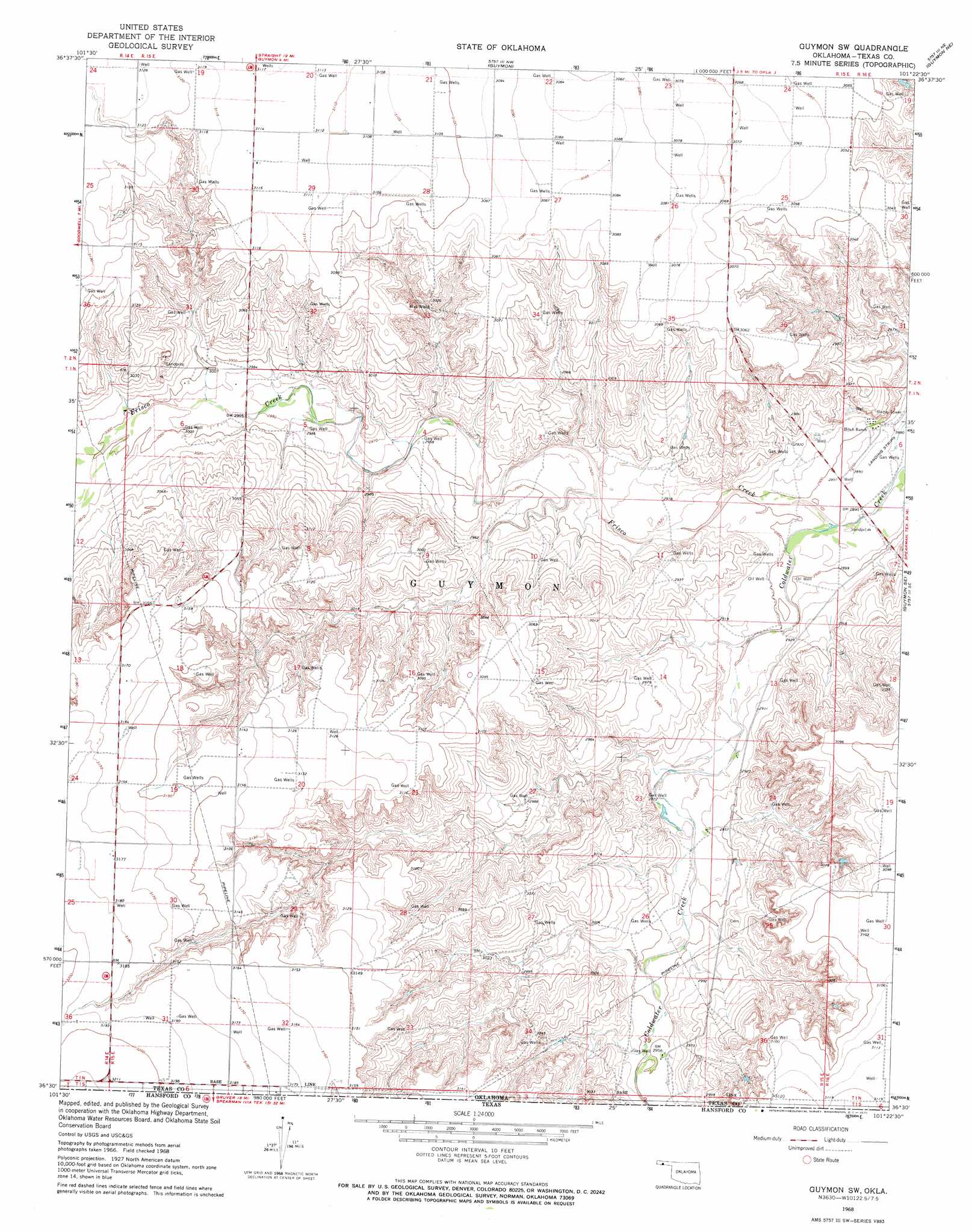
Guymon Sw Topo Map Oklahoma
To zoom in, hover over the map of Guymon Sw
USGS Topo Quad 36101e4 - 1:24,000 scale
| Topo Map Name: | Guymon Sw |
| USGS Topo Quad ID: | 36101e4 |
| Print Size: | ca. 21 1/4" wide x 27" high |
| Southeast Coordinates: | 36.5° N latitude / 101.375° W longitude |
| Map Center Coordinates: | 36.5625° N latitude / 101.4375° W longitude |
| U.S. State: | OK |
| Filename: | o36101e4.jpg |
| Download Map JPG Image: | Guymon Sw topo map 1:24,000 scale |
| Map Type: | Topographic |
| Topo Series: | 7.5´ |
| Map Scale: | 1:24,000 |
| Source of Map Images: | United States Geological Survey (USGS) |
| Alternate Map Versions: |
Guymon SW OK 1968, updated 1970 Download PDF Buy paper map Guymon SW OK 2010 Download PDF Buy paper map Guymon SW OK 2012 Download PDF Buy paper map Guymon SW OK 2016 Download PDF Buy paper map |
1:24,000 Topo Quads surrounding Guymon Sw
Hough Sw |
Hough |
Straight Sw |
Optima |
Hooker |
Goodwell Nw |
Goodwell Ne |
Guymon |
Guymon Ne |
Optima Dam |
Goodwell |
Goodwell Se |
Guymon Sw |
Guymon Se |
Hardesty |
Sunray 1 Nw |
Sunray 1 Ne |
Phillips Camp |
Bernstein |
Hansford Camp |
Sunray 1 Sw |
Sunray 1 Se |
Gruver |
Kimball |
Waka Sw |
> Back to 36101e1 at 1:100,000 scale
> Back to 36100a1 at 1:250,000 scale
> Back to U.S. Topo Maps home
Guymon Sw digital topo map on disk
Buy this Guymon Sw topo map showing relief, roads, GPS coordinates and other geographical features, as a high-resolution digital map file on DVD: