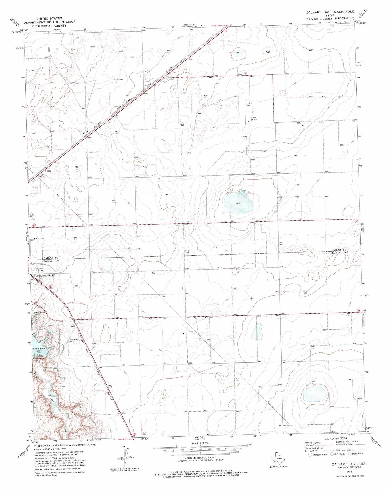
Dalhart East Topo Map Texas
To zoom in, hover over the map of Dalhart East
USGS Topo Quad 36102a4 - 1:24,000 scale
| Topo Map Name: | Dalhart East |
| USGS Topo Quad ID: | 36102a4 |
| Print Size: | ca. 21 1/4" wide x 27" high |
| Southeast Coordinates: | 36° N latitude / 102.375° W longitude |
| Map Center Coordinates: | 36.0625° N latitude / 102.4375° W longitude |
| U.S. State: | TX |
| Filename: | o36102a4.jpg |
| Download Map JPG Image: | Dalhart East topo map 1:24,000 scale |
| Map Type: | Topographic |
| Topo Series: | 7.5´ |
| Map Scale: | 1:24,000 |
| Source of Map Images: | United States Geological Survey (USGS) |
| Alternate Map Versions: |
Dalhart East TX 1973, updated 1976 Download PDF Buy paper map Dalhart East TX 2010 Download PDF Buy paper map Dalhart East TX 2012 Download PDF Buy paper map Dalhart East TX 2016 Download PDF Buy paper map |
1:24,000 Topo Quads surrounding Dalhart East
Tovrea Ranch |
Pritchard Ranch |
Stratford 2 Sw |
Stratford 2 Se |
Brickel |
Bolin |
Bolin Ne |
Chamberlin |
Wilco Ne |
Conlen |
Canyon School |
Dalhart West |
Dalhart East |
Wilco |
Exum |
King |
Pardue Camp |
Hartley |
Hartley Ne |
Moran Ranch |
King Sw |
King Se |
Hartley Sw |
Hartley Se |
Bird Ranch Store |
> Back to 36102a1 at 1:100,000 scale
> Back to 36102a1 at 1:250,000 scale
> Back to U.S. Topo Maps home
Dalhart East topo map: Gazetteer
Dalhart East: Airports
Miller Airfield elevation 1206m 3956′Dalhart East: Dams
Rita Blanca Creek Reservoir Dam elevation 1187m 3894′Dalhart East: Populated Places
Hitt elevation 1214m 3982′Dalhart East: Reservoirs
Rita Blanca Creek Reservoir elevation 1187m 3894′Rita Blanca Lake elevation 1187m 3894′
Dalhart East digital topo map on disk
Buy this Dalhart East topo map showing relief, roads, GPS coordinates and other geographical features, as a high-resolution digital map file on DVD: