Flagg Springs Topo Map Oklahoma
To zoom in, hover over the map of Flagg Springs
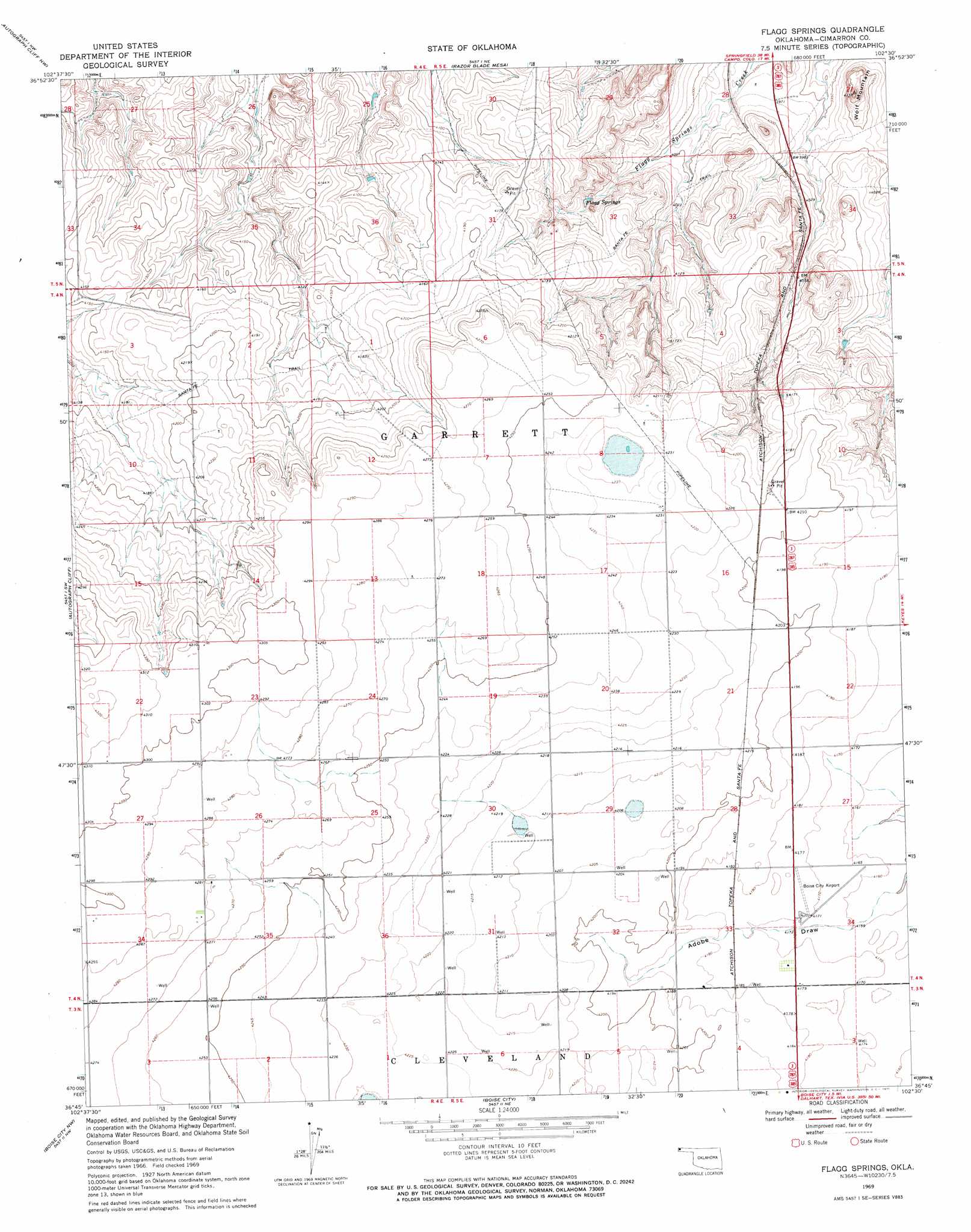
USGS Topo Quad 36102g5 - 1:24,000 scale
| Topo Map Name: | Flagg Springs |
| USGS Topo Quad ID: | 36102g5 |
| Print Size: | ca. 21 1/4" wide x 27" high |
| Southeast Coordinates: | 36.75° N latitude / 102.5° W longitude |
| Map Center Coordinates: | 36.8125° N latitude / 102.5625° W longitude |
| U.S. State: | OK |
| Filename: | o36102g5.jpg |
| Download Map JPG Image: | Flagg Springs topo map 1:24,000 scale |
| Map Type: | Topographic |
| Topo Series: | 7.5´ |
| Map Scale: | 1:24,000 |
| Source of Map Images: | United States Geological Survey (USGS) |
| Alternate Map Versions: |
Flagg Springs OK 1969, updated 1971 Download PDF Buy paper map Flagg Springs OK 2010 Download PDF Buy paper map Flagg Springs OK 2012 Download PDF Buy paper map Flagg Springs OK 2016 Download PDF Buy paper map |
1:24,000 Topo Quads surrounding Flagg Springs
Tubs Springs |
Campo Sw |
Campo |
Moore Draw Sw |
Moore Draw Se |
Kenton Ne |
Autograph Cliff Nw |
Razor Blade Mesa |
Keyes Nw |
Keyes Ne |
Kenton Se |
Autograph Cliff |
Flagg Springs |
Keyes Sw |
Keyes West |
Felt Ne |
Boise City Nw |
Boise City |
Conrad Nw |
Sampsel Lake |
Felt |
Boise City Sw |
Boise City Se |
Conrad Sw |
Conrad |
> Back to 36102e1 at 1:100,000 scale
> Back to 36102a1 at 1:250,000 scale
> Back to U.S. Topo Maps home
Flagg Springs topo map: Gazetteer
Flagg Springs: Airports
Boise City Airport elevation 1270m 4166′Flagg Springs: Dams
Gaylor Number 1 Dam elevation 1275m 4183′Flagg Springs: Reservoirs
Gaylor Number 1 Reservoir elevation 1275m 4183′Flagg Springs: Springs
Flagg Springs elevation 1234m 4048′Flagg Springs: Summits
Wolf Mountain elevation 1261m 4137′Flagg Springs digital topo map on disk
Buy this Flagg Springs topo map showing relief, roads, GPS coordinates and other geographical features, as a high-resolution digital map file on DVD: