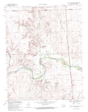
Razor Blade Mesa Topo Map Oklahoma
To zoom in, hover over the map of Razor Blade Mesa
USGS Topo Quad 36102h5 - 1:24,000 scale
| Topo Map Name: | Razor Blade Mesa |
| USGS Topo Quad ID: | 36102h5 |
| Print Size: | ca. 21 1/4" wide x 27" high |
| Southeast Coordinates: | 36.875° N latitude / 102.5° W longitude |
| Map Center Coordinates: | 36.9375° N latitude / 102.5625° W longitude |
| U.S. States: | OK, CO |
| Filename: | o36102h5.jpg |
| Download Map JPG Image: | Razor Blade Mesa topo map 1:24,000 scale |
| Map Type: | Topographic |
| Topo Series: | 7.5´ |
| Map Scale: | 1:24,000 |
| Source of Map Images: | United States Geological Survey (USGS) |
| Alternate Map Versions: |
Razor Blade Mesa OK 1969, updated 1971 Download PDF Buy paper map Razor Blade Mesa OK 2011 Download PDF Buy paper map Razor Blade Mesa OK 2012 Download PDF Buy paper map Razor Blade Mesa OK 2016 Download PDF Buy paper map |
| FStopo: | US Forest Service topo Razor Blade Mesa is available: Download FStopo PDF Download FStopo TIF |
1:24,000 Topo Quads surrounding Razor Blade Mesa
> Back to 36102e1 at 1:100,000 scale
> Back to 36102a1 at 1:250,000 scale
> Back to U.S. Topo Maps home
Razor Blade Mesa topo map: Gazetteer
Razor Blade Mesa: Dams
Gaylor Ecd Number 1 Dam elevation 1269m 4163′Razor Blade Mesa: Populated Places
Castaneda elevation 1210m 3969′Razor Blade Mesa: Reservoirs
Gaylor Ecd Number 1 Reservoir elevation 1269m 4163′Razor Blade Mesa: Streams
Aubrey Creek elevation 1180m 3871′Aubury Creek elevation 1180m 3871′
Cold Springs Creek elevation 1201m 3940′
Ute Canyon Creek elevation 1184m 3884′
Ute Canyon Creek elevation 1184m 3884′
Razor Blade Mesa: Summits
Razor Blade Mesa elevation 1245m 4084′Sugarloaf Mountain elevation 1257m 4124′
Winchester Mesa elevation 1263m 4143′
Razor Blade Mesa: Valleys
Aubrey Canyon elevation 1181m 3874′Coal Springs Canyon elevation 1211m 3973′
Ute Canyon elevation 1194m 3917′
Razor Blade Mesa digital topo map on disk
Buy this Razor Blade Mesa topo map showing relief, roads, GPS coordinates and other geographical features, as a high-resolution digital map file on DVD:


