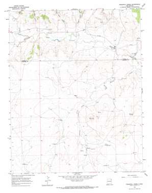
Pedernal Creek Topo Map New Mexico
To zoom in, hover over the map of Pedernal Creek
USGS Topo Quad 36103a4 - 1:24,000 scale
| Topo Map Name: | Pedernal Creek |
| USGS Topo Quad ID: | 36103a4 |
| Print Size: | ca. 21 1/4" wide x 27" high |
| Southeast Coordinates: | 36° N latitude / 103.375° W longitude |
| Map Center Coordinates: | 36.0625° N latitude / 103.4375° W longitude |
| U.S. State: | NM |
| Filename: | o36103a4.jpg |
| Download Map JPG Image: | Pedernal Creek topo map 1:24,000 scale |
| Map Type: | Topographic |
| Topo Series: | 7.5´ |
| Map Scale: | 1:24,000 |
| Source of Map Images: | United States Geological Survey (USGS) |
| Alternate Map Versions: |
Pedernal Creek NM 1966, updated 1968 Download PDF Buy paper map Pedernal Creek NM 2010 Download PDF Buy paper map Pedernal Creek NM 2013 Download PDF Buy paper map Pedernal Creek NM 2017 Download PDF Buy paper map |
1:24,000 Topo Quads surrounding Pedernal Creek
> Back to 36103a1 at 1:100,000 scale
> Back to 36102a1 at 1:250,000 scale
> Back to U.S. Topo Maps home
Pedernal Creek topo map: Gazetteer
Pedernal Creek: Dams
Smithson Four Reservoir Dam elevation 1464m 4803′Smithson One Reservoir Dam elevation 1464m 4803′
Smithson Reservoir Number 2 Dam elevation 1451m 4760′
Smithson Three Reservoir Dam elevation 1464m 4803′
Pedernal Creek: Reservoirs
Franks Dam elevation 1436m 4711′Smithson Reservoir Number 2 elevation 1451m 4760′
Pedernal Creek: Springs
Morrison Spring elevation 1465m 4806′Pedernal Creek: Streams
Mesita Creek elevation 1461m 4793′Pedernal Creek elevation 1421m 4662′
Pedernal Creek: Summits
Flint Hills elevation 1540m 5052′Pedernal Creek: Valleys
Charley Adams Canyon elevation 1449m 4753′Los Gatos Canyon elevation 1463m 4799′
San Lorenzo Canyon elevation 1452m 4763′
Ute Canyon elevation 1473m 4832′
Pedernal Creek: Wells
Gean Well elevation 1529m 5016′Line Well elevation 1498m 4914′
North Gallegos Well elevation 1530m 5019′
North Well elevation 1478m 4849′
Rodger Well elevation 1545m 5068′
West Well elevation 1487m 4878′
Pedernal Creek digital topo map on disk
Buy this Pedernal Creek topo map showing relief, roads, GPS coordinates and other geographical features, as a high-resolution digital map file on DVD:


