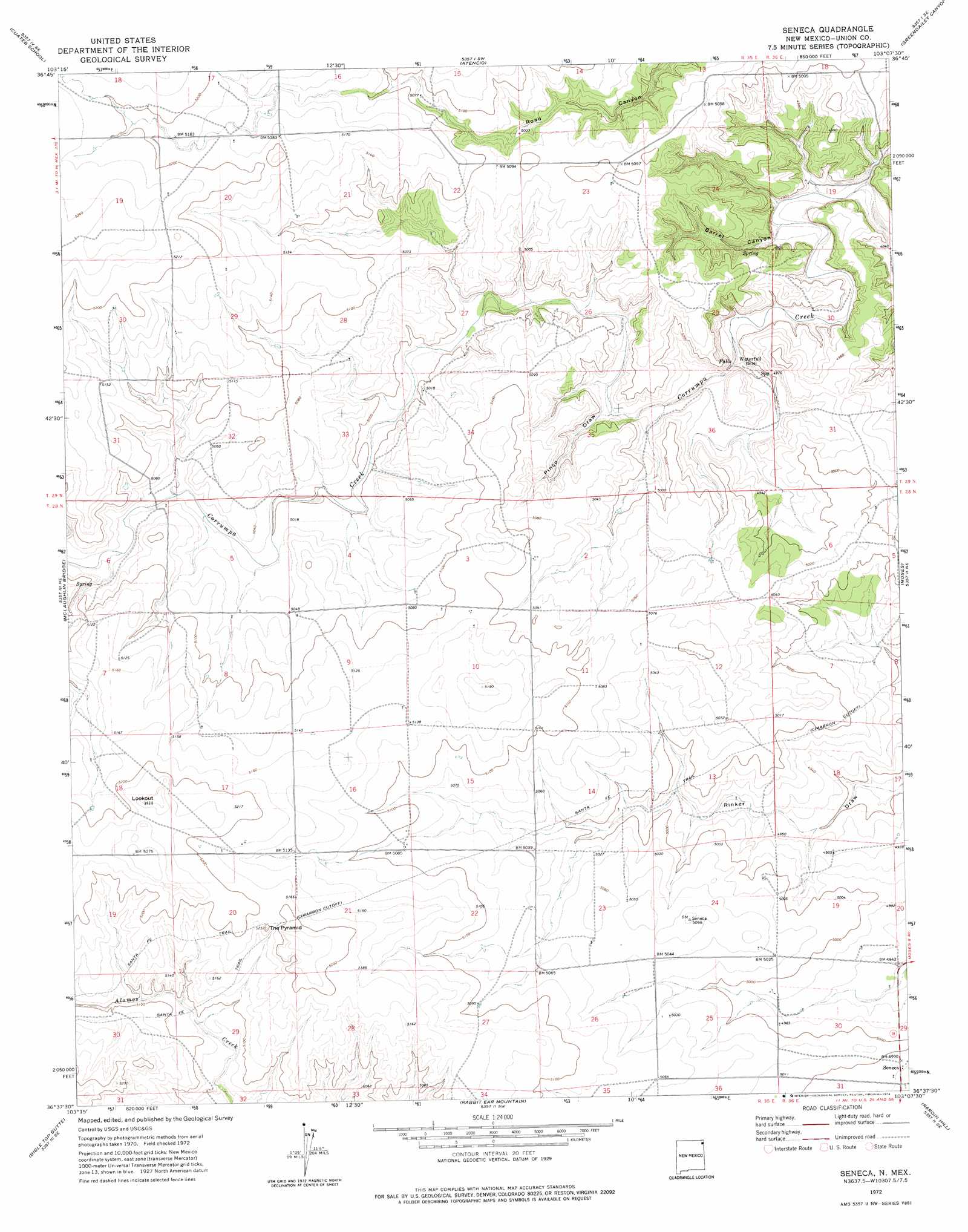
Seneca Topo Map New Mexico
To zoom in, hover over the map of Seneca
USGS Topo Quad 36103f2 - 1:24,000 scale
| Topo Map Name: | Seneca |
| USGS Topo Quad ID: | 36103f2 |
| Print Size: | ca. 21 1/4" wide x 27" high |
| Southeast Coordinates: | 36.625° N latitude / 103.125° W longitude |
| Map Center Coordinates: | 36.6875° N latitude / 103.1875° W longitude |
| U.S. State: | NM |
| Filename: | o36103f2.jpg |
| Download Map JPG Image: | Seneca topo map 1:24,000 scale |
| Map Type: | Topographic |
| Topo Series: | 7.5´ |
| Map Scale: | 1:24,000 |
| Source of Map Images: | United States Geological Survey (USGS) |
| Alternate Map Versions: |
Seneca NM 1972, updated 1974 Download PDF Buy paper map Seneca NM 1998, updated 2001 Download PDF Buy paper map Seneca NM 2011 Download PDF Buy paper map Seneca NM 2013 Download PDF Buy paper map Seneca NM 2017 Download PDF Buy paper map |
| FStopo: | US Forest Service topo Seneca is available: Download FStopo PDF Download FStopo TIF |
1:24,000 Topo Quads surrounding Seneca
Travesser Park |
Tub Spring |
Wedding Cake Butte |
Goodson School |
Kenton |
Guy |
Cuates School |
Atencio |
Greendailey Canyon |
Kenton Sw |
Boiler Gap |
Mclaughlin Bridge |
Seneca |
Moses |
Wheeless |
Mount Dora |
Bible Top Butte |
Rabbit Ear Mountain |
Rardin Hill |
Felt Sw |
Black Canyon |
Royce |
Clayton |
Texline North |
Corlena Nw |
> Back to 36103e1 at 1:100,000 scale
> Back to 36102a1 at 1:250,000 scale
> Back to U.S. Topo Maps home
Seneca topo map: Gazetteer
Seneca: Pillars
The Pyramid elevation 1584m 5196′Seneca: Populated Places
Seneca elevation 1521m 4990′Seneca: Post Offices
Seneca Post Office elevation 1521m 4990′Seneca: Summits
Lookout Hill elevation 1606m 5269′Seneca: Valleys
Barrel Canyon elevation 1476m 4842′Pinco Draw elevation 1505m 4937′
Seneca digital topo map on disk
Buy this Seneca topo map showing relief, roads, GPS coordinates and other geographical features, as a high-resolution digital map file on DVD: