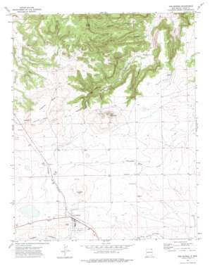
Des Moines Topo Map New Mexico
To zoom in, hover over the map of Des Moines
USGS Topo Quad 36103g7 - 1:24,000 scale
| Topo Map Name: | Des Moines |
| USGS Topo Quad ID: | 36103g7 |
| Print Size: | ca. 21 1/4" wide x 27" high |
| Southeast Coordinates: | 36.75° N latitude / 103.75° W longitude |
| Map Center Coordinates: | 36.8125° N latitude / 103.8125° W longitude |
| U.S. State: | NM |
| Filename: | o36103g7.jpg |
| Download Map JPG Image: | Des Moines topo map 1:24,000 scale |
| Map Type: | Topographic |
| Topo Series: | 7.5´ |
| Map Scale: | 1:24,000 |
| Source of Map Images: | United States Geological Survey (USGS) |
| Alternate Map Versions: |
Des Moines NM 1972, updated 1975 Download PDF Buy paper map Des Moines NM 2010 Download PDF Buy paper map Des Moines NM 2013 Download PDF Buy paper map Des Moines NM 2017 Download PDF Buy paper map |
1:24,000 Topo Quads surrounding Des Moines
> Back to 36103e1 at 1:100,000 scale
> Back to 36102a1 at 1:250,000 scale
> Back to U.S. Topo Maps home
Des Moines topo map: Gazetteer
Des Moines: Mines
Colomex Pit elevation 2083m 6833′Colorado and Southern Ballast Pit elevation 2037m 6683′
Des Moines: Populated Places
Des Moines elevation 2026m 6646′Des Moines: Post Offices
Des Moines Post Office elevation 2026m 6646′Des Moines: Springs
Mitchel Springs elevation 1992m 6535′Des Moines: Summits
Carr Mountain elevation 2104m 6902′Dunchee Hill elevation 2057m 6748′
Purvine Hills elevation 2080m 6824′
Purvine Mesa elevation 2087m 6847′
Twin Mountain elevation 2006m 6581′
Des Moines: Valleys
Brown Canyon elevation 1772m 5813′Burnt Canyon elevation 1787m 5862′
Fowler Canyon elevation 1812m 5944′
Mitchel Canyon elevation 1784m 5853′
Des Moines: Wells
10246 Water Well elevation 2033m 6669′10305 Water Well elevation 1965m 6446′
10306 Water Well elevation 2033m 6669′
Des Moines digital topo map on disk
Buy this Des Moines topo map showing relief, roads, GPS coordinates and other geographical features, as a high-resolution digital map file on DVD:


