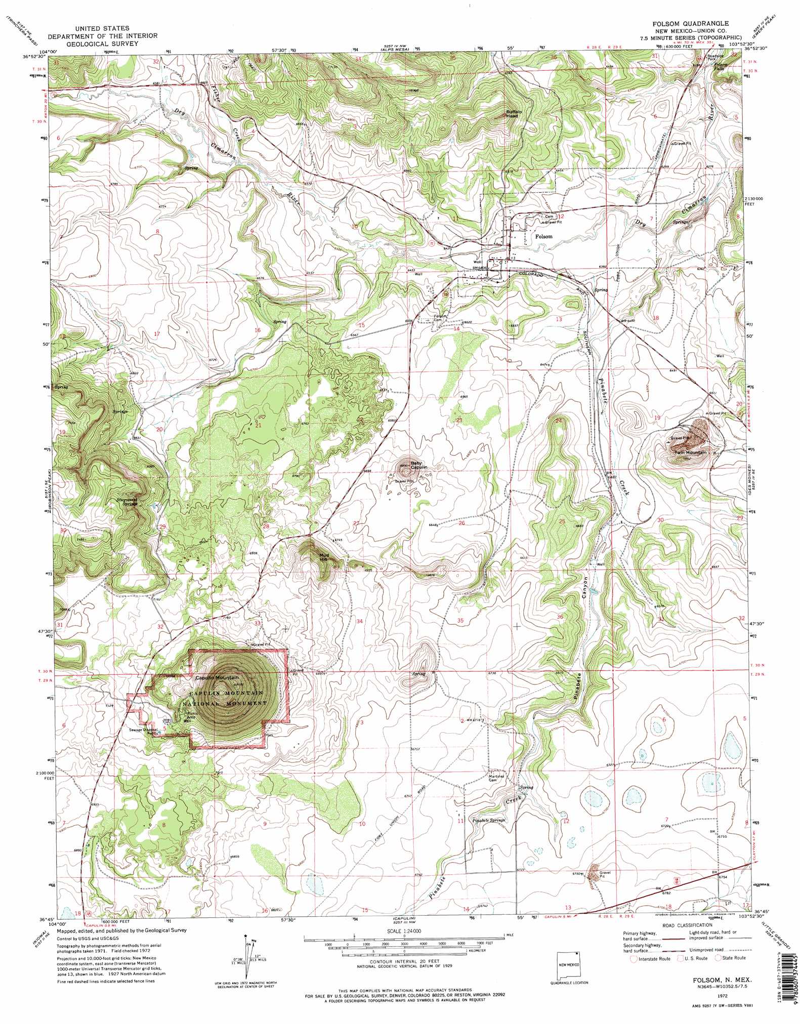
Folsom Topo Map New Mexico
To zoom in, hover over the map of Folsom
USGS Topo Quad 36103g8 - 1:24,000 scale
| Topo Map Name: | Folsom |
| USGS Topo Quad ID: | 36103g8 |
| Print Size: | ca. 21 1/4" wide x 27" high |
| Southeast Coordinates: | 36.75° N latitude / 103.875° W longitude |
| Map Center Coordinates: | 36.8125° N latitude / 103.9375° W longitude |
| U.S. State: | NM |
| Filename: | o36103g8.jpg |
| Download Map JPG Image: | Folsom topo map 1:24,000 scale |
| Map Type: | Topographic |
| Topo Series: | 7.5´ |
| Map Scale: | 1:24,000 |
| Source of Map Images: | United States Geological Survey (USGS) |
| Alternate Map Versions: |
Folsom NM 1972, updated 1975 Download PDF Buy paper map Folsom NM 1972, updated 1975 Download PDF Buy paper map Folsom NM 2010 Download PDF Buy paper map Folsom NM 2013 Download PDF Buy paper map Folsom NM 2017 Download PDF Buy paper map |
1:24,000 Topo Quads surrounding Folsom
Abeyta |
Trinchera |
Branson |
Branson Se |
Pine Canyon |
Dale Mountain |
Trinchera Pass |
Alps Mesa |
Emery Peak |
Cross L Ranch |
Johnson Park |
Robinson Peak |
Folsom |
Des Moines |
Cross L Ranch Sw |
Mesa Larga |
Kiowa |
Capulin |
Little Grande |
Wetherly Lake |
Pine Buttes |
Palo Blanco Mountain |
Malpie Mountain |
Cow Mountain |
Grenville Sw |
> Back to 36103e1 at 1:100,000 scale
> Back to 36102a1 at 1:250,000 scale
> Back to U.S. Topo Maps home
Folsom topo map: Gazetteer
Folsom: Falls
Folsom Falls elevation 1874m 6148′Folsom: Mines
Baby Capulin elevation 2035m 6676′Bary Capulin elevation 2061m 6761′
Capulin Mountain elevation 2143m 7030′
Twin Mountain Rock Mine elevation 2006m 6581′
Folsom: Parks
Capulin Volcano National Monument elevation 2400m 7874′Folsom: Populated Places
Folsom elevation 1948m 6391′Folsom: Post Offices
Folsom Post Office elevation 1948m 6391′Folsom: Springs
Bennett Spring elevation 2025m 6643′Pinabete Springs elevation 2037m 6683′
Stuyvesant Springs elevation 2138m 7014′
Folsom: Streams
Fisher Creek elevation 1987m 6519′Pinabete Creek elevation 1907m 6256′
Folsom: Summits
Baby Capulin elevation 2094m 6870′Buffalo Head elevation 2095m 6873′
Capulin Mountain elevation 2486m 8156′
Mud Hill elevation 2179m 7148′
Twin Mountain elevation 2084m 6837′
Folsom: Valleys
Pinabete Canyon elevation 1964m 6443′Folsom: Wells
10010 Water Well elevation 2035m 6676′10245 Water Well elevation 2052m 6732′
10304 Water Well elevation 2038m 6686′
Folsom digital topo map on disk
Buy this Folsom topo map showing relief, roads, GPS coordinates and other geographical features, as a high-resolution digital map file on DVD: