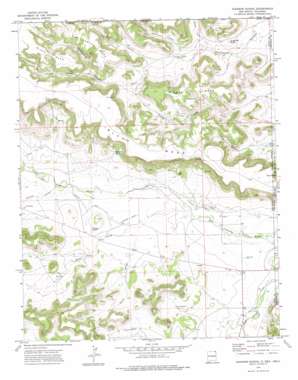
Goodson School Topo Map New Mexico
To zoom in, hover over the map of Goodson School
USGS Topo Quad 36103h1 - 1:24,000 scale
| Topo Map Name: | Goodson School |
| USGS Topo Quad ID: | 36103h1 |
| Print Size: | ca. 21 1/4" wide x 27" high |
| Southeast Coordinates: | 36.875° N latitude / 103° W longitude |
| Map Center Coordinates: | 36.9375° N latitude / 103.0625° W longitude |
| U.S. States: | NM, OK |
| Filename: | o36103h1.jpg |
| Download Map JPG Image: | Goodson School topo map 1:24,000 scale |
| Map Type: | Topographic |
| Topo Series: | 7.5´ |
| Map Scale: | 1:24,000 |
| Source of Map Images: | United States Geological Survey (USGS) |
| Alternate Map Versions: |
Goodson School NM 1972, updated 1975 Download PDF Buy paper map Goodson School NM 2011 Download PDF Buy paper map Goodson School NM 2013 Download PDF Buy paper map |
1:24,000 Topo Quads surrounding Goodson School
> Back to 36103e1 at 1:100,000 scale
> Back to 36102a1 at 1:250,000 scale
> Back to U.S. Topo Maps home
Goodson School topo map: Gazetteer
Goodson School: Canals
Roberts Ditch elevation 1361m 4465′Wiggins Ralley Ditch Number 1 elevation 1333m 4373′
Goodson School: Mines
Black Mesa Prospect elevation 1401m 4596′Independence Group elevation 1342m 4402′
Goodson School: Springs
Bramlett Spring elevation 1382m 4534′Negro Spring elevation 1447m 4747′
Goodson School: Streams
Bontz Arroyo elevation 1330m 4363′Potter Arroyo elevation 1346m 4416′
Sloan Creek elevation 1360m 4461′
Smiley Arroyo elevation 1353m 4438′
Goodson School: Summits
Big Canyon Mesa elevation 1537m 5042′Lone Mesa elevation 1493m 4898′
Lone Mesa elevation 1493m 4898′
Middle Mesa elevation 1514m 4967′
Potter Rincon elevation 1454m 4770′
Red Hill elevation 1379m 4524′
Sugarloaf Butte elevation 1404m 4606′
Goodson School: Valleys
Big Canyon elevation 1388m 4553′Big Canyon elevation 1389m 4557′
Blacksmith Canyon elevation 1343m 4406′
Ellmore Canyon elevation 1365m 4478′
Ellmore Canyon elevation 1365m 4478′
Long Canyon elevation 1370m 4494′
Middle Canyon elevation 1371m 4498′
North Canyon elevation 1384m 4540′
North Canyon elevation 1368m 4488′
Road Canyon elevation 1328m 4356′
South Fork Canyon elevation 1434m 4704′
Trail Canyon elevation 1405m 4609′
Goodson School digital topo map on disk
Buy this Goodson School topo map showing relief, roads, GPS coordinates and other geographical features, as a high-resolution digital map file on DVD:


