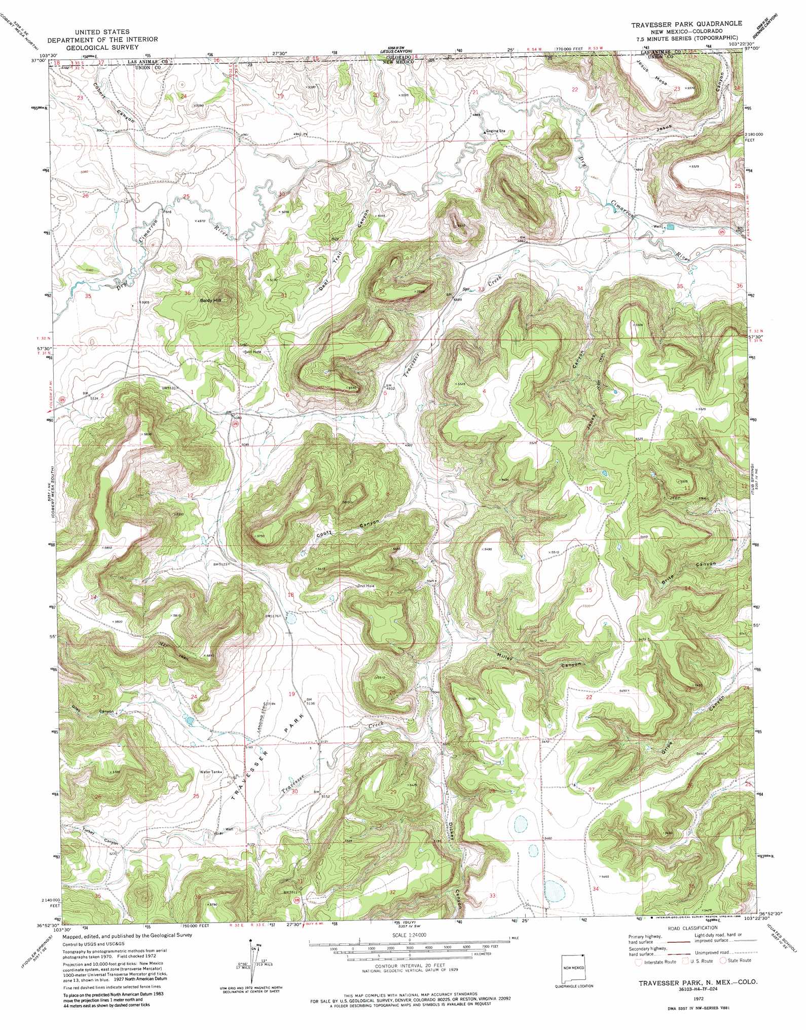
Travesser Park Topo Map New Mexico
To zoom in, hover over the map of Travesser Park
USGS Topo Quad 36103h4 - 1:24,000 scale
| Topo Map Name: | Travesser Park |
| USGS Topo Quad ID: | 36103h4 |
| Print Size: | ca. 21 1/4" wide x 27" high |
| Southeast Coordinates: | 36.875° N latitude / 103.375° W longitude |
| Map Center Coordinates: | 36.9375° N latitude / 103.4375° W longitude |
| U.S. States: | NM, CO |
| Filename: | o36103h4.jpg |
| Download Map JPG Image: | Travesser Park topo map 1:24,000 scale |
| Map Type: | Topographic |
| Topo Series: | 7.5´ |
| Map Scale: | 1:24,000 |
| Source of Map Images: | United States Geological Survey (USGS) |
| Alternate Map Versions: |
Travesser Park NM 1972, updated 1974 Download PDF Buy paper map Travesser Park NM 1972, updated 1986 Download PDF Buy paper map Travesser Park NM 2010 Download PDF Buy paper map Travesser Park NM 2013 Download PDF Buy paper map |
1:24,000 Topo Quads surrounding Travesser Park
Miners Peak |
Tobe |
Dalerose Mesa |
Kim South |
Pintada Creek |
Pine Canyon |
Cobert Mesa North |
Jesus Canyon |
Dennis Canyon |
Furnish Canyon West |
Cross L Ranch |
Cobert Mesa South |
Travesser Park |
Tub Spring |
Wedding Cake Butte |
Cross L Ranch Sw |
Fiddler Springs |
Guy |
Cuates School |
Atencio |
Wetherly Lake |
Blind Gap |
Boiler Gap |
Mclaughlin Bridge |
Seneca |
> Back to 36103e1 at 1:100,000 scale
> Back to 36102a1 at 1:250,000 scale
> Back to U.S. Topo Maps home
Travesser Park topo map: Gazetteer
Travesser Park: Flats
Travesser Park elevation 1568m 5144′Travesser Park: Streams
Travesser Creek elevation 1463m 4799′Travesser Park: Summits
Baldy Hill elevation 1678m 5505′Jesus Mesa elevation 1699m 5574′
Travesser Park: Valleys
Cobert Canyon elevation 1496m 4908′Cobert Canyon elevation 1505m 4937′
Cooty Canyon elevation 1505m 4937′
Deer Trail Canyon elevation 1495m 4904′
Dickey Canyon elevation 1542m 5059′
Giles Canyon elevation 1605m 5265′
Jesus Canyon elevation 1477m 4845′
Jesus Canyon elevation 1477m 4845′
Jones Canyon elevation 1475m 4839′
Miller Canyon elevation 1530m 5019′
Turkey Canyon elevation 1593m 5226′
Travesser Park digital topo map on disk
Buy this Travesser Park topo map showing relief, roads, GPS coordinates and other geographical features, as a high-resolution digital map file on DVD: