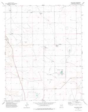
Mills East Topo Map New Mexico
To zoom in, hover over the map of Mills East
USGS Topo Quad 36104a2 - 1:24,000 scale
| Topo Map Name: | Mills East |
| USGS Topo Quad ID: | 36104a2 |
| Print Size: | ca. 21 1/4" wide x 27" high |
| Southeast Coordinates: | 36° N latitude / 104.125° W longitude |
| Map Center Coordinates: | 36.0625° N latitude / 104.1875° W longitude |
| U.S. State: | NM |
| Filename: | o36104a2.jpg |
| Download Map JPG Image: | Mills East topo map 1:24,000 scale |
| Map Type: | Topographic |
| Topo Series: | 7.5´ |
| Map Scale: | 1:24,000 |
| Source of Map Images: | United States Geological Survey (USGS) |
| Alternate Map Versions: |
Mills East NM 1974, updated 1978 Download PDF Buy paper map Mills East NM 1998, updated 2001 Download PDF Buy paper map Mills East NM 2011 Download PDF Buy paper map Mills East NM 2013 Download PDF Buy paper map |
| FStopo: | US Forest Service topo Mills East is available: Download FStopo PDF Download FStopo TIF |
1:24,000 Topo Quads surrounding Mills East
> Back to 36104a1 at 1:100,000 scale
> Back to 36104a1 at 1:250,000 scale
> Back to U.S. Topo Maps home
Mills East topo map: Gazetteer
Mills East: Flats
Cochran Lake elevation 1821m 5974′Mills East: Lakes
Big Chicosa Lake elevation 1785m 5856′Chicosa Lake elevation 1779m 5836′
Dorhman Lake elevation 1788m 5866′
Dry lake elevation 1798m 5898′
Gibson Lake elevation 1800m 5905′
Payton Lake elevation 1867m 6125′
Mills East: Parks
Chicosa Lake State Park elevation 1780m 5839′New Goodnight Trail Historical Marker elevation 1780m 5839′
Mills East: Valleys
Leonard Draw elevation 1799m 5902′Mills East digital topo map on disk
Buy this Mills East topo map showing relief, roads, GPS coordinates and other geographical features, as a high-resolution digital map file on DVD:


