Farley Topo Map New Mexico
To zoom in, hover over the map of Farley
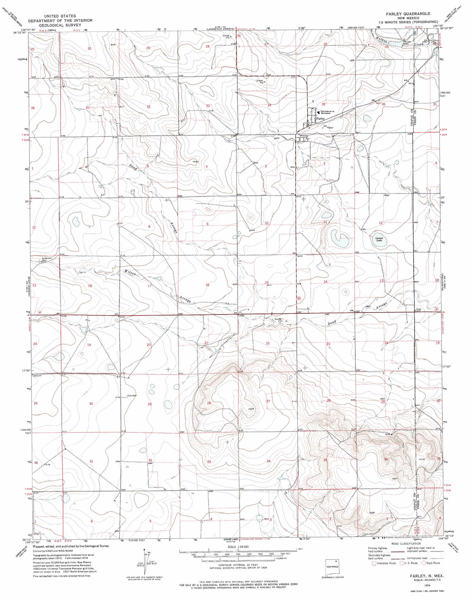
USGS Topo Quad 36104c1 - 1:24,000 scale
| Topo Map Name: | Farley |
| USGS Topo Quad ID: | 36104c1 |
| Print Size: | ca. 21 1/4" wide x 27" high |
| Southeast Coordinates: | 36.25° N latitude / 104° W longitude |
| Map Center Coordinates: | 36.3125° N latitude / 104.0625° W longitude |
| U.S. State: | NM |
| Filename: | o36104c1.jpg |
| Download Map JPG Image: | Farley topo map 1:24,000 scale |
| Map Type: | Topographic |
| Topo Series: | 7.5´ |
| Map Scale: | 1:24,000 |
| Source of Map Images: | United States Geological Survey (USGS) |
| Alternate Map Versions: |
Farley NM 1974, updated 1977 Download PDF Buy paper map Farley NM 2010 Download PDF Buy paper map Farley NM 2013 Download PDF Buy paper map |
1:24,000 Topo Quads surrounding Farley
Tres Hermanos Peak |
Pine Buttes |
Palo Blanco Mountain |
Malpie Mountain |
Cow Mountain |
Sauble Circle Dot Ranch |
Point Of Rocks Mesa |
Lawrence Arroyo |
Gladstone Nw |
Sofia |
Abbott |
Ingram Lake |
Farley |
Gladstone |
Romero Spring |
Abbott Lake |
Spear Hills |
Divine Lake |
Yates |
Aragon Hill |
Mills West |
Mills East |
Kansas Valley |
Valencia Spring |
Yates Se |
> Back to 36104a1 at 1:100,000 scale
> Back to 36104a1 at 1:250,000 scale
> Back to U.S. Topo Maps home
Farley topo map: Gazetteer
Farley: Dams
Muller Dam elevation 1826m 5990′Farley: Lakes
Lanier Lake elevation 1814m 5951′Farley: Populated Places
Farley elevation 1849m 6066′Farley: Post Offices
Farley Post Office (historical) elevation 1849m 6066′Farley: Streams
Holkeo Creek elevation 1822m 5977′Palo Blanco Creek elevation 1823m 5980′
Wilson Arroyo elevation 1803m 5915′
Farley: Wells
Anderson Well elevation 1869m 6131′Farley digital topo map on disk
Buy this Farley topo map showing relief, roads, GPS coordinates and other geographical features, as a high-resolution digital map file on DVD: