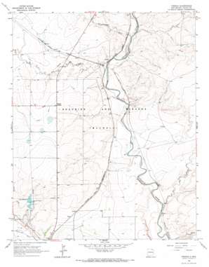
French Topo Map New Mexico
To zoom in, hover over the map of French
USGS Topo Quad 36104d5 - 1:24,000 scale
| Topo Map Name: | French |
| USGS Topo Quad ID: | 36104d5 |
| Print Size: | ca. 21 1/4" wide x 27" high |
| Southeast Coordinates: | 36.375° N latitude / 104.5° W longitude |
| Map Center Coordinates: | 36.4375° N latitude / 104.5625° W longitude |
| U.S. State: | NM |
| Filename: | o36104d5.jpg |
| Download Map JPG Image: | French topo map 1:24,000 scale |
| Map Type: | Topographic |
| Topo Series: | 7.5´ |
| Map Scale: | 1:24,000 |
| Source of Map Images: | United States Geological Survey (USGS) |
| Alternate Map Versions: |
French NM 1965, updated 1967 Download PDF Buy paper map French NM 2010 Download PDF Buy paper map French NM 2013 Download PDF Buy paper map French NM 2017 Download PDF Buy paper map |
1:24,000 Topo Quads surrounding French
> Back to 36104a1 at 1:100,000 scale
> Back to 36104a1 at 1:250,000 scale
> Back to U.S. Topo Maps home
French topo map: Gazetteer
French: Dams
Springer Reservoir Number One Dam elevation 1810m 5938′Springer Reservoir Number Two Dam elevation 1817m 5961′
French: Populated Places
French elevation 1772m 5813′Toril elevation 1805m 5921′
French: Post Offices
French Post Office (historical) elevation 1772m 5813′French: Reservoirs
City Reservoir elevation 1813m 5948′French: Streams
Dry Arroyo elevation 1768m 5800′Ladd Arroyo elevation 1777m 5830′
Rio del Plano elevation 1750m 5741′
Vermejo River elevation 1776m 5826′
French digital topo map on disk
Buy this French topo map showing relief, roads, GPS coordinates and other geographical features, as a high-resolution digital map file on DVD:


