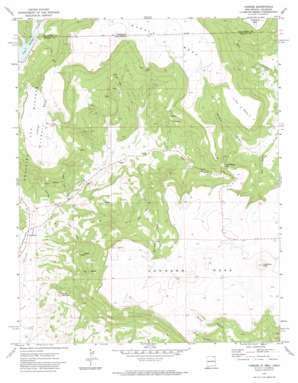
Yankee Topo Map New Mexico
To zoom in, hover over the map of Yankee
USGS Topo Quad 36104h3 - 1:24,000 scale
| Topo Map Name: | Yankee |
| USGS Topo Quad ID: | 36104h3 |
| Print Size: | ca. 21 1/4" wide x 27" high |
| Southeast Coordinates: | 36.875° N latitude / 104.25° W longitude |
| Map Center Coordinates: | 36.9375° N latitude / 104.3125° W longitude |
| U.S. States: | NM, CO |
| Filename: | o36104h3.jpg |
| Download Map JPG Image: | Yankee topo map 1:24,000 scale |
| Map Type: | Topographic |
| Topo Series: | 7.5´ |
| Map Scale: | 1:24,000 |
| Source of Map Images: | United States Geological Survey (USGS) |
| Alternate Map Versions: |
Yankee NM 1971, updated 1974 Download PDF Buy paper map Yankee NM 2010 Download PDF Buy paper map Yankee NM 2013 Download PDF Buy paper map Yankee NM 2017 Download PDF Buy paper map |
1:24,000 Topo Quads surrounding Yankee
> Back to 36104e1 at 1:100,000 scale
> Back to 36104a1 at 1:250,000 scale
> Back to U.S. Topo Maps home
Yankee topo map: Gazetteer
Yankee: Gaps
Manco Burro Pass elevation 2408m 7900′Yankee: Mines
Block Coal Mine Number Two elevation 2504m 8215′Davis Mine elevation 2232m 7322′
Denton Mine elevation 2320m 7611′
Franks Mine elevation 2271m 7450′
Hartzel Mine elevation 2231m 7319′
Harvey-Genta Mine elevation 2503m 8211′
Hobbs Mine elevation 2378m 7801′
Horse Coal Mine elevation 2435m 7988′
Klantchnik Mine elevation 2380m 7808′
Llewellyn Mine elevation 2459m 8067′
M and M Mine elevation 2199m 7214′
McClafferty Mine elevation 2348m 7703′
Mendelsohn Mine elevation 2435m 7988′
New Yankee Number 4 Claim elevation 2335m 7660′
Newton Mine elevation 2399m 7870′
Newton-Talbott Mine elevation 2469m 8100′
Old Honeyfield Mine elevation 2487m 8159′
Old Latimore Mine elevation 2355m 7726′
Reynolds Mine elevation 2390m 7841′
Scoop Prospect elevation 2440m 8005′
Sperry Mine elevation 2218m 7276′
Sugarite Mine elevation 2272m 7454′
Sunset Coal Mine elevation 2390m 7841′
Sunshine Mine elevation 2142m 7027′
Tondrow Peak Mine elevation 2529m 8297′
Turner Mine elevation 2433m 7982′
Turner Mine Number Two elevation 2345m 7693′
Yankee Number Five Mine elevation 2562m 8405′
Yankee Number Four Mine elevation 2562m 8405′
Yankee Number One Mine elevation 2345m 7693′
Yankee Number Three Mine elevation 2345m 7693′
Yankee Number Two Mine elevation 2345m 7693′
Yankee-Reynolds Prospect elevation 2266m 7434′
Yankee: Populated Places
Carisbrook elevation 2044m 6706′Yankee elevation 2149m 7050′
Yankee: Post Offices
Carisbrook Post Office (historical) elevation 2044m 6706′Yankee Post Office (historical) elevation 2149m 7050′
Yankee: Reservoirs
Lake Maloya elevation 2292m 7519′Yankee: Streams
East Fork Chicorica Creek elevation 2039m 6689′Schwachheim Creek elevation 2291m 7516′
Yankee: Summits
Barela Mesa elevation 2611m 8566′Horse Mesa elevation 2662m 8733′
Horse Shoe Mesa elevation 2479m 8133′
Johnson Mesa elevation 2636m 8648′
Little Mesa elevation 2479m 8133′
Potato Mountain elevation 2226m 7303′
Towndrow Peak elevation 2625m 8612′
Yankee: Valleys
Brides Pocket elevation 2254m 7395′Rathbun Canyon elevation 2242m 7355′
Sugarite Canyon elevation 2069m 6788′
Yankee Canyon elevation 2051m 6729′
Yankee digital topo map on disk
Buy this Yankee topo map showing relief, roads, GPS coordinates and other geographical features, as a high-resolution digital map file on DVD:


