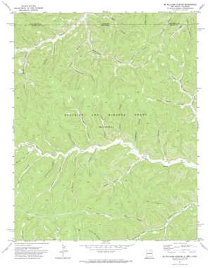
Mcwilliams Canyon Topo Map New Mexico
To zoom in, hover over the map of Mcwilliams Canyon
USGS Topo Quad 36104h6 - 1:24,000 scale
| Topo Map Name: | Mcwilliams Canyon |
| USGS Topo Quad ID: | 36104h6 |
| Print Size: | ca. 21 1/4" wide x 27" high |
| Southeast Coordinates: | 36.875° N latitude / 104.625° W longitude |
| Map Center Coordinates: | 36.9375° N latitude / 104.6875° W longitude |
| U.S. States: | NM, CO |
| Filename: | o36104h6.jpg |
| Download Map JPG Image: | Mcwilliams Canyon topo map 1:24,000 scale |
| Map Type: | Topographic |
| Topo Series: | 7.5´ |
| Map Scale: | 1:24,000 |
| Source of Map Images: | United States Geological Survey (USGS) |
| Alternate Map Versions: |
Mc Williams Canyon NM 1971, updated 1974 Download PDF Buy paper map McWilliams Canyon NM 2010 Download PDF Buy paper map McWilliams Canyon NM 2013 Download PDF Buy paper map McWilliams Canyon NM 2017 Download PDF Buy paper map |
1:24,000 Topo Quads surrounding Mcwilliams Canyon
> Back to 36104e1 at 1:100,000 scale
> Back to 36104a1 at 1:250,000 scale
> Back to U.S. Topo Maps home
Mcwilliams Canyon topo map: Gazetteer
Mcwilliams Canyon: Streams
Sheep Spring Creek elevation 2204m 7230′Mcwilliams Canyon: Valleys
Alkali Canyon elevation 2164m 7099′Bruggerman Canyon elevation 2206m 7237′
Commissary Canyon elevation 2280m 7480′
Conklin Canyon elevation 2247m 7372′
Corduroy Canyon elevation 2264m 7427′
Cottonwood Canyon elevation 2239m 7345′
Dargot Canyon elevation 2227m 7306′
Deer Canyon elevation 2274m 7460′
Doyle Canyon elevation 2221m 7286′
Drive Out Canyon elevation 2225m 7299′
Drive Out Canyon elevation 2228m 7309′
Fence Canyon elevation 2230m 7316′
Jenkins Canyon elevation 2244m 7362′
Jones Canyon elevation 2217m 7273′
McCuen Canyon elevation 2273m 7457′
McWilliams Canyon elevation 2127m 6978′
McWilliams Canyon elevation 2127m 6978′
Number Eight Canyon elevation 2283m 7490′
Number Five Canyon elevation 2183m 7162′
Number Nine Canyon elevation 2260m 7414′
Sawmill Canyon elevation 2171m 7122′
Sheep Spring Canyon elevation 2204m 7230′
Shingle Mill Canyon elevation 2307m 7568′
Six Horse Canyon elevation 2244m 7362′
Spring Canyon elevation 2274m 7460′
T B L Canyon elevation 2293m 7522′
Taber Morey Canyon elevation 2238m 7342′
TX Canyon elevation 2325m 7627′
White Horse Canyon elevation 2205m 7234′
Mcwilliams Canyon digital topo map on disk
Buy this Mcwilliams Canyon topo map showing relief, roads, GPS coordinates and other geographical features, as a high-resolution digital map file on DVD:


