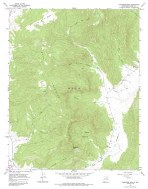
Comanche Peak Topo Map New Mexico
To zoom in, hover over the map of Comanche Peak
USGS Topo Quad 36105a3 - 1:24,000 scale
| Topo Map Name: | Comanche Peak |
| USGS Topo Quad ID: | 36105a3 |
| Print Size: | ca. 21 1/4" wide x 27" high |
| Southeast Coordinates: | 36° N latitude / 105.25° W longitude |
| Map Center Coordinates: | 36.0625° N latitude / 105.3125° W longitude |
| U.S. State: | NM |
| Filename: | o36105a3.jpg |
| Download Map JPG Image: | Comanche Peak topo map 1:24,000 scale |
| Map Type: | Topographic |
| Topo Series: | 7.5´ |
| Map Scale: | 1:24,000 |
| Source of Map Images: | United States Geological Survey (USGS) |
| Alternate Map Versions: |
Comanche Peak NM 1965, updated 1968 Download PDF Buy paper map Comanche Peak NM 1965, updated 1980 Download PDF Buy paper map Comanche Peak NM 1965, updated 1986 Download PDF Buy paper map Comanche Peak NM 1994, updated 1998 Download PDF Buy paper map Comanche Peak NM 2010 Download PDF Buy paper map Comanche Peak NM 2013 Download PDF Buy paper map Comanche Peak NM 2017 Download PDF Buy paper map |
1:24,000 Topo Quads surrounding Comanche Peak
> Back to 36105a1 at 1:100,000 scale
> Back to 36104a1 at 1:250,000 scale
> Back to U.S. Topo Maps home
Comanche Peak topo map: Gazetteer
Comanche Peak: Areas
El Poso elevation 2840m 9317′El Valle de los Boregos elevation 2750m 9022′
La Tierra Amarilla elevation 2363m 7752′
Los Chupaderos elevation 2272m 7454′
Comanche Peak: Mines
A and M Mining elevation 2500m 8202′Comanche Peak: Populated Places
El Turquillo elevation 2237m 7339′Comanche Peak: Post Offices
El Turquillo Post Office (historical) elevation 2237m 7339′Comanche Peak: Ranges
Rincon Mountains elevation 2793m 9163′Comanche Peak: Streams
Cañada de la Cueva elevation 2338m 7670′Cañada de los Lovatos elevation 2315m 7595′
Encinal Creek elevation 2256m 7401′
Comanche Peak: Summits
Comanche Peak elevation 2732m 8963′Los Hornos elevation 2879m 9445′
Comanche Peak: Valleys
Solis Canyon elevation 2254m 7395′Trumbell Canyon elevation 2277m 7470′
Comanche Peak digital topo map on disk
Buy this Comanche Peak topo map showing relief, roads, GPS coordinates and other geographical features, as a high-resolution digital map file on DVD:


