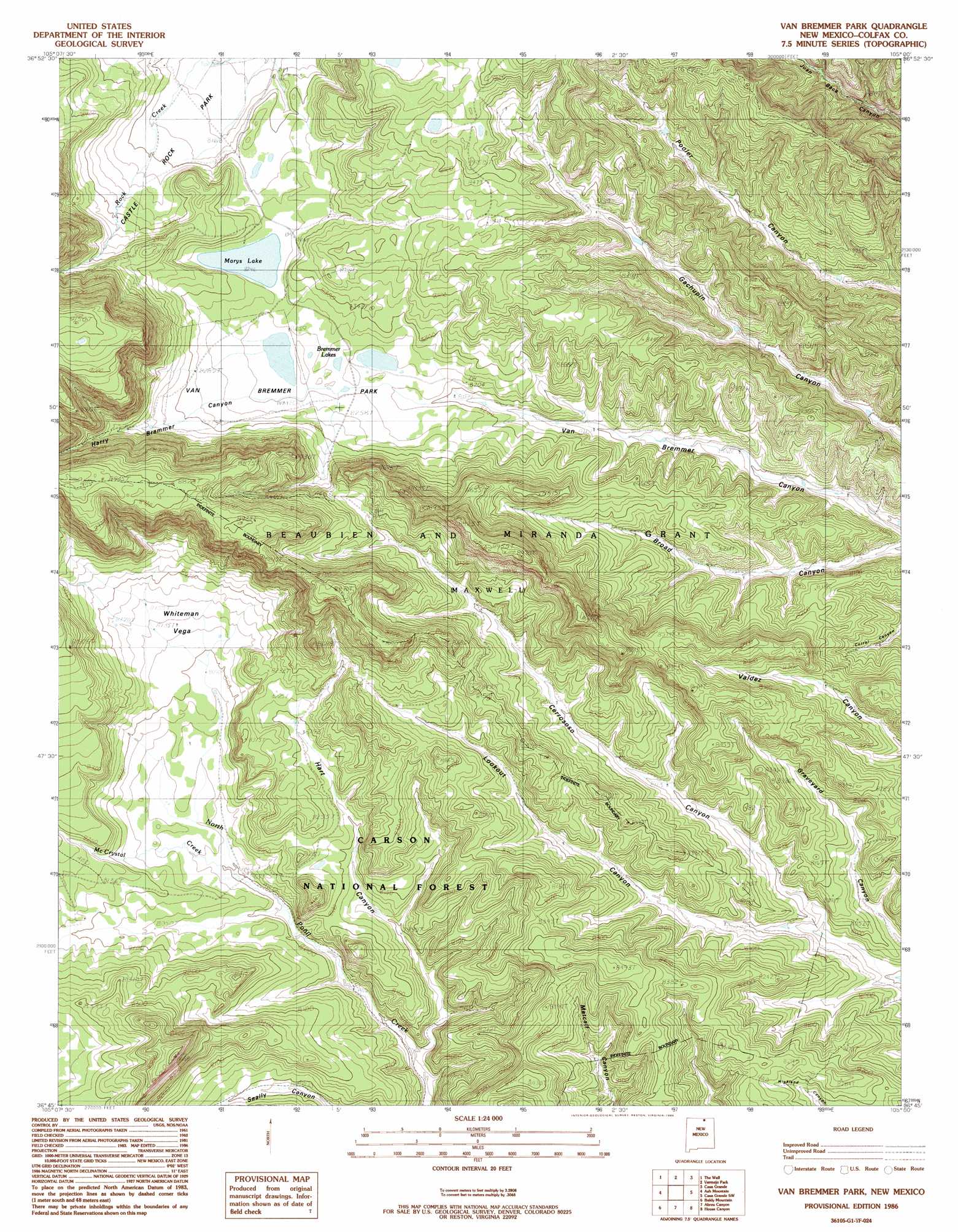
Van Bremmer Park Topo Map New Mexico
To zoom in, hover over the map of Van Bremmer Park
USGS Topo Quad 36105g1 - 1:24,000 scale
| Topo Map Name: | Van Bremmer Park |
| USGS Topo Quad ID: | 36105g1 |
| Print Size: | ca. 21 1/4" wide x 27" high |
| Southeast Coordinates: | 36.75° N latitude / 105° W longitude |
| Map Center Coordinates: | 36.8125° N latitude / 105.0625° W longitude |
| U.S. State: | NM |
| Filename: | o36105g1.jpg |
| Download Map JPG Image: | Van Bremmer Park topo map 1:24,000 scale |
| Map Type: | Topographic |
| Topo Series: | 7.5´ |
| Map Scale: | 1:24,000 |
| Source of Map Images: | United States Geological Survey (USGS) |
| Alternate Map Versions: |
Van Bremmer Park NM 1986, updated 1986 Download PDF Buy paper map Van Bremmer Park NM 1995, updated 1997 Download PDF Buy paper map Van Bremmer Park NM 2011 Download PDF Buy paper map Van Bremmer Park NM 2013 Download PDF Buy paper map |
| FStopo: | US Forest Service topo Van Bremmer Park is available: Download FStopo PDF Download FStopo TIF |
1:24,000 Topo Quads surrounding Van Bremmer Park
La Valley |
Culebra Peak |
Torres |
Tercio |
Little Pine Canyon |
Big Costilla Peak |
The Wall |
Vermejo Park |
Casa Grande |
Caliente Canyon North |
Comanche Point |
Ash Mountain |
Van Bremmer Park |
Casa Grande Sw |
Caliente Canyon South |
Red River Pass |
Baldy Mountain |
Abreu Canyon |
House Canyon |
Dawson |
Eagle Nest |
Touch-Me-Not Mountain |
Ute Park |
Cimarron |
Cimarron Se |
> Back to 36105e1 at 1:100,000 scale
> Back to 36104a1 at 1:250,000 scale
> Back to U.S. Topo Maps home
Van Bremmer Park topo map: Gazetteer
Van Bremmer Park: Areas
Whiteman Vega elevation 2480m 8136′Van Bremmer Park: Lakes
Marys Lake elevation 2515m 8251′Van Bremmer Park: Parks
Van Bremmer Park elevation 2513m 8244′Van Bremmer Park: Populated Places
Ring Place elevation 2474m 8116′Van Bremmer Park: Streams
McCrystal Creek elevation 2438m 7998′Van Bremmer Park: Valleys
Harry Bremmer Canyon elevation 2523m 8277′Hart Canyon elevation 2396m 7860′
Lookout Canyon elevation 2425m 7956′
Van Bremmer Park digital topo map on disk
Buy this Van Bremmer Park topo map showing relief, roads, GPS coordinates and other geographical features, as a high-resolution digital map file on DVD: