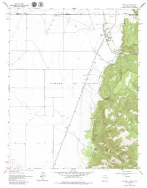
Costilla Topo Map New Mexico
To zoom in, hover over the map of Costilla
USGS Topo Quad 36105h5 - 1:24,000 scale
| Topo Map Name: | Costilla |
| USGS Topo Quad ID: | 36105h5 |
| Print Size: | ca. 21 1/4" wide x 27" high |
| Southeast Coordinates: | 36.875° N latitude / 105.5° W longitude |
| Map Center Coordinates: | 36.9375° N latitude / 105.5625° W longitude |
| U.S. States: | NM, CO |
| Filename: | o36105h5.jpg |
| Download Map JPG Image: | Costilla topo map 1:24,000 scale |
| Map Type: | Topographic |
| Topo Series: | 7.5´ |
| Map Scale: | 1:24,000 |
| Source of Map Images: | United States Geological Survey (USGS) |
| Alternate Map Versions: |
Costilla NM 1963, updated 1967 Download PDF Buy paper map Costilla NM 1963, updated 1980 Download PDF Buy paper map Costilla NM 1963, updated 1980 Download PDF Buy paper map Costilla NM 2010 Download PDF Buy paper map Costilla NM 2013 Download PDF Buy paper map |
1:24,000 Topo Quads surrounding Costilla
> Back to 36105e1 at 1:100,000 scale
> Back to 36104a1 at 1:250,000 scale
> Back to U.S. Topo Maps home
Costilla topo map: Gazetteer
Costilla: Canals
Acequia Madre elevation 2397m 7864′Association Ditch elevation 2353m 7719′
Cerritos Number 2 elevation 2383m 7818′
Cerro Canal elevation 2367m 7765′
Cordillera Ditch elevation 2382m 7814′
Mesa Ditch elevation 2393m 7851′
New Mexico Branch Cerro Canal elevation 2337m 7667′
Costilla: Mines
Cedros Prospect elevation 2754m 9035′Costilla: Populated Places
Costilla elevation 2381m 7811′Costilla: Post Offices
Costilla Post Office elevation 2381m 7811′Costilla: Valleys
Cedro Canyon elevation 2435m 7988′Jaroso Canyon elevation 2456m 8057′
Costilla: Wells
10000 Water Well elevation 2385m 7824′10001 Water Well elevation 2337m 7667′
10002 Water Well elevation 2335m 7660′
10003 Water Well elevation 2334m 7657′
10004 Water Well elevation 2340m 7677′
10005 Water Well elevation 2329m 7641′
10006 Water Well elevation 2334m 7657′
10007 Water Well elevation 2324m 7624′
10008 Water Well elevation 2328m 7637′
10009 Water Well elevation 2339m 7673′
10011 Water Well elevation 2325m 7627′
10012 Water Well elevation 2325m 7627′
10014 Water Well elevation 2320m 7611′
10015 Water Well elevation 2331m 7647′
10016 Water Well elevation 2304m 7559′
10017 Water Well elevation 2305m 7562′
10020 Water Well elevation 2301m 7549′
10056 Water Well elevation 2363m 7752′
10057 Water Well elevation 2439m 8001′
10059 Water Well elevation 2337m 7667′
10105 Water Well elevation 2314m 7591′
10109 Water Well elevation 2299m 7542′
Costilla digital topo map on disk
Buy this Costilla topo map showing relief, roads, GPS coordinates and other geographical features, as a high-resolution digital map file on DVD:


