Youngsville Topo Map New Mexico
To zoom in, hover over the map of Youngsville
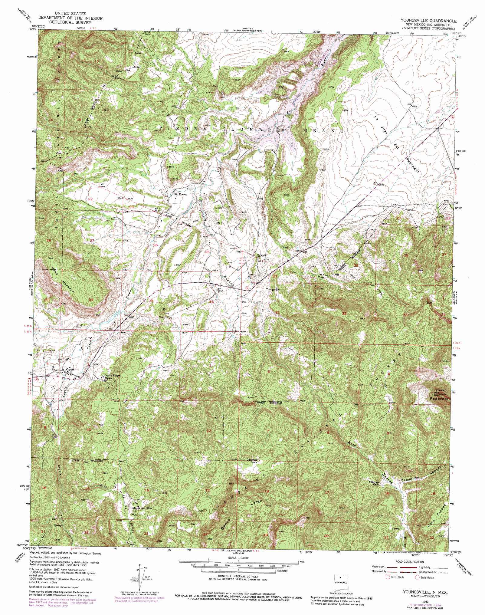
USGS Topo Quad 36106b5 - 1:24,000 scale
| Topo Map Name: | Youngsville |
| USGS Topo Quad ID: | 36106b5 |
| Print Size: | ca. 21 1/4" wide x 27" high |
| Southeast Coordinates: | 36.125° N latitude / 106.5° W longitude |
| Map Center Coordinates: | 36.1875° N latitude / 106.5625° W longitude |
| U.S. State: | NM |
| Filename: | o36106b5.jpg |
| Download Map JPG Image: | Youngsville topo map 1:24,000 scale |
| Map Type: | Topographic |
| Topo Series: | 7.5´ |
| Map Scale: | 1:24,000 |
| Source of Map Images: | United States Geological Survey (USGS) |
| Alternate Map Versions: |
Youngsville NM 1953, updated 1955 Download PDF Buy paper map Youngsville NM 1953, updated 1964 Download PDF Buy paper map Youngsville NM 1953, updated 1980 Download PDF Buy paper map Youngsville NM 2002, updated 2003 Download PDF Buy paper map Youngsville NM 2011 Download PDF Buy paper map Youngsville NM 2013 Download PDF Buy paper map Youngsville NM 2017 Download PDF Buy paper map |
| FStopo: | US Forest Service topo Youngsville is available: Download FStopo PDF Download FStopo TIF |
1:24,000 Topo Quads surrounding Youngsville
Llaves |
Navajo Peak |
Alire |
Canjilon |
Mogote Peak |
French Mesa |
Laguna Peak |
Echo Amphitheater |
Ghost Ranch |
Canjilon Se |
Gallina |
Arroyo Del Agua |
Youngsville |
Canones |
Abiquiu |
Nacimiento Peak |
Jarosa |
Cerro Del Grant |
Polvadera Peak |
Vallecitos |
Rancho Del Chaparral |
Seven Springs |
Valle San Antonio |
Valle Toledo |
Guaje Mountain |
> Back to 36106a1 at 1:100,000 scale
> Back to 36106a1 at 1:250,000 scale
> Back to U.S. Topo Maps home
Youngsville topo map: Gazetteer
Youngsville: Mines
Wasson elevation 2221m 7286′Youngsville Prospects elevation 2419m 7936′
Youngsville: Populated Places
Coyote elevation 2052m 6732′Rio Puerco elevation 1977m 6486′
Youngsville elevation 2092m 6863′
Youngsville: Post Offices
Coyote Post Office elevation 2052m 6732′Youngsville Post Office (historical) elevation 2092m 6863′
Youngsville: Reservoirs
Cedro Tank elevation 2244m 7362′La Jolla Trick Tank elevation 2225m 7299′
Pedernal Trick Tank elevation 2779m 9117′
Pinta Tank elevation 2394m 7854′
Youngsville: Ridges
Banco Largo elevation 2779m 9117′Youngsville: Streams
Arroyo Honda elevation 1998m 6555′Coyote Creek elevation 2006m 6581′
El Rito elevation 2478m 8129′
Rito de las Sillas elevation 2133m 6998′
Rito Encino elevation 1960m 6430′
Youngsville: Summits
Cerro Pedernal elevation 3003m 9852′El Cerrito elevation 2111m 6925′
Mesa Naranja elevation 2265m 7431′
Youngsville: Trails
Encino Trail elevation 2562m 8405′Youngsville: Valleys
Temolime Canyon elevation 2422m 7946′Youngsville digital topo map on disk
Buy this Youngsville topo map showing relief, roads, GPS coordinates and other geographical features, as a high-resolution digital map file on DVD: