Las Nutrias Topo Map New Mexico
To zoom in, hover over the map of Las Nutrias
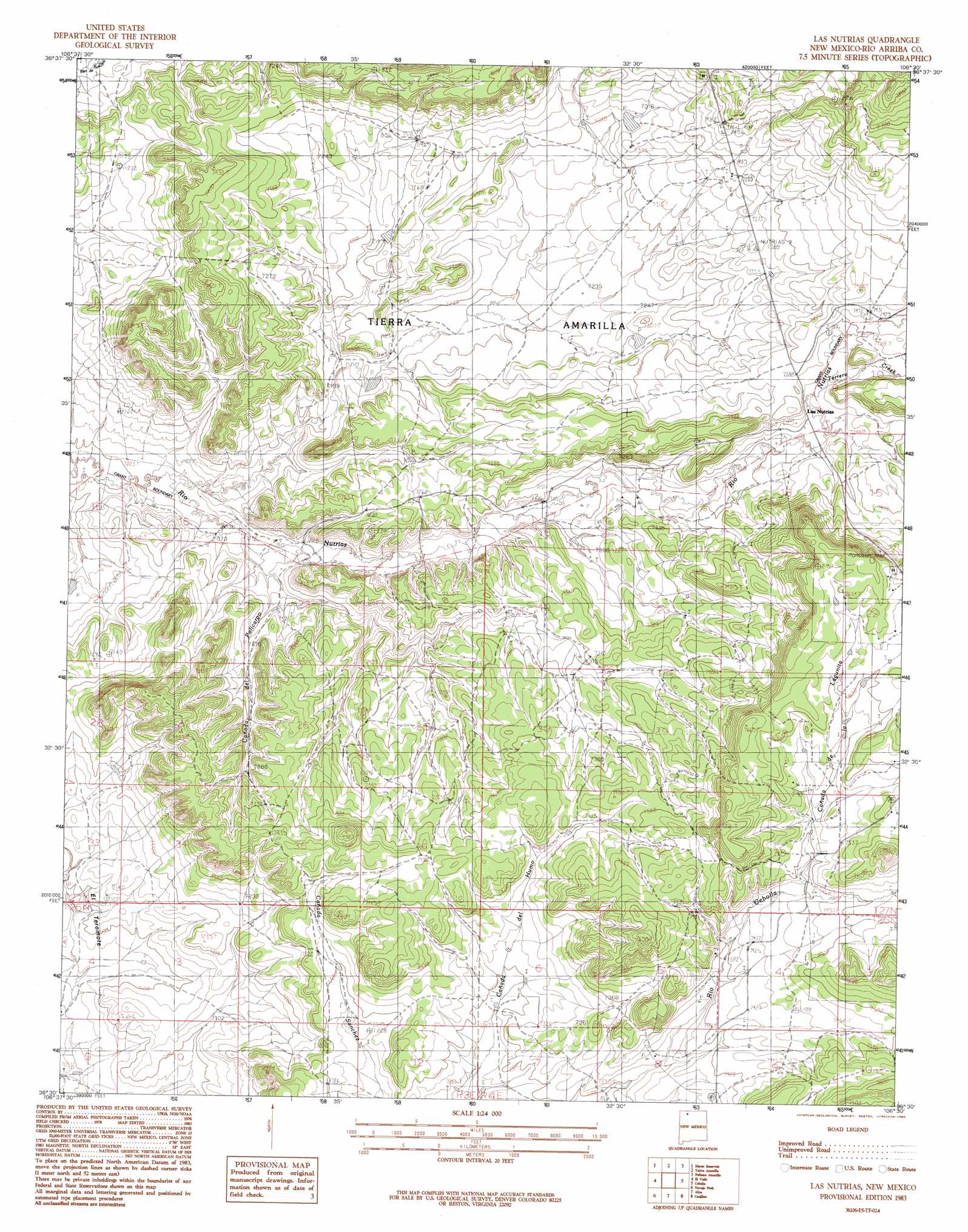
USGS Topo Quad 36106e5 - 1:24,000 scale
| Topo Map Name: | Las Nutrias |
| USGS Topo Quad ID: | 36106e5 |
| Print Size: | ca. 21 1/4" wide x 27" high |
| Southeast Coordinates: | 36.5° N latitude / 106.5° W longitude |
| Map Center Coordinates: | 36.5625° N latitude / 106.5625° W longitude |
| U.S. State: | NM |
| Filename: | o36106e5.jpg |
| Download Map JPG Image: | Las Nutrias topo map 1:24,000 scale |
| Map Type: | Topographic |
| Topo Series: | 7.5´ |
| Map Scale: | 1:24,000 |
| Source of Map Images: | United States Geological Survey (USGS) |
| Alternate Map Versions: |
Las Nutrias NM 1983, updated 1983 Download PDF Buy paper map Las Nutrias NM 2010 Download PDF Buy paper map Las Nutrias NM 2013 Download PDF Buy paper map Las Nutrias NM 2017 Download PDF Buy paper map |
1:24,000 Topo Quads surrounding Las Nutrias
Horse Lake |
Sawmill Mesa |
Brazos |
Brazos Peak |
Lagunitas Creek |
Apache Mesa |
Heron Reservoir |
Tierra Amarilla |
Penasco Amarillo |
East Gavilan Canyon |
Pounds Mesa |
El Vado |
Las Nutrias |
Cebolla |
Canjilon Mountain |
Llaves |
Navajo Peak |
Alire |
Canjilon |
Mogote Peak |
French Mesa |
Laguna Peak |
Echo Amphitheater |
Ghost Ranch |
Canjilon Se |
> Back to 36106e1 at 1:100,000 scale
> Back to 36106a1 at 1:250,000 scale
> Back to U.S. Topo Maps home
Las Nutrias topo map: Gazetteer
Las Nutrias: Populated Places
Las Nutrias elevation 2243m 7358′Las Nutrias: Streams
Cañada de la Lagunita elevation 2273m 7457′Cañada del Policarpo elevation 2147m 7043′
Cañada Sanchez elevation 2205m 7234′
Las Nutrias digital topo map on disk
Buy this Las Nutrias topo map showing relief, roads, GPS coordinates and other geographical features, as a high-resolution digital map file on DVD: