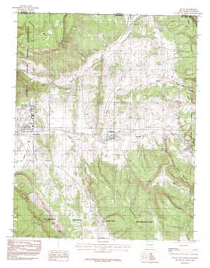
Dulce Topo Map New Mexico
To zoom in, hover over the map of Dulce
USGS Topo Quad 36106h8 - 1:24,000 scale
| Topo Map Name: | Dulce |
| USGS Topo Quad ID: | 36106h8 |
| Print Size: | ca. 21 1/4" wide x 27" high |
| Southeast Coordinates: | 36.875° N latitude / 106.875° W longitude |
| Map Center Coordinates: | 36.9375° N latitude / 106.9375° W longitude |
| U.S. States: | NM, CO |
| Filename: | o36106h8.jpg |
| Download Map JPG Image: | Dulce topo map 1:24,000 scale |
| Map Type: | Topographic |
| Topo Series: | 7.5´ |
| Map Scale: | 1:24,000 |
| Source of Map Images: | United States Geological Survey (USGS) |
| Alternate Map Versions: |
Dulce NM 1983, updated 1983 Download PDF Buy paper map Dulce NM 1983, updated 1992 Download PDF Buy paper map Dulce NM 2011 Download PDF Buy paper map Dulce NM 2013 Download PDF Buy paper map Dulce NM 2017 Download PDF Buy paper map |
1:24,000 Topo Quads surrounding Dulce
> Back to 36106e1 at 1:100,000 scale
> Back to 36106a1 at 1:250,000 scale
> Back to U.S. Topo Maps home
Dulce topo map: Gazetteer
Dulce: Airports
Dulce Airport elevation 2114m 6935′Dulce: Dams
Lower Mundo Dam elevation 2252m 7388′Dulce: Lakes
Atole Pond elevation 2229m 7312′Dulce: Mines
Belino-Peisker Mine elevation 2133m 6998′Caranta Lease elevation 2128m 6981′
Cornell Prospect elevation 2133m 6998′
Lumberton Prospect elevation 2121m 6958′
Tafoya Mine elevation 2228m 7309′
Tafoya Prospect elevation 2116m 6942′
Dulce: Parks
Jicarilla Apache Reservation Historical Marker elevation 2066m 6778′Dulce: Populated Places
Amargo elevation 2136m 7007′Dulce elevation 2066m 6778′
Lumberton elevation 2090m 6856′
Dulce: Post Offices
Amargo Post Office (historical) elevation 2136m 7007′Dulce Post Office elevation 2066m 6778′
Lumberton Post Office elevation 2090m 6856′
Dulce: Ridges
Cuesta Monero elevation 2237m 7339′Dulce: Streams
Coyote Creek elevation 2129m 6984′Coyote Creek elevation 2131m 6991′
Webb Creek elevation 2080m 6824′
Dulce: Summits
Archuleta Mesa elevation 2767m 9078′Dulce Mountain elevation 2507m 8225′
Dulce: Valleys
Dulce Canyon elevation 2068m 6784′Webb Canyon elevation 2195m 7201′
Dulce digital topo map on disk
Buy this Dulce topo map showing relief, roads, GPS coordinates and other geographical features, as a high-resolution digital map file on DVD:


